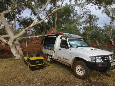
7am
16.8 degrees, luckily not the 9 degrees predicted. It has clouded over so maybe
that is why it was warmer. Lots of birds flittering around as there is a hawk
flying around. When I got up earlier a couple of kangaroos were hopping up over
the rocks on the other side.
Packed
up and headed back out to the CSR. Continued along passing the Kutkububba
Community. Further along the road continues north west. We turned off at the big sign and will head nearly north on
the CSR.


Not
sure about the close up selfies these days!!

Two
kilometres along we came to Well 2.
Well 2 (63 feet, 19.2m)
It was common for explorers to travel with mobs of
sheep and goats to be used for fresh meat and milk. At Well 2 a mob of 25 goats
was attacked by dingoes making it necessary for Canning’s party to build secure
yards at each campsite.


Very
neat timber work and lots of water down there. There was a bit of timber
railing further over in the bush which could have been where he housed the
goats etc.


Great
information here.


Found
a survey marker.


Someone
had a bad start to their trip and there was an engine abandoned further over.


Still
cold and overcast as we headed to the next spot. Some photos of the track as we
went along. Lots of spinifex.


Big
burnt section so we could see a long way. A few obstacles and bumpy rocks but
otherwise easy going so far.


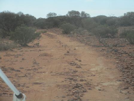
Up
and down a few hills.


In
my notes it mentions a pile of rocks like a grave but they think it was used as
a table by Canning on his return trip in 1930-31. Not sure if this is the right
one but it was about the right kilometres from Well 2.

Continued
along with the track changing all the time.


A
bird’s nest high in the tree.

Past
a large granite outcrop.

Then
we arrived at Tank 2A (The Granites).
The Granites – Tank 2A
This ‘tank’, blasted from solid granite, was built
during the return journey from Halls Creek. Water filters through the soil to
the rock. It then soaks along the surface of the rock into the well. Wandering
animals were kept out of the water by a corrugated iron room. The construction
crews, on their return journey from Halls Creek, were out of food by the time
they reached this site for this well. Canning went to Wiluna for supplies but
arrived to find that none was available. Teamsters bringing food for Wiluna
were bogged on the track far to the west. Canning explained his plight to the
townspeople who gave food to be immediately sent out to the construction crews.
Canning rode on to meet the teamsters, loaded up with stores and returned to
his men. A round trip of about 800 kilometres.


They
were amazing people to have coped with what they did and achieved so much.
Had
a cuppa as the sun started to peek out of the clouds giving us a bit of warmth.
Walked
around to the other side of the rocks. Looking up towards the granite rock base
where the water would flow down to go into the well.


Found
a survey marker near the well.

Further
over we found a star picket and on the tree was a metal plaque with the
initials P & A and number 7 stamped on it. P stands for Surveyor H. Paine and A for Inspecting Surveyor G. Anderson.


The
track continues that way.

Found
some great granite boulders.


Continued
along the track. Someone has left their Rego in quartz.


Saw
a Telstra sign so turned off to check it out. Obviously they used to have a
huge aerial here but now there is just the concrete platforms and the staywire
braces. No wonder we can’t get any phone reception!!


More
track shots as we continued along.


Lots
of quartz signs started to appear beside the track.


Should
have stopped and made one for ourselves but we kept on.
Down
into a creek area where we found the ‘rare’ Mulga Trees.
Minnaritchie or Red Mulga, can be
found between the Granites and Well 3. These trees have a distinctive red
curling bark, sparse foliage and grow in creeks that cut across stony tablelands.
The wood is extremely hard and was used in the early days for fences and
buildings. The red mulga only grows in a very narrow band of latitude across
Australia and can also be seen on similar soil types north of Oodnadatta and
south of Birdsville. They are one of Australia’s rare trees.


Lovely
big River Red Gums greeted us as we pulled into Well 3.

This
well is on the southern end of Cunya Station. They don’t allow big vehicles or
towing trailers through here as there are lots of creek crossings.

Well 3 was 23 feet (7m) but
in 1935 the depth was increased to 43 feet. It sits is on the banks of Sweeney
Creek. Steve sent the bucket down to pull up some water. Was a bit smelly so we
didn’t take any.


Had some lunch with several
hundred flies. I gave up and sat in the truck with the windows up!!
Crossed over the creek – bit
of 4WD action!!


Found one of Canning’s blazed
trees nearby hidden in the trees.


Further along is an open area
for the campground, complete with dunny which Steve checked out. Do your
business and it falls in the trailer. There is lime to cover it with and when
the trailer is full it can be towed further away to a dump area (follow the
signs). All this has been down by a group – Track Care WA. Well done to them,
it is great to see this rather than piles of dunny paper everywhere. Campground
lacks a bit of character though.


A bit further up the road
Steve saw two holes – Gnamma holes. Very good ones too.


Back on the track – hasn’t
been much different to any of the tracks we go on to detect. Been of far worse
actually. Crossed a few more creek crossing. Nothing too bad actually so not
sure why the ban on trailers etc now they have the new hitches etc.


Lots of big round rocks which
Steve reckons are old river rocks – might be gold here.

Crossed over a station road –
more like a highway which goes down to Coopers Well which belong to the
Station. He makes it quite clear you aren’t allowed to travel on it!!


We continued on the CSR which
of course gets no maintenance but there are lots of signs showing us the right
way to go.

Turned off (the sign was
missing here) to find Well 3A. Open area which looks like the cattle have been
feeding on as there are lots of cattle paddies.


Well 3A (40 feet, 12.1m)
William Snell thought the distance between some of
Canning’s wells was too great so his reconstruction party built this well in
1929.
William Snell in Victoria in 1872. He joined the WA
gold rush in 1892. The following year he was found unconscious beside the grave
of a mate he had just buried. While recuperating in a Perth hospital he decided
it would be more profitable to cart supplies and equipment than to mine for
gold. He started a business on the goldfields at Menzies. In 1898 he started
‘Snell & Co, General Merchandisers and Importers’ with his wife. He was
elected Lord Mayor of Leonora in 1900, a position he held until he resigned 7
years later. During this time Snell organised a railway link between Gwalia and
Leonora. Snell also had several camel teams working throughout the north-west.
William Snell moved to the Pilbara, taking up land now mined by the Mt Newman
Company. Between 1914 to 1929 Snell took up many leases including Mt Keith, to
the south of Wiluna and Lake Nabberu, the first of many around the southern end
of the CSR. It was during his wanderings on these leaseholds that “Snell’s
Compass” became a legend. He would make the points of the compass on a flat
rock set on a hill. In the centre of the compass points would be an arrow and
number representing the distance in miles and direction to water. Many a
pioneer was thankful to Snell for his foresight.
William Snell will probably be remembered more for his
work reconditioning the CSR than for any other reason. The CSR was first
criticised by Tom Cole the first drover to complete a drive down the Canning in
1911. Cole claimed there were long stages with poor feed; an advance party had
to travel ahead to avoid the disaster of two wells being unfit for use; wells
could not water more than 300 cattle in one mob and it took at least one week
between mobs to replenish the wells. Others reported damage by dingoes,
Aborigines, fires and general deterioration. Political pressure brought by
station owners led by Robert Falconer started in 1926 and continued until
Cabinet agreed in 1928 to re-equip the stock route. William Snell, land owner
and bushman of high repute, believed the stock route should be positioned about
100km to the east where feed was more plentiful. However, parliament decided to
give Snell the job of reconditioning the existing route.
Work started from a base at Weld Springs in February
1929 and continued until October. New wells were built, many were cleaned,
troughing replaced, decking and fencing repaired. Aborigines would not use the
windlass and bucket to draw water and caused damage by throwing rocks and
timber down the wells in an attempt to raise the water level. Snell tried to
overcome this problem by installing rope ladders. By October Snell’s party had
built 5 wells and reconditioned 33, finishing at Well 35. He had exhausted his
supplies of steel and as the northern wet was about to start, decided to return
to Wiluna, rest his party and start again the following year. Food and
equipment were buried in square tanks at various locations for use the following
year. However it was a sad homecoming for Snell whose only son, Lewis, had died
from a burst appendix on September 15, while Snell was reconditioning Well 20.
It is possible this may have influenced the decision to ask Canning to finish
reconditioning the CSR.

Steve got a rock and dropped
it through a gap and we heard the splash of water.
Walked over to a sign – the
road was realigned from here to Windich Springs in co-operation with Cunyu
Station to minimise track damage to this section. There is a lot of ‘lakes’
from here to the Springs so obviously it wasn’t a good track position. The
track certainly looks washed away.


Continuing along running
parallel with Frere Range.

Turned off to check out a
large salt lake. No name for this one on the map but there are many more coming
up that link Lake Nabberu from west to east which is probably why they did the
realignment.
Lake Nabberu
Canning had difficulty finding a point to cross Lake
Nabberu so he built a crossing of wooden logs woven together with rope. This
became known as the Corduroy Crossing because of its similarity to corduroy
cloth which is made from strongly woven cotton with pronounced cross ribs.
Little, if any, of the original crossing can be seen. The crossing of the lake
is now closed.


Sky got cloudier as we went
on. I am on gate duty of course. Steve checking I have done it right!


More bumping along the track.


On one of my maps (printed in
2008) it shows Pharis Bore but on the other book or the Hema it doesn’t exist.
Well 4 (45 feet, 13.7m)
Michael Tobin put down several bores in this area in
an attempt to find suitable water. This water, the best they could find, was
always of poor quality.
We found a track that led
down to another station bore but there was no sign of Well 4.

Across Kennedy Creek which
flows into Lake Nabberu.

A bit of corrugation on the
ironstone flat sections but nothing too bad.

Next stop Well 4A. They used
an existing tree to put the pulley wheel on. Steve dropped a rock down a gap
and we heard it splash.
Well 4A (33 feet, 10m)
William Snell’s party built Well 4A on the bank of
Kennedy Creek in 1929. John Forrest had previously named the creek after James
Kennedy, a policeman who accompanied Forrest on his expedition through this
area.


Nearby is PA25 survey mark –
not much left of the post.


No water in Kennedy Creek but
looking at the high banks it would get a rush along when the wet comes.

Followed it along for a bit
then crossed the creek and up the other side.

Another gate to open and
close being careful not to touch the electric fence.

Into a nice clear area with
picnic table and toilets. A fence separated us from the springs so no camping
down there.
Windich Springs – Water 4A
John Forrest named the springs after Tommy Windich,
his trusted Aboriginal companion and guide. Forrest described the springs as
the best he had seen anywhere in the colony. A cyclone in 1965 brought flooding
rains to the area and both Windich and Little Windich Springs were filled with
silt.
Fancy bringing all this out here but it is very nice and informative.


Walked down to the Springs –
very nice.


Steve found a rock cairn and
of course had to add another rock.

The sign pointing our way
towards Halls Creek. It is now 5pm and the breeze is cold and the sky overcast
but we decided to keep going.


Next stop is Well 4B in ruins
but the bits and pieces are still here. No water in it though.
Well 4B (42 feet, 12.8m) was built by
William Snell’s party in 1929.


Last gate of the northern
boundary of Cunya Station.


Spotted our first kangaroo
but he bounded off before I got a photo.
The sun is setting and with
the heavy cloud band is making a wonderful display.


The spotlights are playing up
as dark has descended at 5.30pm – we said we didn’t need any as we wouldn’t be
driving at night!!

Just as we turned off to Well
5 I spotted two dingoes. Got one in the car light then Steve shone a torch on
the other one for me. They just stood and watched us.


We drove on further and
parked near the well. Then I saw something dart across the track and it was
another dingo – or the same one but Steve shouted at it and it disappeared.
Well I hope it has!!
Too late for a camp photo –
will do that in the morning. It was windy and cold so we had dinner hiding at
the back of the truck out of the wind. Played a couple of games of Dice then
had a quick wash then into bed.
Map of this section of our trip.