Up
early, 6.30am 12 degrees!! Clear sky with wispy clouds and a cold breeze. No
more dingo visits and we didn’t hear any howling. Took our camp photo since it
was too late last night to take one.
Well 5 (104 feet, 32m) is the
deepest well on the CSR.
Good shot down the well – you
can see our reflections in the water.
Zoomed in on the bottom half
which isn’t timber-lined.
This well was restored in
2004.
Someone is having fun with
some signs.
Back out to the main track
where signs show that we have left Wiluna Country and are heading into
Birriliburu Country. The Wiluna one is facing the wrong way as it has come off
its concrete base so someone lent it against the tree.
Obviously we must have come
in another track last night as we didn’t see this sign leading into the Well 5.
Just a bit further up used to
be the track to the Carnarvon Range but there is no access to that now and they
made that very clear.
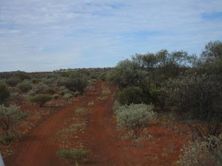
Continued along the track
with the changing vegetation and road conditions.
Spotted Mount Salvado (731m) in
the distance.
This mount was named after Dom Rosendo Salvado who in
1846 founded a Benedictine Mission for Aborigines at New Norcia. The mission
built up a reputation for breeding quality horses. John Forrest called his
favourite horse, Mission, because it was supplied by Salvado.
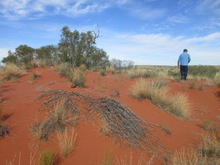
Little dunes here and there.
In my notes it said ‘Black
Boys’ and on the map ‘Grass Trees’ will appear and right on cue they were
there.
Past some rocky ridges making
a rocky track.
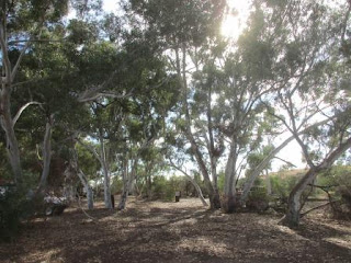
Pulled into a beautiful sight
of Well 6 (Pierre Spring). Nice and shady with lots of River Red Gums though we
are still feeling cold at the moment.
There were some people camped
there so we went over for a chat. They are from Byford, WA. Roy and Veronica
have a month and a travelling with son Brent, his mate Johnny and grandson, Roy
Jnr but they only have 10 days so they are moving along quickly. They said the
CSR is closed past Well 23 due to boggy conditions so the ones coming down had
to turn off at Kunawaritji Community and head west to Telfer Mine then down
through Rudall River National Park and then join the CSR again at Well 23. What
a shame, sounds like we are going to have to miss about 10 wells but maybe it
will dry up by the time we get up there. I had rung Wiluna Shire office and
they said the CSR was open – probably only meant their end but you would think
they would get advice for the whole track!! Anyway we are on it and will see
what we can.
Some interesting stories.
Well 6 – Pierre Springs
John Forrest named a spring found to the south of Well 6 after the second of his guides, Tommy Pierre. This spring was filled with silt during cyclonic flooding in 1965. Canning’s party found water at a depth of about four metres. The huge gum trees appear to be nourished by underground water, possibly from a waterhole in an old creek bed.
The well has been restored
and has lovely water. Took a video as Steve filled up the ‘washing machine’ with
water from the well so we will have clean clothes to hang out tonight.
Signed the visitors’ book.
My information said there are
some aboriginal paintings in overhangs 800m past the toilets so we went for a
walk. We only found a sand dune which we climbed for a great view of the
Inglebong Hills and surrounding area. Took a video looking over of the area. Maybe
the paintings are over in the hills.
Heading back again – the Well
area stands out with the big trees.
The others headed off north.
Hopefully we will catch up with them at the next stop. We had a cuppa then
headed off too. Looking up at the Ingelbong Hills. Too much spinifex around so
we didn’t go looking for any paintings.
Continued along the track to
where we spotted a nice escarpment .
Found a track up to the base.
On the way out I spotted a
post and this sign was laying in the dirt.
The ironstone dirt makes the
most corrugations (hence the fuzzy photo) though nothing too bad so far.
Further along we spotted Mt
Davis (669m).
On the Hema Navigator it showed
BM593 and we found what it was – Bench Mark though this one said 55.
Along the track then we came
to our first ‘sand ridge’. Easy one – still in 2WD in 3rd gear.
Back on the flat then through
some creek area.
We have entered Glen-Ayle
Station. A few clouds around and a cool breeze still.
Well 7 (70 feet, 21.3m) was
in a creek area. The Dekkers were just leaving as we got there.
Steve tossed in a rock – of
course.
Back onto the track and Steve
checked out someone’s broken springs.
More track photos.
Passed an open area where we
spotted some cattle near some yards and on the other side, Willy Willy bore and
windmill.
Next stop was Well
8 (60 feet, 18.2m) - William
Snell put a windmill and tank on Well 8 in 1929. Steve did the rock test
but this well is dry.
Found the foundations for the
windmill.
Moved the truck into the sun
and had lunch enjoying the warmth.
More track photos as we head
towards Well 9. Through some hilly/rocky country. Came to a Y intersection and
followed the others wheel tracks. That track went into a creek and we saw where
the others had turned around. We continued on as it was showing it was the
correct way on the Hema. The creek/track pettered out so we had to back track
to the Y intersection and continued on the other track which turned out to be
the correct on. Just up on the left bank of the creek!!
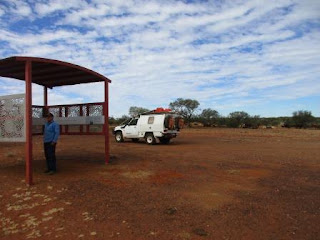
Another great shelter with
information.
Steve got ready to defend himself in Forrest’s Fort.
Forrest’s Fort
John Forrest and Tommy Pierre found water in the nearby creek in June 1874. Claiming it to be one of the best he had seen, Forrest named it after Governor Weld, who had assisted the expedition. The exploring party was attacked by Aborigines and was forced to build a thatched stone fort for protection. Remains of the fort can be seen on a rise to the north of Well 9. 1000 hectares of land surrounding Weld Springs was classified as an historic reserve in 1980.
Further over we found Well 9.
Well 9 – Weld Springs (14 feet, 4.3m)
Canning was less impressed with Weld Springs and sank
a well about 60 metres to the east where excellent water was found. A windmill
and tank were erected by the owners of Glen-Ayle Station, about the 1950s. The
Tempy Stock Route to Carnegie Station joins the Canning at Weld Springs. It was
created at the request of Robert Falconer in the late 1930s to allow access
between his Billiluna and Carnegie properties. However it was rarely used
because Carnegie Station, while a good breeding property, was normally too dry
for fattening cattle. Stock coming down the CSR were usually put on lush
grazing nearer Perth. During the 11 years TA Doman & Co owned Billiluna
they used the CSR many times but only used the Tempy Stock Route once. Spencer
Doman purchased Falconer’s properties in 1948.
Whipping Water – providing enough water for a mob of
cattle was exhausting work. On each well a windlass and buckets were used to
lift water for cooking, drinking and washing. The main supply of water for
cattle was usually lifted in a 50 gallon canvas bag attached to a cable running
through pulleys and hauled by a camel. As the bag reached the top of the well
it was swung out toward the trough and emptied by the drover. This work was
eased by erecting windmills and tanks on the more accessible wells. Drovers for
TA Doman & Co used engine-driven pumps from about 1950. The pumps and fuel
were carried on camels.
Walked down to the creek area
to see if we could find the Spring but it was all dry.
Found a survey marker.
Walked over to the windmill
and yards to read the next sign.
Good use for the trees here.
The cattle were very relaxed
as we wandered around.
Back on the CSR, up and down
dunes, some corrugations on the flats and then rocky bits. Where the
corrugations are there always seems to be a choice of two or three tracks as
people try to find a flatter track. We aren’t finding them bad compared to what
we have been on in Cape York.
Spotted two wallabies near
the road and one stopped for a photo.
Continued on to Well 10 (70 feet, 21.3m). William Snell
equipped this well with a windmill in 1929 but there’s not much left now.
Still water in it.
Through some hilly country –
one of these is McConkey Hill (553m).
The sand ridges are becoming
more prominent – Steve is happy now. The flats are still rocky.
Next stop was Well 11for a
cuppa. We are on a edge of White Lake (I suppose named because of the salt)
which is green at the moment with salt bush. The well still has water but boy
is it smelly.
Well 11 – Goodwin Soak (8 feet, 2.4m)
Hubert Trotman, Canning’s second-in-command, was given
directions to this soak by an Aborigine he met a Pierre Springs. Canning later
named it Goodwin Soak after a bank manager from Wiluna. The construction party
was able to bring its gear to Well 11 on wagons but was later repacked on 70 camels
for the remainder of the northward journey through sand dune country. The
wagons were put up on rocks to prevent damage from termites and were still in
good condition when the party returned 2 years later. By the time Canning
reached Well 11 he could see the value of giving Aboriginal names to the water
points so drovers could ask directions from local natives. The first water
named was Killagurra (Water 17) and the first well, Kananaggi (Well 19).
William Snell completely rebuilt Well 11 in 1929 after it was demolished by
fire. He also equipped it with a small windmill. It was the shallowest of the
wells but always had a good supply of water. Water 11 was the start of the
difficult travel for the construction crews but the end of hard travel for the
drovers. The track from the Cunya road to this point follows closely along
Canning’s early tracks and was regularly used by people meeting drovers coming
down the CSR.
An old survey marker – you
can see the arrow mark at the bottom.
Steve
let some more air out of the tyres – down to 20 in the front and 35 in the rear
and we turned the hubs into 4WD ready for more sand ridges. He was let down
though as we ran along parallel with them and only went over the lowest section
of it!! Travelling in 2nd and 3rd high range over them.
Everything is travelling well in the back and we are comfortable in the front.
Around
the top western edge of White Lake that we had to drive around the edge of for
a while.
Continued
on for a while till we crested another dune and saw Lake Aerodrome. Definitely
room to land a plane on this one.
Lake Aerodrome
This lake was named during the 1929 CSR reconstruction
by William Snell who had been asked to locate suitable landing sites for
aircraft.
Up
and down more dunes, 4WD high range up some of them so Steve is happy.
On
to Well 12 – it has been reconditioned against since Snell did it.
Well 12 (25 feet, 7.6m)
This well had a good water recovery rate from a depth
of about 8 metres. Snell reconditioned it in 1929.
Took
a video of Steve getting some water for our showers tonight.
Set
up camp beside the desert oaks.
Hung out the washing – all clean. Got a fire
going and enjoyed dinner under the millions of stars. Spotted a couple of
satellites too. Very peaceful except for the fridge cutting in an out but that
is reassuring anycase!
Map of this section of our trip.
Map of this section of our trip.


No comments:
Post a Comment