Woke
to the birds singing. Clear sky, light breeze and a bit brisk – 15 degrees at
7am.
Cleaned
our moonstones.
Back
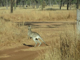
to the main road. Mr Roo was guarding the entrance but he let us pass
eventually.
Past
the turn off to the old Blackbraes Station (now Ranger Station) and volcanic
crater. Leaving things to see when we do Queensland in detail in a few years
time.
Dirt
road has lots of big bull dust holes but otherwise not too bad. Steve spotted
some brolgas in the bush.
Bitumen
again past Chugleigh Station where Erica and Terry go fossicking. Back on the
dirt again.
Pretty
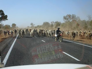
Plains Station are moving their cattle down the road literally. We stopped and
let them come around us. Took a video and lots of photos. There was one chap on
a motorbike out front with another bloke and a young girl riding the horse on
one edge. Finally they all passed, there is a fence on edge side of the road so
they can’t wander too far. Another chap on a horse was rounding up the slow
pokes.
Continued
on to the station turn off and there were more cattle waiting in the yards.
More
cattle in yards as we continued south.
As
we dropped down at hill edge I got two texts through for a moment when the
signal came through on the phone – haven’t had any service. One each from Erica
and Mum. Will call them later when we have full service again.
Bitumen
again as we drop down to Gorge Creek. We are overtaking someone hence we are on
the wrong side of the road.
Then
we turned off to Porcupine Gorge National Park and two kilometres to the
campground.
Made
a cuppa and rang Mum and Erica as we have good phone reception here. All good.
Greg is going to take Mum and Dad up to Millaa on Saturday for the Millaa
Reunion.
Walked
out to the edge and read the info about the Pyramid walk down into the gorge.
Further
along was the Pyramid Lookout. Lovely breeze as it is quite hot now.
Walked
back through the campsites.
A
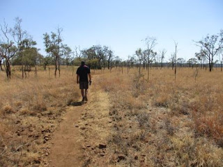
new walking track heads off from here, 2.65km return. Haven’t spotted an
‘porcupines’ but Steve thinks he found spots where they have been digging.
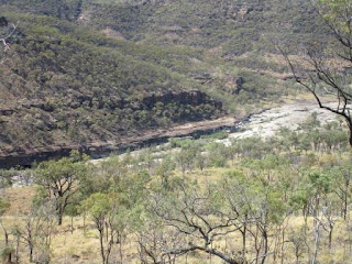
Lovely
vantage spot looking up the gorge to the Pyramid.
Zoomed
in on the Pyramid and then further along the next gorge.
Walked
further around for another great view. Looking back the other direction. Bigger
pool of water there.
Then
around and up to the Pyramid again.
A
willy willy in the distance.
Back
to the truck then back out to the main road. Checked out the Whistling Bore.
Not making any sound. I put my hand over the hole on the other side and it
sounded like my kettle when it is just about to boil.
Further
along we turned off to check out the southern Porcupine Gorge Lookout. The
Gorge is 27km long – big walk to see it all.
Wheel
chair access track with a wooden platform at the end. View from the platform.
As it
is well back from the edge we walked closer to get a better view down into the
gorge.
Zoomed
on the rock formations below where the water has carved holes.
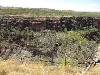
Steve
walked further along and found a better vantage point with a view of the
sandstone cliff face too.
We
can see some fish swimming in the water.
Back
to the main road again. Spotted a sign which was a ‘point of interest’ about
the cutting we just drove through.
Next
one was about the mailman who was killed here.
This
is Bottle Tree Hill. When we got to the top we can see why it is called that.
Nice
view. We are still 500m above sea level.
Next
point of interest was at Eagle Hawk Lookout. The beginning of Porcupine Gorge –
out there somewhere.
A
grave we passed could be two people.
We
drove back to get a photo.
As
we went to turn back around I spotted a pig on the other side. He was standing
under the tree – bit blurry as Steve was moving the car. When we stopped he
looked up then turned away and ran off.
Slowly
dropping down, now 400m elevation. Across Porcupine Creek – dry, wide and
sandy.
Across
the grid of the old rabbit/dingo fence.
I
had seen on Wikicamps about Belemnite Fossils and Erica had mentioned it. We
spotted a car stopped and realised what they were looking for. She showed me
what they had found – a good complete one and lots of bits. Thank goodness she
knew what she was looking for.
I
wandered around picking up bits.
Steve
wandered further along then over the road and came back with a ‘ladybird’. Will
have to keep it for Jon.
As
we were getting in the truck he picked up a nice full fossil. Added it to my
collection.
Past
Mt Beckford Station where sandalwood grew and was cut and sent over to Asian
countries. Spotted some camels there too.
Into
Hughenden for a late lunch by the Flinders River which is Queensland’s longest
river.
Lovely
murals on the toilet block.
Dry
river but a lovely green park with big shady trees.
At
the other end I read about the history etc and the lady that started the park.
Across
the bridge – a huge windmill on the other side.
Old
Masonic building then the Grand Hotel (est 1912) – looks like it is getting
refurbished.
Windmill
shelter in town with info about the Great Artesian Basin and drilling to get to
that water.
Noticed
this sign across the road.
‘Hughie’
is a replica of Muttaburrasaurus Langdoni
found near Muttaburra to the south. He was a land living, plant eating dinosaur
who roamed the earth 100 million years ago.
Drove
around town looking for fuel. The 24hr one was broken so went up the ‘hill’ to
the United to fill up. Further up the hill was the ‘Lights on the Hill’ servo
opposite the Cemetery (earliest grave there is 1884) but it was being
refurbished. So much for my Fuel App.
Checked
out the historic Coolabah Tree by Station Creek. The blazes are hidden as the tree grew a layer over them but they have made replicas of them. The shearing one is from a tree 2km downstream.
Headed
out of town on the Flinders Highway then turned off and headed past Mt Walker.
Onto
gravel heading to Muttaburra. Open grazing land for cattle. Black soil country
– don’t want to see any rain now. Steve remembers when we were heading to
Adelaide for the Aust F500 Titles and we took a shortcut down a black soil road
to Wilcania. A big storm hit us – first it was a massive dust storm then the
rain came down. Very slow going after that.
Into Barcaldine Shire – road now has a better gravel base. Still open grazing land. Saw a few roos, hawks, brolgas and cattle.
20km
north of Muttaburra we got back on the bitumen. More scrubby trees here, 200m
elevation. Lots of kangaroos about.
Checked
out the sculptures from the 2004 Muttaburra Sculpture Festival. Very good
shearer and sheep using old bits and pieces.
Another
couple.
Through
Muttaburra which is the geographic centre of Queensland. The town’s famous
moment was when a local grazier, Doug Langdon, found the fossilised skeleton of
a dinosaur. More to explore here and there is more dinosaur info in the
Interpretation Centre.
Spotted
this cute sculpture of Mr Emu and his chicks.
Six
kilometres down a track to Broadwater Waterhole in the Thomson River. The
Thomson flows into Cooper Creek.
Plenty
of spots to choose from. The water is brown soup because of the black soil.
Got some firewood then had drinks overlooking the water.
Had
to use two maps for a trip today.
I
worked on my blog for a while then got dinner. A flock of Apostle birds dropped
by. Busy noisy birds.
7pm
27 degrees, no breeze. Enjoyed a lovely shower – didn’t use the lagoon water
though.
Played
a few games of Skipbo – both having wins.
Lovely
evening under the blanket of stars and the moon.











No comments:
Post a Comment