Got
up at 8am and we were surrounded in mist (17 degrees). Looked lovely.
By
9am the mist had lifted and it is now 23 degrees in the van.
Headed
off to explore Mt Field National Park. The farmers used the poplars as paddock
borders.
A
crop of raspberries as we head into Westerway.
Stopped
at the fruit shop to buy some raspberries. Checked out the picking machinery.
Littau harvester which does raspberries, blueberries and blackberries. Dan
would be in heaven.
An old version.
There
was a tour group in and they got to hop on the harvester as it travelled over
the blackberries (thornless – not like the nasty ones on the side of the
road!!) The sun is out and getting hot though it is still cool when you stand
in the shade.
Up
the road to Mt Field National Park. Great map info at the Info Centre.
I
asked the lady about the walks and she suggested the combined waterfall circuit
for 2 ½ hours. She said there were stairs (forgot to ask whether we go up or
down them). Headed off to see Russell Falls first. Nice walk along the creek.
A
cute potoroo getting a feed.
Easy
walk to the bottom of the falls. Another couple were there and offered to take
a photo of us. She got more of the boardwalk then the top of the falls.
Very
nice falls. In 1885, Tasmania’s first reserve was created around Russell Falls
and rail excursions from Hobart to the falls became popular. The reserve was
extended with the formation of Mount Field National Park in 1916, which along
with Freycinet, is the State’s oldest National Park.
Then
we went up the hill – looking back down the rock stairs.
Then
more timber stairs.
Till
we reached the top of the Falls.
Further
on we turn off to check out Horseshoe Falls. Cute.
Lots
of tall trees.
Lots
have fallen down too. This one was cut up and the bark peeled off like they did
in the old days.
Another
fallen tree with big root system and it goes along way.
Steve
saw a Tiger snake slither off but I missed it.
Into
the Tall Trees Walk area. Information about the tree measuring devise –
Clinometer.
Tree
scar.
This
tree has a huge opening.
Found
the possum tree – totally shredded.
Lovely
trees.
Another
one with four holes in the base and a twisted trunk.
Nice
walk along the edge of a hill and then through tree ferns. Lovely and cool
here.
Along
the top of a ridge where it was a lot hotter and dryer till we reached Lady
Barron Falls which cascaded down over two levels.
Spiders
web.
Lovely
walk through all the tall trees.
And
by the cool creek which we crossed over.
Through
a more open grassy area.
Then
we saw the stairs – oops we have to go up. We started running up (there are 239
steps).
Luckily
they put in comfortable seats to relax in and enjoy the view.
And
some more.
While
we rested I took a photo of our map.
Another
big holey tree – big enough for Steve.
A
lot drier and open scrub at the top of the hill.
More
bracken ferns.
Back
to the Info Centre, cute carving.
We
went into the Centre to check out the displays. Lots about the Tassie Tiger
(Thylacines). The last one was trapped in the Florentine Valley nearby in 1933
and was in the Hobart Zoo.
After
lunch in the park we headed up Lake Dobson Road. This road climbs 1000m in 16km
to Alpine Country. Narrow dirt road that was created to provide jobs in the
Depression in 1934. Stopped at the lookout at 510m elevation to look over the
valley.
Zoomed
in.
Interesting information.
Up
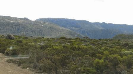
to 900 m and the area is covered in rocks.
Red
posts so you can see them above the snow line.
Up
in the Alpine Country at 1050 metres. Cool but the sun is still warming.
Parked
the truck and made a cuppa. Wandered down to Lake Dobson.
Got
our sticks out again and headed off to walk to Lake Seal Lookout. First part
was easy walk around the edge of the lake.
Lovely
twisted colour of the snow gum.
Then
we started uphill. Not bad, just rocky.
The
walk around the lake is called Pandani Grove Nature Walk. There are heaps of
Pandani along this area up the hill too.
Little
red berry bush.
We
came out onto the road that goes up to the huts on the snow fields. Nice and
steep – like walking up to Mt Oberon at Wilson’s Prom again.
Steve
spotted a cute little owl in the tree!!!
Beautiful
flowers.
As
we turned the corner we looked over Eagle Tarn.
Up
the road again.
At
the next corner stopped to admire the view!! And breath!!
We
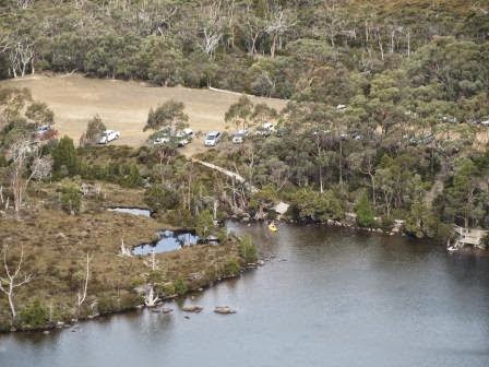
could look back over Lake Dobson and the car park.
Zoomed
in on a couple relaxing by the lake.
Big
house which are owned by Ski Clubs.
Walked
past them – people were up there and had driven up!!! Must have a key for the
locked gate.
Looking
over Broad River Valley and Platypus Tarn.
Now
for some rock climbing – something Steve is great at but I get wobbly legs.
But
the views are spectacular. We thought we were at the Lake Seal Lookout as there
were other people there and Lake Seal was below us.
Looking
back over the road we travelled past Wombat Moor.
Up
the hillside is another ski tow called Rodway Hut.
Steve
the king of the mountain. Behind him is Mt Bridges (1208m).
On
the other mountain was a huge crack.
My
pose shot well away from the rocky edge. The wind has come up too and a few
dark clouds are moving in.
Another
shot of Lake Seal.
Zoomed
in on the valley below at the National Park.
A
little wombat pool as we tried to find the track down to the ski fields.
Climbed over rocks then realised we weren’t on the track. Found it – certainly
a better track then we were following!!
Found
a board walk and it eventually came to an intersection of boardwalks and a sign
“Lake Seal Lookout”!! We hadn’t even got to the correct lookout.
The
boardwalk also goes around to Rodway’s Hut.
Now
that’s the view I had seen in the Info Centre. How good is that!!
Zoomed
in on the little lake high on the ridge which is called Tarn Shelf that runs
around Mt Bridges.
Rodway
Range.
Another
shot of the crack in the mountainside.
Rocky
top.
Found
the ski slopes. This one is called University Tow.
Next
one is Beginners Tow – only a short one.
Last
one is Mawsons Tow (the high mountain near here is Mt Mawson 1318m).
The
white stuff isn’t fake snow, it is to help revegetate the area. Will be covered
in snow again shortly!!
Headed
back down the road – top view over Lake Dobson again.
This
is Mount Mawson. Looks like trees have been cleared down the hill for the cross
country skiers.
Walked
back down the road and the track back to Lake Dobson. Great walk – so glad we
went to the ski field area too.
Stopped
at Lake Fenton which is the drinking water for the area.
Wound
our way back down the road, lucky there isn’t too much traffic as there isn’t
much room to pass. One area had a large landslide of glacier rocks which have
scoured down the hillside.
Went
into the campground to check it out. Nice enough but all in a row like a
caravan park though some have a nice view of Tyenna River.
Back
to the van and it is still very warm. 33 degrees in van at 7pm so no blankets
needed tonight. The door and all the windows are open. Rang Rebecca and Clive
for a chat.
Took
a photo of the blueberries and raspberries. I had them with cream and Steve had rice cream. Yum.
At
10pm it was still 24 degrees with a light breeze. The moon looked beautiful
shining over the water and it was so nice to be able to stand outside and not
feel cold. Did some star gazing too. It is a long weekend in Hobart for the
Regatta so we have a few locals enjoying themselves below us.
.JPG)


.JPG)
.JPG)
.JPG)

.JPG)
.JPG)
.JPG)
.JPG)
.JPG)
.JPG)
.JPG)

.JPG)
.JPG)
.JPG)
.JPG)
.JPG)


.JPG)
.JPG)


.JPG)
.JPG)
.JPG)
.JPG)
.JPG)
.JPG)
.JPG)
.JPG)
.JPG)

.JPG)
.JPG)
.JPG)


.JPG)
.JPG)
.JPG)
.JPG)
.JPG)
.JPG)


.JPG)
.JPG)


.JPG)
.JPG)
.JPG)
.JPG)
.JPG)
.JPG)
.JPG)
.JPG)
.JPG)


.JPG)
.JPG)
.JPG)
.JPG)


.JPG)
.JPG)

.JPG)
.JPG)


.JPG)
.JPG)

.JPG)
.JPG)
.JPG)

.JPG)
.JPG)
.JPG)
.JPG)
.JPG)


.JPG)
.JPG)


No comments:
Post a Comment