11.7
degrees at 6.30am so must be about 8 outside!! Steve had wondered if it snows
here so we guess with those temperatures in summer it probably does.
Headed
back towards Mt William. Opposite Mt Frederick was a cross track and a sign
stating the road level was 424m and we are on the Great Dividing Range. I
didn’t realise it came down this far. It travels across to just below Bendigo.
We learn something new each day.
Mt
William in the distance. It is a 10km drive up then 1.8km walk up the road to
the top.
There
was one other car in the car park. Made a cuppa and read the info board. All
this area was burnt in January 2006.
The
other couple came back and said it was wonderful. They were from Rockhampton
and he had worked in Cairns – seems like everyone has been to Cairns. They
didn’t tell us how steep the road was though. Should have heeded the sign!!
After we went around the bend it went straight up!! Interesting rocks to look
at while I walked up backwards for a bit!!!
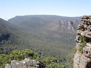
Fabulous
views along the way made it all worthwhile.
Around
another bend for a different aspect – looking south-east.
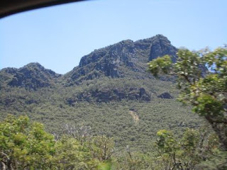
Further
up – looking south – we are camped down there under the pointy-top one I think.
Bit hazy but still magnificent views. Hope there isn’t a fire down there.
Passed
two guys coming down with their backpacks. Nearly to the top is a turn off for
the Major Mitchell Plateau Hike. Now we know where they came from.
The
towers at the top are for telecommunications and air navigation. The sign
confirms the snow discussion.
Steve
found a cairn around the northern end of the fenced area. We made it to the
top.
The
road up was opened in 1963. Major Mitchell climbed it first in July 1836 and
named it Mount William. We are 1167 metres above sea level and the highest
point in the National Park. Yeah I love being able to work out what’s what.
Scanned
around from south to north over the Serra Range.
Four
backpackers arrived and walked further out on the rocks. Zoomed in on Lake
Fyans (11miles) and Lake Lonsdale (18miles), which looks dry.
Zoomed
in on Halls Gap.
On
the eastern side I scanned around from north to south.
Mt
Ararat.
After
a chocolate bar and an apple and lots of water we headed back down. It is like
Fleet Street again with so many people trudging up the road. We told them all
to go around the fenced area to find the cairn as there isn’t a sign. I should
have started my ‘Advice to townships about tourist icons that need signs or
more info etc’ but my blog keeps me busy enough.
Looking
back over the escarpment to the Pyramid – must be nearly at Gordonvale!!
A
guy road past on his bike – is he mad!! His mate gave up and was pushing it up
– they will have no brakes if they plan to ride it back down. Back to the truck
and the car park is full of cars now. Headed back down then stopped at an old
lookout.
Further
down we stopped for a shot of this escarpment and the huge slides from it.
Back
to the van for lunch (26 degrees in the van) then we packed up and headed off.
Decided to head down to a free camp beside a lake 25km away from Terang.
Continued down the Grampians Tourist Road
along the Serra Range till Mt Abrupt came into view. Didn’t stop to do
the hike up that one as Mt William is the highest so that will do us fine!!
The
other side of Mt Abrupt.
Missed
getting a shot of The Piccaninny then Mt Sturgeon came into view. There are walks
to both of these too.
Turned
left at the base of Mt Sturgeon then headed into Dunkeld. Left onto the Glenelg
Highway with wonderful views back to the Grampians as the surrounding area is
so flat you can see them for miles.
Passed
a wind farm and they are still harvesting wheat around here.
Interesting
driveway.
Through
Wickliffe which was a little village with an old sandstone church and home.
Turned
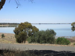
off at Lake Bolac onto a minor road to head to Mortlake. Checked out the Lake
on the way.
Drystone
rock walls lined the paddocks next for a few kilometres before we got into
Noorat. There was a sign about the walls but no room to pull up. Will try and
find out the story.
Pulled
up at the park in Noorat for a cuppa. Alan Marshall the author of ‘I Can Jump
Puddles’ lived here and based the book on experiences of growing up here. Alan
lived in the house behind the Beehive Store with Mount Noorat in the
background.
Mount
Noorat is one of Victoria’s best preserved dormant volcanoes. The crater is
159m deep ad 400m wide.
Lovely
old pub.
Continued
down the road to Terang where the others will be staying from Boxing Day. Drove
25km to Cobden then turned onto a dirt road down to Lake Elingamite.
Dropped
down from the road to a lovely area with an avenue of trees (120m above sea
level). One other camp here – a tent. Got our spot and set up.
The
water level is very low on the lake and a sign warns that the foreshore is
thick mud so won’t be going for a dip here!!
Got
out the washing machine and got up to date with the wash ready for the busy
week with the others. Pulled out the carpet and swept and mopped the floor –
housecleaning done!!
The
flies are back – got out my flyswat and killed a few hundred while we had a
drink outside.
Plugged
the phone into the aerial and continued my Christmas ring around at 6pm. So
nice to chat with everyone. Range Christine, Susan, Valerie & Russell,
Steve & Michelle, Tracy & Grant, Marree (Pete was out), Ian, Jenny,
Wendy B and Carolyn. Rochelle & Jodie were out. Rang Glen to see how he was
going – they were in Dubbo so should be in Terang tomorrow night.
Cooling
off a bit but not too bad. Three other lots came in to camp for the night. At
9pm the sun was just disappearing and had dropped before I got down to the
lake. Still a beautiful colour though.
Just
got into bed then Pete phone – he forgot the time difference but it was great
to hear from him. Sounds like everyone is over the rain up there already – a
true wet Christmas like when we were kids.


No comments:
Post a Comment