Add to Mildura plaque info
yesterday
I
read in one of the brochures that the hull sat on the reef undisturbed until WW2
when allied planes used it for bombing practice.
7.30am
27 degrees, clear sky and light breeze. After breakfast we went down for a swim
– so clear and calm. The white line of waves on the reef is very distinctive
this morning with less wind.
A cool
wind sprang up so we decided to just walk in the shallows – sooks that we are.
Spotted a small reef shark cruise by then a shovel-nosed shark had fun burying
itself. A stingray came by too.
Packed
up and headed back north.
Stopped
at Milyering Discovery Centre. I asked the staff about Yardie Station – they
said it was handed back to CALM in the 1980s and became a Conservation Park. I
asked about Sal Salis Ningaloo Reef that we noticed on the map. It was closed
now but we noticed some framework for canvas covers. I thought it was a school
education centre but it is a privately owned high-end Eco Lodge. They laughed
at the thought of schools paying the exorbitant prices people pay to stay
there.
Lots
of information and things to check out.
In
the dome I found the name of one shell I found on our way north – The Heart
Urchin. The Sea Urchin were the ones Steve made a cairn out of. The slugs we
have seen are called Chitons.
In
another room there was info and photos about Cyclone Vance and the Whaling
Station.
Now
we know who Thomas Carter Lookout is named after. He took up the first of four
pastoral leases around this area in 1898 and he discovered some palms.
We
watched some of a DVD called ‘Naturally Ningaloo’. The section about Manta Rays
was interesting as each one has its own special markings.
Wow
there are a lot of caves and sink holes in Cape Range – obviously there is no
access to the public.
Great
poster showing Yardie Creek and its gorge that we walked up yesterday.
Stopped
for a cuppa at Hunters Beach below the lighthouse. More information about the
Jurabi Coastal Park.
Windier
here.
Good
waves are rolling in for Surfers Beach to the north. The main reef seems to
finish near here so the waves can roll in.
Around
to the east side of the VLF towers. Fascinating looking at the towers and all
the tie down wires etc. Amazing feat to build that back then. Continued on up
the east side of the cape.
Notice
about the Point Murat Naval Pier which is a great diving area. It is to the
left and the boat ramp is to the right.
Bundegi
Beach is the northern end of the Ningaloo Marine Park and World Heritage Area.
It looked so nice I just had to have another dip as it is quite hot again
already. Steve kept lookout for sharks (haha) but only spotted a turtle.
Headed
back with emus wandering along the roadside before the Holt Communication
Centre. Spotted another ‘big thing’ – a whale shark. Just managed to get a
photo as we drove by.
Into
Exmouth township where we grabbed some fresh fruit and vegies from the IGA.
Drove out of town to Town Beach which is in the Exmouth Gulf. Nice mural on the
toilets and lots of green grass in the picnic area.
We
went further along where there was room to park. We can see the marina. Very
nice but it is still and hot here.
Had
a quick lunch then realised we missed seeing the ‘Big Prawn’ so headed back
into town. There is a water point there so while Steve topped up the water
tanks I wandered around reading the information and taking pictures. Now we
understand about the prawn processing factory we saw at the turn off to Charles
Knife Gorge. We are lucky to see the prawn as it is usually put into storage
for the cyclone season.
Nice
neat town with lovely trees. The flowers are fascinating.
Obviously
this was the site of the old Information Centre – now it is an art gallery.
There was an information shelter on the other side which I checked out. Cape
Range is 80km long and 20km wide. As we have learnt everything about the area
and its history we are skipping the new aquarium and galleries this time.
Headed
south again and topped up with fuel at the cheaper 24hr bowser. Amazing how
much we used driving up and down the Cape Range National Park. Since we topped
up we have covered 365km.
Continued
south then turned off onto the track up to Potshot Canyon. It was named Potshot
after the shot holes left by explosive charges detonated to trigger miniature
earthquakes for seismographic studies during the oil searches in the 1950s. Meandered
along trying to find somewhere to leave the van. After crossing a few dry creek
beds Steve decided to pull off onto a flat creek area and we unhooked the van.
We left all the roof vents open as it is very hot now – 40 degrees.
Continued
along the track winding our way up the canyon crisscrossing the creek beds till
we arrived at the end.
We
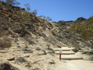
climbed up the steps, can’t go up to the top anymore.
Somewhere
up there hikers arrived from the walk from Thomas Carter Lookout.
Looking
to the other side and up another valley then around to the canyon we just drove
up.
Back
to the van and hooked up again.
Back
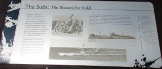
to the main road then down to near Learmonth where we stopped at the Krait and
Potshot Memorials.
Very
hot in the sun but we are ok under our big Bunnings hats. It must have been terrible
for all the defence personnel living here in these conditions with canvas tents
etc to live in. Climbed up the hill to read all the information. First about
Operation Potshot.
Then
the Jaywick Operation – the Z Force trained in Cairns in the House on the Hill (where we
used to go dancing when we were 16). Two missions – one successful, one not
with a very sad ending.
A
ball float and floating tank are on display.
Got
some better photos of the Solar Observatory as we passed. The info board in
Exmouth said it was opened in 1979 and is part of a world wide network that
monitors solar activity 24 hours a day. This site was chosen as Exmouth has in
excess of 3500 hours of sunlight per year.
Continued
south through Exmouth Gulf Station. The homestead is over on the hill to the
east on the Rough Range (only looks like rolling hills) – now I realise that
was just the name of the range rather than the description of it. The Hema
shows the site of Rough Range No. 1 Oil well further east of us.
Down
to the turn-off to take us east to the North West Coastal Highway. Up and down
the red sand ridges covered in dead-looking grass.
Passed
Bullara Station which is a working cattle station that has homestead and
camping facilities in the cooler months.
Onto
flat red soil country and grasses. Steve battling with a strong side wind.
Entered
Girilia Station, a de-stocked wilderness station, that also has camping
facilities and advertises great fishing at Girilia Bay which is at the southern
end of Exmouth Gulf.
Back
into spinifex country with a long sand ridge beside us.
Turned
north east onto the North West Coastal Highway and entered ‘The Pilbara’.
The
wind is behind us now so ‘Pat’ is very happy zooming along even with the hot
day.
Rolling
over red sand ridges – much easier on the bitumen compared to when we were
doing this on the Canning Stock Route.
Clouds
in the north and east as we continued on. Crossed the Yannarie River (wide and
dry) then pulled into the Barradale 24hour rest stop. Barradale is the name of
this station. There is an old house nearby but no one was about.
We
chose to drive down closer to the river to try and get some shade for the rest
of the afternoon as the wind is very hot and dry.
6pm
41 degrees in the van. Such a contrast to the coast where it was a much nicer
temperature.
Had
dinner after the sun had set.
Lightning
started flashing to the east – would be nice to get a good drop of rain to cool
things down.
10pm
35 degrees. The wind has stopped – so glad we have our 12 volt fans.
The
lightning is still flashing in the distance – no rain.


No comments:
Post a Comment