7.30am
20.8 degrees, overcast and a cold wind.
Mum
rang to give me an update – she has gout in her toe giving her a lot of pain.
Greg and Katie were there giving Mum and Dad are hand which is wonderful.
We
headed east to Quairading into ‘rock’ country. Lots of trees beside the road
have had branches broken off – probably from the storm recently that brought
all that rain we had. We pulled off to check out a lovely little church and
have a cuppa – can’t wear my driver out by driving too far!!
St
Andrew’s Anglican Church, Greenhills. Can’t get in but got a good photo of the
inside. Lovely the timber ceiling.
On
the road again and I noticed on Wikicamps a mark called ‘Beercan tree’ – I
think a lot of the cans have been blown off as there are a heap on the other
side of the road.
Into
Quairading where we are greeted by the Grain Family. Graffiti vandals hit the
back roads too unfortunately. The Grain Family came from The Grain Man which
was the logo for the Grains Expo held here in 1987 – Wesley Wheat, Ollie Oats
and Lucey Lupin.
Parked
in town and went for a walk looking for the wood sculptures. Lovely gardens
around the Shire Hall (built 1925).
All
quiet here. Peered in a window at a collection of signs on the wall of the IGA.
Only
a little place but of course there is a pub.
Interesting
name for a bank.
Lots
of old cars that maybe are going to be restored.
In
the centre of the street was a wonderful War Memorial. I understand this all a
bit more after reading Albert Facey’s book.
Across
the road is the old railway station. This train line from York to Bruce Rock
isn’t used any more. Great map.
Found
one of the Natural Wood Sculptures – the rest are inside but it isn’t open
today.
Continued
east over ‘Pink Lake’ which due to the recent rain isn’t pink at the moment.
Turned
into the old townsite of Kwolyin. Checked out the information board.
The
main street taken about 1958.
The
Hotel looked very grand.
In
2013 the shire have made a72 hour campground here with great facilities and
closed the camping area near Kokerbin Rock. Hope the BBQ works.
Continued
9kms out to Kokerbin Rock. The third largest monolith in Australia (Ayres Rock,
NT then Mt Augustus, WA).
Great
photo though it looks like we can’t drive around the rock anymore are there is
a huge gate across the road.
Info about monoliths. We
think that this is ‘Wave Rock’ on the map. Needs some plants removed.
Devil’s
Marbles.
Around
to the other side and up the rock. Found a ‘bobbing’ lizard. When you come
close he bobs his head up and down.
Up
to the cairn at the top, erected to commemorate WA’s 150th
Anniversary. Missed the Grand Canyon – everything is a bit overgrown.
Great
view though we have to hold on as the wind is trying to blow us over. At least
it is blowing the clouds away. Starting at Mt Stirling to the north-west then
around in a circle.
My
time to pose.
Walked
down the rock towards where we think the van is below us. Interesting
weathering.
Found
our van.
Looking
back to Devil’s Marbles area or Dog Rock as it said on the map.
Headed
back down.
Steve
found a cubby hole.
Back
down then we turned off to check out the old well. Still has water in it.
There
are picnic tables here too with some more information about the well and the
old school site up the road.
Headed
back around the rock. Now we have figured out things I think this is the
Devil’s Marbles area.
Walked
in to an area we think would be the Grand Canyon walk but it is all overgrown.
Found
a good cave.
A
big marble stuck between to big rocks.
I
stood up to take a photo and stuck my head in this web. Luckily the spider
didn’t get too bother by the intrusion.
Continued
back – looking up to where we were standing on the summit.
Found
another overgrown track trying to find the ‘wave rock’. Found the platform.
You
can see the wave but it all needs a bit of a prune around here.
Steve
found a small wave to surf.
I
laid on the rock to try and get a better photo.
Continued
along next to the rock to the other platform where the first info was about
monoliths.
Back
to the truck – view up to the summit area.
Found
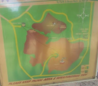
an old map showing where you used to be able to drive to and other walks. If
they want to change things they should take down the old maps!!
Drove
around to the other picnic area checking out the site of the old school.
Back
to the campground and found a spot to park. The wind is getting stronger.
Had
lunch and watched our photos of two years ago – haven’t caught up yet. Worked
on my blog till coffee time then headed off to check out the walks around here.
Will do the Railway Walk.
Found
the town’s golf club – 2nd tee.
Up
the rock following markers though we passed three stacked together. They are
falling off the rock!
The
sun is making long shadows as it goes down. Looking across to Coarin Rock on
the other side of the road.
Very
wobbly surface to walk on.
Great
sign but the wind or someone has turned it around. Steve straightened it up.
That
marker leads around the rock. We are heading down the slope to the old railway
line.
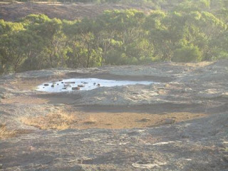
Found
a rock pool.
Found
the railway line and a sort of track. Luckily there were a few white posts
still visible to follow and I have my ‘tracker’ with me.
Continued
along beside old telephone lines and railway lines.
Finally
back to the road and the old tennis courts and clubhouse. There are still white
lines after all these years.
Further
over we found a newly fenced area with a few graves of the Holland family.
A
huge Jade bush nearby.
This
is where the Hall was situated.
Anyone
for a game of cricket.
Back
to the van for a drink as the sun has set - will check out the rest of the 'town' tomorrow. The BBQs don’t work – no ignition
Steve says. Bit cool to be eating outside now any case as the wind has cooled
things down a lot.
Put
the HWS on as we will need a warm shower tonight.


