Clear
cold morning 10 degrees in van at 8am. (7.7 outside).Texted Wendy Blue to wish
her a happy birthday.
Steve
climbed up (using caretaker’s bigger ladder) to reseal the join over the door
where we think the water got in the other day as they are forecasting rain
again.
I
wandered over to say bye to Pete and Penny as they are heading off to Bruny
Island for a few days. Penny said it was 4 degrees overnight – I can believe
it. Nice and warm where they are camped (where we were the first night). Note
to self – think about sun angle when parking. We chose here because we wanted
the fireplace and creek edge and as it was overcast didn’t think about morning
sun!!!
Jon
rang, poor Bandit got a bad tick and is having a day at the vets. Hope he gets
better.
Headed
down towards Shipwrights Point to dump the toilet canisters but missed the turn
off as we were peering at the Huon Salmon boat which sucks the salmon out of
the pens.
Kept
going up to Franklin. The camp area looks a bit drier compared to the last time
we drove in.
The
funny islands in the middle of the Huon River.
The
tavern looks old worldly.
Zoomed
in on Mr Pig and noticed the history board there. Will have to dig out my
Franklin history brochure and come follow the trail.
Interesting
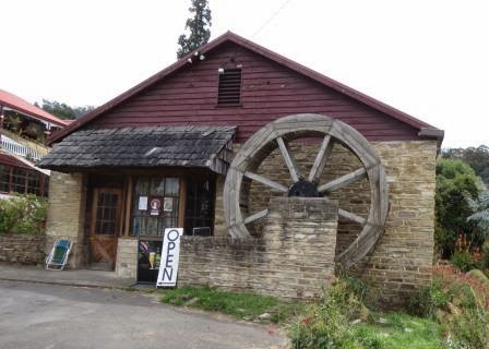
place with waterwheel.
Someone
had mentioned that there was another free camp up one of the roads here so we
went for a drive. Didn’t find the camp but found unusual houses up the hill
slopes and lovely views.
So
modern it doesn’t quite fit in with the rural setting.
Looking
back down the Huon River.
Stopped at a fruit stall outside a house (with video camera) and bought $5 worth of big plump cherries – yum yum.
Stopped at a fruit stall outside a house (with video camera) and bought $5 worth of big plump cherries – yum yum.
Back
to the entrance to Geeveston. Stopped to get a photo of the huge poles with the
banners hanging on them. Geeveston is known as ‘The Forest Town’.
Heading
out of town towards the Tahune Airwalk area. Passed apparently the best pie
makers and their cute ute on the roof.
Lovely
old car in the driveway.
Following
along Arve Road we stopped at the Look-In Lookout. Just a short walk around
some old mill equipment etc.
And
of course some lovely big old trees.
Amazing
how they managed to cut down the big old trees. Just chopping the firewood is
enough for us.
Stopped
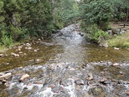
at Arve River Picnic area. The old river crossing.
Looking
upstream.
Steve
was making a cuppa while I went to the toilets and the old bloke in the hut
came over trying to bum a cigarette. “Interesting”. The toilets have the new
type of graffiti too – done with chalk – at least that is easier to clean off.
A few march flies tried to annoy us. Big tree trunk.
Information
board explained about the forestry clearing and the different areas. It
mentioned Leatherwood trees and bees. We passed a pile of bee hives tucked into
the bush as we were arriving here.
The
Arve River Streamside Reserve Forest Walk sign said “10 min round trip” so we
headed off. Lovely walk for a bit along the river.
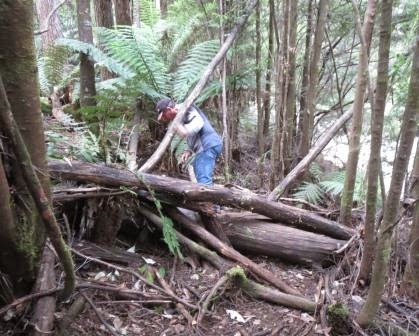
When
that tree fell it took so many more with it. The trees are all crossed up over
each other and rotting away. My photos don’t get the mess it looks though.
Down
the stairs through some more big trees that have been cut through.
This
one went for ages but the camera doesn’t show the length well.
Steve
said “looks like the ferns and fungus probably kill the trees too.”
Keep
forgetting to put that wet rag in to clean these boards.
Looking
at the colouring of the trees I can see where they got the khaki camouflage
colours from.
The
old guy has driven off – for cigarettes I suppose – and left his fire burning
and his possessions in the little hut.
Turned
off into Hartz Road heading for the Hartz Mountains National Park. “A Working
Forest since 1850” the sign read. Dirt road used by logging trucks too – all
the logging areas are marked the area name and spur, eg Hartz Spur 1. Some have
gates and some are open. Stopped at Waratah Lookout (780m elevation) where
there is a good map showing the area and an old hut with modern gas BBQ etc but
you have to climb up the hill to get to it!!!
The
local community of Geeveston has a special bond with the area. Town founders,
the Geeves family, cut the first track to the area and explored much of the
south-west. One of the earliest tourism ventures was by local storekeeper,
Richard Geeves, who organised tours in the early 1900’s. Trips took 3-4 days
and parties stayed at a ‘chalet’, complete with housekeeper and guide.
Found
out the skink we have been seeing is the Southern Snow Skink.
As
we headed off we read about the Waratah – not in bloom now but we saw them in
Cradle Mountain.
Out
onto the platform. The Arve River falls over the cliff face near us. Usually I
suppose you wouldn’t see it but as we have had all this rain it has made it
more noticeable. The Arve Falls are further on up the track.
Fabulous
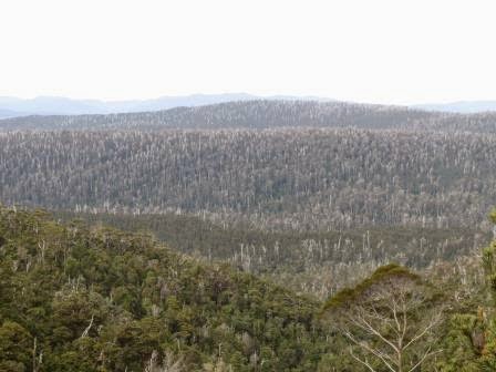
view overlooking the Huon Valley forests to the Wellington Range. Old Myrtle forests
grow immediately below the lookout. It looks like a heap of echidnas with all
the dead white trees sticking out of the green growth.
Areas
of trees have been cleared in the distance. The wind was howling up the valley
so when you leant over the lookout you got a blast but step back and all is
calm again.
Back
to the truck and onto flat open area to walk down to the official Arve Falls
(780m). The mountains tower up beside us all bear on top from when they are
covered in snow.
Info
boards along the path.
The
Tassie Snow Gum has the button looking seeds. On the ground they look like big
buttons off a coat.
Lots
to read along the way.
I
zoomed in on a plant as I saw some red and thought it was a late blooming
Waratah but when I looked on the computer it was just new shoots on a plant.
The
water is flowing well – even saw a little trout.
More
info about Banksia, even though I have read them before in other areas.
The
River is either fed by two streams or it split further up as there are two lots
of water coming in at the top of this photo.
Crossed
over the River (on a bridge). Would be a nice spot for a dip!!!
At
top of falls before walking down to the platform.
Lovely
falls in the top bit with so much more water coming over them.
Then
they just disappear below us.
A
couple of selfies – one with falls behind and the other the mountain view.
The
echidna looking mountains.
Did
some “exercise” – quick short sprints up the stairs to get the heart pumping
(that is what “they” say to do).
Further
along the narrow winding road – only single lane really but lots of pull over
areas along the way. At the end is a big hut and toilets – a lot of money spent
here. Info, walker sign in and tables and chairs (860m elevation). It is only for day use!!! Seems a bit
extravagant as most people come, do the walk and go.
A
topographical map to show where we are and where the hikes go.
The
walks info. We might come back and do the Lake Osbourne one as we are running
out of time now.
Great
shot of snow on Hartz Peak.
Hartz
Mountain National Parks history.
Story
of the two Geeves boys when they perished on the mountain. There is a memorial
up the track which we will check out.
Outside
another Info board to read.
As
we head in we have to do the foot cleaning process because it is World Heritage
Area.
Started
off on a muddy track but it quickly changed to a boardwalk which was nice. Mr
Wombat used it too – he left his calling card.
The
plaque is mounted on the large rocks.
Great
view from here.
A
Southern Snow Skink.
A
cute little waterfall on the way back.
Headed
back down the road. As we passed the Waratah Lookout again a wallaby sat beside
the road and seemed to be looking to the other side expectantly.
Her
joey was on the other side.
On
the way we had noticed a sign hidden in the bush about a stump/butt and Steve
had seen a steel rail up the hill. Slowly we headed back down looking, looking
and looking!! Eventually we found it (340m elevation). While Steve parked the
truck I headed up the track. Bit muddy and had to climb over a log but I found
the huge buttress of the tree. Decided to a “Butt” shot!! Hope my butt is
smaller.
Climbed
up higher to the other side. A plant growing out of the top of it now.
We
couldn’t find where it would have come from but we think that it was growing on
the road and when it was felled it landed here and the stump would have been
removed to put the road through.
A
pretty blue feather.
Steve
climbing over the obstacles – obviously these old ‘tourist’ attractions don’t
get any attention any more though someone had walked up before us.
Steve’s
turn for the “butt” shot.
On
the way back we passed a sign “Rehabilitation area after sever wind damage in
November 2002”.
Looking
over Geeveston as we head back down Arve Road.
Love
this tree.
The
river level has dropped a lot – might get to see the platypus yet. He was out
yesterday having a swim!!
What
a change from last night. When we got back it was so balmy that I had to change
out of jeans and put a lighter top on and just my thongs on my feet (just in
case you thought of some other thong!!!) It was so nice not to be cold. At 6pm
it was 26.7 degrees in the van so I had to open some windows. Had dinner beside
the river, not needing to huddle around the fire either.
Rang
John and Joc to see when they arrive in Hobart so we can all catch up with
“cousin” Cathy and her daughter Darcie as they arrive on Friday for a couple of
days. Rang Cathy to arrange meeting up with them on Saturday. Went over to chat
with a group having a drink, Queenslanders – discussion “how to vote”.
Back
to the van for a cuppa and turned on the TV but no signal – the booster isn’t
working. That was where Steve was redoing rusty screws as he was fixing the
water leak. The speakers for the radio don’t work either!! Another job for
tomorrow. Quiet night then reading and blogging.
At
10pm it was 26.7 degrees in the van so we opened some windows!!! It was so nice
not to be cold.
Mum
and Dad at Bicheno.


.JPG)
.JPG)
.JPG)
.JPG)
.JPG)
.JPG)
.JPG)
.JPG)
.JPG)
.JPG)
.JPG)
.JPG)
.JPG)
.JPG)
.JPG)
.JPG)
.JPG)


.JPG)
.JPG)
.JPG)
.JPG)
.JPG)
.JPG)
.JPG)
.JPG)
.JPG)
.JPG)
.JPG)
.JPG)
.JPG)

.JPG)
.JPG)


.JPG)
.JPG)

.JPG)
.JPG)
.JPG)

.JPG)
.JPG)
.JPG)


.JPG)
.JPG)


.JPG)
.JPG)


.JPG)
.JPG)
.JPG)
.JPG)

.JPG)
.JPG)
.JPG)


.JPG)
.JPG)
.JPG)
.JPG)


.JPG)
.JPG)


.JPG)
.JPG)

No comments:
Post a Comment