Up
early and on the road by 8am to get to Fremantle for our 9.30am ferry to
Rottnest Island. Lovely day with a clear sky, cool to start. The ferry leaves
from O’Connor Landing – named in recognition of the designer of Fremantle Inner
Harbour, CY O’Connor, Engineer-in-Chief of WA, 1891-1902 (who did the pipeline
to Kalgoorlie, busy man).
Checked
out ‘The World’ moored up from us – everyone has a balcony on this one.
Further
along towards to ocean was ‘STS Leeuwin II’.
The
mouth of the Swan River where we will be heading.
Across
the river to all the shipping containers and cargo ships.
Little
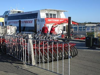
wobbly trip across as there was a good swell from the south-west. Got our bikes
– takes us back. Oh the seat, now we remember why we don’t ride bikes anymore.
Walking
down the jetty – lovely view to the right.
Steve
had to get a photo of me on my bike.
Into
Thomson Settlement. Rottnest Island earning its name in 1696 when Dutch
explorer, William de Vlamingh, mistook the island’s unusual marsupial
population for common rats. Now the Quokka is one of the main drawcards of the
island. Rottnest Island was originally established in 1838 as a prison for
Aboriginal people from the mainland. They were housed in an octagonal “Quod”
built in 1864 which is now part of the Rottnest Lodge.
The
water is so clear and blue in Thomson Bay. Lots of buoys for the boats to tie
up to.
Nice
pines everywhere.
Headed
off – not bad but I my gears don’t change, luckily it is stuck in the easy
pedalling gear.
This
jetty was originally built in 1907 and there was a tramway connecting it to the
Settlement. Renamed Army Jetty because of its use during WW2. They put in more
rail lines to transport heavy equipment etc. The road we rode down was
originally the railway track.
We
are on the other side of Thomson Bay but there is still a bit to go to get to
the point.
Continued
on – someone forgot to tell us there are hills on the island!! Into Kingstown
Barracks and the railway station.
The
barracks and houses are now used for holiday accommodation. There are walks to
do as well as the bike ways, would need a few days to do it all. Rode out to
the water – view back to the mainland and sand dunes.
This
is the map they should have given us – better detail.
Not
sure who the houses are named after, maybe commandants as each has a different
name and year span – Fitzgerald 1848-1855.
A
couple of peacocks enjoying the shade at Clarke 1846-47. The sun is warm but
there is a cool breeze so it is pleasant.
The
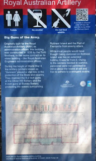
Barracks built in 1936 and Parade Ground are still in great condition. Big gun
too.
Across
from the Barracks is the Royal Australian Engineers administrative offices.
They used copper for the gutters and downpipes.
Another
admin office for the Royal Australian Artillery.
The
railway line to Oliver Hill is only for walkers.
We
continued along the road and came to the railway shed anycase.
Bickley
Swamp.
The
hills get our knees so we get off and walk which feels great after being on the
bike seat!! Lots of trees in the gullies.
The
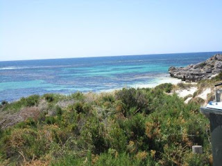
view of Porpoise Bay when you get to the top though makes it worthwhile.
Stopped
to explore Henrietta Rocks and the wreck of ‘Shark’, sunk in 1939. Only the
winch mechanism is left now.
Fabulous
view.
Walked
down the stairs to the beach.
Continued
on – the downhill bits are fun. I go a lot faster than Steve as I don’t have
the gears slowing me down but he gets me up the hills as he can change gears.
Turned
off to do the Parker Point Loop.
At
the bottom of a hill there were a lot of people milling around so we stopped
for a look and found our first Quokka. If he thought you had food he would go
to you for a sniff.
Steve
conned him with a stick.
Nice
treed area.
At
Parker Point there were more Quokkas under the trees.
There
is a marine sanctuary here where you can snorkel but no fishing. Time for a
selfie at the lookout.
Steve
trying ‘the shoosh’ that the American movie commentator said gives you a better
look for photos – don’t think it worked!!
Great
beach area.
Zoomed
in over the island to Perth City.
Continued
along the coastline – fabulous.
Next
stop was Little Salmon Bay – very nice. Great cave to get out of the sun though
the wind is strong on this side and quite cool.
Chatted
with a couple of internationals who are skateboarding around the island – doing
well as they have been everywhere we have been and we are on bikes.
Continued
around Salmon Bay.
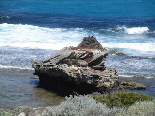
Two
Osprey are on their nest.
While
we were watching one took off for a fly over us.
Then
he landed gracefully back on the nest.
Great
limestone rock formations along this part of the coastline.
Looking
across the Bay to Wadjemup Lighthouse.
Another
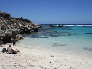
great beach area – there is 36 beach coves around the island.
Clicking
away as we continue around – getting good I can click while I ride!!
Sandy
area and pines.
There
are a few signs guiding our way – still a long way to the western point of the
island. Lunch at Green Island – that sounds like home.
Bit
different to our Green Island.
Nancy
Cove surrounds Green Island. Nice ledge to sit on. Fed one seagull then all his
friends arrived but he wouldn’t share and got all cranky at the other ones.
Headed
off again to the most westerly point. Another few Quokkas stop us – lots of
poop everywhere.
Down
the narrow neck with Rocky Bay on the northern side of the island – lots of
boat anchoring buoys here.
Stopped
to check out the memorial to Roland Smith.
Steve
found another Quokka then a little one came out. So cute and soft.
I
walked up the steps, bending over to get under the trees, to the old lookout –
there was even a picnic table. Rocky Bay and across to Wadjemup Lighthouse.
Mr
Percival floated along looking for something to eat.
Went
across to the eastern side of the neck to Strickland Bay.
Only
low foliage along here so the wind is blowing us backwards. Nearly at the end.
Cape
Vlamingh (named after the Dutch explorer). Great photo.
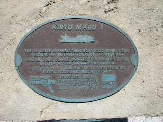
There
are lots of wrecks around the island. This Japanese ship ran aground in 1984
out there somewhere.
A
bit further yet.
A
quiet cove called Fish Hook Bay on the southern side of the cape.
The
waves are rolling in over the ledges.
Site
of a search light.
Lots
of water between us and Antarctica.
A
King’s Skink enjoying the sun.
Steve
had wandered down the boardwalk.
He
was reading about the food web.
Noticed
lots of holes in the ground and guessed right – more Shearwaters.
Watching
the water rush over the rocks through the hole in the rock.
Great
spot for whale and dolphin watching but none were around today.
Made
it to the western point – now to get back to the other side going around the northern
side.
Back
on the bike and off we go.
Turned
off and headed north. Found some more Quokkas near the Radar Stations.
Down
the hill to Stark Bay – glad the brakes work.
Pushed
the bike back up another hill for another great view back over the bay.
Crayfish
Rock.
Ricey
Beach.
Can
see the lighthouse again.
Spotted
a Quokka under the tree and when I pulled up he came rushing out to say hello.
Then he continued across the road. Got a video of him jumping – both back legs
hopping together.
City
of York Bay named after the wreck there which ran aground in 1899.
Earlier
this morning we had jets flyover us, now we have three of the Roulettes.
Took
another detour past Catherine Bay.
Then
around to Little Armstrong Bay where they are creating a stairway down to the
beach. Using the limestone blocks for the entrance.
Back
to the main road then turned off for a kilometre ride down to the pink lakes –
Lake Baghdad.
Great
photo.
It
looked pinker through my polarised sunglasses.
One
wind turbine on the island. The way the wind is blowing today they could have a
whole farm here.
Back
out to the main road, up the hill and then we are beside the lake again – 2
extra kms we didn’t need to do!!
Turned
off into Little Parakeet Bay – a favourite for the snorkelers. Tempted but we
are waiting to swim at The Basin as it is the only one with a free water
shower.
Continued
on to Geordie Bay.
As
we cycled around Steve spotted a mantra ray working its way along the water’s
edge – or was it the girl’s rear end!!
Around
to the general store then back along the water’s edge. Nice secluded bay here.
Fay’s
Beach in Longreach Bay.
The
road is getting taken back by the sand dunes.
Arrived
at The Basin with everyone else!! Got changed and headed in for a dip. It was
freezing but the sun was warm and after my skin froze it was very nice. Nice
little sandy area between the reef. Heaps of fish came out to check me out.
Steve
gave in and got in too. Ticked off another thing – swimming in the Indian
Ocean.
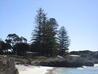
Nice
area with big pines lining the foreshore.
I
even found a souvenir shell – well the bottom of it.
Washed
off and redressed. Revitalised us. Not much further till we are back at the
Settlement.
Continued
around the bay to a lookout – looking over Thomson Bay.
One
of the street signs with history information.
More
Quokkas.
Back
into Vincent Way (one of the oldest streetscapes in Australia) and there are
Quokkas everywhere.
Found
some history plaques outside the old limestone buildings that are now holiday
rentals. The Pilot Service quarters.
The
Boat House set into the bank.
House
first used by a Moral Agent – his task was to improve the morals of the
prisoners. Then it became the pilot’s cottage.
Second
home for the Superintendent.
Prison
guard’s quarters.
These
were the first two buildings on the island in 1840 – home for the
Superintendent until 1848 then the Governor made it his summer house.
The
Front Walk – these buildings have been used continuously for 150 years.
The
Salt House where all the salt was stored from the many lakes on the island.
The
shops are where the stables used to be.
We
found the ice cream shop – our reward for all that riding and walking.
Of
course the Quokkas are everywhere and the crows and magpies fight over the
leftover food.
Spotted
some more history plaques. The Common. Still looks the same except for the big
trees in front of the building.
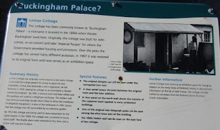
Went
to the other side of the Common to check out Buckingham Palace. I think the
Queen might be disappointed.
A
section on the Aboriginal aspect of the island.
The
old school house is a rental too – people were on the balcony enjoying
themselves so I didn’t get a photo.
Across
the road is the orchard.
The
Chapel.
Boys
Reformatory.
The
Hay Store is now the Museum. Need to spend a couple of days here to see it all.
Holy
Trinity Catholic Church, complete with bell tower.
Nearly
time to go so we rode back to the jetty and dropped off our bikes. Has been fun
but we much prefer walking!! Found a big anchor near some seats. Rang Mum and
Dad to tell them what we have been up to!!
Realised
we missed the Bathurst Lighthouse which was a further around from where we rode
out to the lookout over Thomson Bay – but we have seen lots of them so not
going to rush over to it!! There was another wreck out from it – ‘Transit’ 1842
and a few more further out.
Saw
the skateboarding international boys at the jetty – they did well but didn’t
make it to the western point like we did. Our ferry is here.
All
the bikes are loaded back on too.
It was a rolly trip back as the swell has come
up a lot and the wind has got stronger. Lots of spray coming up on the windows.
Back
to Fremantle and our truck then programmed ‘girlie’ to take us home. The
Fremantle Port Authority have a big building – nearly looks like an airport
tower.
Man
and dog statue – will have to find what that is about when we come back to
explore Fremantle.
Sun
still shining at 7pm but the moon is up and nearly full.
Nearly
home at 7.20pm and the sun set is creating a lovely colour above the Perth Hills.
Back
in for a drink and to put our feet up. Great day though we might not remember
the hills and the bike seat fondly tomorrow.




















No comments:
Post a Comment