Early
phone call from Kerry Lee in Cairns – she forgot the time change but we were
awake so all was good. They are still progressing with their dream of being on
the road too.
My
last day of being 53 and the sky is clear and blue!! Watched the flood reports
on Sunrise – poor things.
Drove
around the WW2 Army Hospital area checking out the signs and the foundations
that are left.
Back
to the picnic area beside the dam. More history.
Looking
back over the dam to the channel we followed up to the rock yesterday.
The
caretaker’s house has disappeared.
Drove
through town then onto the highway heading west to find the No. 4 Pump Station.
Passed big silos at the train depot. They need a paint job like the ones in
Victoria. This is one of the largest inland grain receival points in the State
capable of storing 468,860 tonnes and it is the longest grain storage facility
in the Southern Hemisphere. Around 40% of WA’s wheat is grown within a 100km
radius of Merredin. There were carriages full of grain and ones full of ore
from the mines.
The
pump house is closed off now because of asbestos too. It was built in 1902 and
closed in 1960.
The
round tank was not the usual choice.
Walked
around the fence for a look.
The
first generation electric pump station.
The
newer reservoir.
The
latest electric pump station built in 2002.
On
a info board which is supposed to be a picnic area – but the grass has been
left to grow all over it – we found some info on Merredin.
Gavin
rang back so we will catch up with him soon in Kalgoorlie. Back into town to
check out the big water tank for the old steam trains.
Walked
over the deep rock-sided channels into Pioneer Park where a bronze sculpture of
a farmer and his Clydesdale horse celebrate the role of these horses in opening
up the wheatbelt.
On
one side of the park is the Railway Museum and the other side is the Military
Museum.
Drove
through town checking out the lovely old buildings.
The
Cummins Theatre was railed to Merredin and rebuilt in 1928 by local brewer
James Cummins. It was reconstructed with bricks salvaged from several
Coolgardie Hotels. The original theatre’s stage, decking and pressed metal
ceiling were part of the Tivoli Theatre (circa 1897) built in Coolgardie. It is
still used for productions, films etc.
Back
to the RV parking spot near the new train station. My transport on the 23rd
April when I head back to Perth to fly home – The Prospector.
Walked
back to the old train station.
Continued
east on the Great Eastern Highway – another one needing fixing up as it is
narrow and bumpy. Turned off onto the old Goldfields Road at Burracoppin. The
old hotel is now a private residence – plenty of room in there.
Down
the dirt road which was smoother than the highway to the No. 1 Rabbit Proof
Fence.
Back
out to the highway at the old township of Walgoolan. Pulled into the rest stop
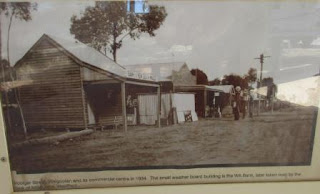
and checked out the history information and photos.
Looks
sad and lonely now.
A
lady walked over to ask if we had tyre plugs which of course Steve has. They
had a puncture on this motorbike. Her husband hitched a ride into Merredin to
get something so Steve set about trying to plug the hole. Unfortunately it was
a big hole.
Found
$2 on the ground beside it so a good deed got rewarded.
The
couple were from Brisbane. Eventually he came back with a spray stuff to block
the hole so they could get into town. Seemed to work so we headed off again. Wahlsten
Rock pokes out of the field.
Next
stop was Carrabin. Shiny silver signs!! Carrabin was a townsite in 1912. Only
the servo and motel remains now and they have diesel for 122.9c/l – how can
they do that when the towns are selling at 136.9!!
I
have seen a few of these signs and will have to google the name to see what
this railway is about.
Continued
on following the water pipeline – up and over the railway line.
Into
Southern Cross, founded by Tom Riseley and Mick Toomey in 1888 who named the
locality after the stars that guided them to the place where they found gold.
The streets are named after stars and constellations too.
Stopped
at the site of the first cemetery for a cuppa. Sad to see all the deaths from
disease and at such young ages.
Info
about some of the small townsites we passed through.
Will
have to find a few of these wells.
The
prospectors heading east to the goldfields.
Nice
big hotel and some lovely old buildings. The Coffee Lounge (est 1896) is
getting a makeover.
Up
to Wimmera Hill Lookout.
Some of the old mining area. We looked on the Dept of Mines website and there is only a narrow area detected here going south to north with lots of farmland surrounding it.
Headed
east again following the big water pipeline. Turned off to the old township of
Ghooli, the No. 6 Pumping Station. Past a big reservoir and some homes that are
derelict now.
The
pumphouse etc has been fenced off due to asbestos. Beside it is the reservoir
which is covered with a roof.
The
old steam pumphouse was replaced with this electric one in 1970.
Stories
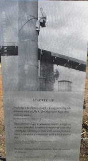
from the people who worked and lived here.
Zoomed
in on where the railway line went to dump off the timber to run the boilers and
the weigh station in front to weigh the loads of timber.
I
walked up the steps to the covered reservoir for a look around.
Back
onto the main road then we saw a huge reservoir and further on in the trees the
latest electric pump station, built in 2002.
Pulled
off the road to let some truck go by before more road works. The water pipe is
bigger in diameter here. Left the agricultural lands behind now – just scrub.
Through
Yellowdine where it’s servo had diesel for 122.9 – really should stop and fuel
up at the small places. Originally a railway siding in 1895 until gold was
discovered at a number of locations south in 1934. One of the earliest
industries in the town was a plaster works built here here in 1934. Only a
couple of houses left here near the servo.
More
rocks and more road works – at least the road is being improved.
Further
along we turned off the highway, over the water pipe, onto dirt road for 5km to
Karalee Rock and Dam. Popular spot – lots of vans and camper trailers here.
Pulled up near a picnic table and fireplace near a Qld van and chatted with the
chap about where to camp. He said we were fine there so we set up camp. Jim and
Kay are from Hervey Bay.
Went
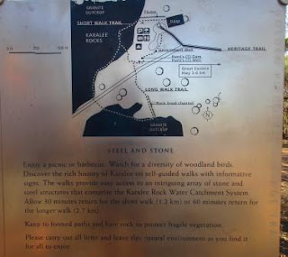
for a wander to check out the rock and dam. Another water catchment scheme.
Amazing
to see the open flue built all those years ago still works.
Walked
up the steps onto the dam wall where the water flows in from the flue.
Across
the other side is the spillway.
Looking
back over the campground.
Walked
around the dam edge to the spillway. It will flow down into a creek area.
As
I climbed down onto the spillway my left arm jerked and boy what a pain in my
shoulder. It had frozen up again recently and I haven’t been able to lift it up
but now it was free and I can move it again!!
Back
around to the flue and then along it towards Karalee Rock.
Flood
gate and outlet gate controlled by this big rock weight.
The
water flows off the rock into the concrete channel then continues down the flue
to the dam.
Over
the channel at the bottom of the rock that brings water from the other rock
catchments.
Walked
up the rock – view back to the channel and flue and the sediment trap at the
beginning of the channel.
Then
from further up the rock.
Continued
walking up the rock – only a slight slope.
We
have skinny shadows!!
Followed
the markers across the rock then back down to the catchment wall again.
The
other channel comes from another rock and flows back to the dam too via the
flue.
A
well which provided water for travellers in the early days.
A
fence is around this well where they dug out white clay which was used to make
china.
Back
to the van for drinks with Jim and Kay. Oh dear I won’t be able to put down my
glass as the bottom chipped off when I touch another glass with it. Will have
to go shopping in Kalgoorlie.
Steve
got the fire going and we chatted as the sun set making the trees shine.
Lovely
evening though it cooled off quickly once the sun went down.


No comments:
Post a Comment