All
packed. Lined up the cars and the guys at the end of the street for a photo.
Hugs
and kisses with Mum and Dad – will be back in 3 weeks or so.
We
were on Channel 39 on UHF so I could give them a running commentary of the
countryside. They had both been to Cairns before. Headed out via Brinsmead and
Redlynch.
Zoomed
in up the Barron Gorge.
View
left up Redlynch Valley.
Through
Smithfield and past the turn offs to all the beaches. Onto the coastal scenic
drive heading to Port Douglas where the rainforest meets the sea. Lovely calm
sea.
Through
Ellis Beach – looks pretty with the canopy of leaves.
Looking
across to Red Cliff Point where Rex Lookout is.
Another
photo of the mountains.
Stopped
at Rex Lookout to enjoy the view. Couldn’t get a more perfect day.
Double Island
The
4WDs ready for adventure. Gecko Adventures with Malcolm in the Middle and Bob
Tail at the rear.
Across
the Mowbray River. I was telling the others to look left in case we see the
resident croc and there he was floating in the river. I took a quick photo and
later realised I managed to get him in the photo with a lot of zooming in –
just his head out.
Into
Port Douglas - the tourist cane loco chugs by.
Around
to 4 Mile Beach for a cuppa. Lots of people out and about so we parked on the
other side of the park then walked down to the beach. Put our feet in the
water.
I
found the photos of Mum and Dad with us kids and Mum’s parents parked on 4 Mile
Beach in 1967. Oops excuse the nudist shot!! I am the one in the red togs.
Sugar
cane ready to go to Mossman Mill.
Through
Mossman – lovely raintrees and old church.
Across
the Mossman River with its lovely painted toilets in the rest area.
To
Wonga Beach then into the line-up for the Daintree Ferry. $16 for a one way
ticket. The notice board said it was 25.1 degrees at 11.30am. Lots of
wait-a-while in the scrub beside us. The river is through that scrub.
Mal
and us made it onto the ferry. There was room for Bob but they said they had to
keep to a time schedule and couldn’t wait for him. The Daintree River.
We
took photos from the other side as Bob and Margaret came over on the ferry. We
will be seeing a lot of these signs from now on.
Continued
on the narrow road up Alexandra Range into Daintree National Park. This was all
dirt when we came up in my Gemini in the early 80s.
Pulled
into the Alexandra Range Lookout. Fabulous view of the Daintree River flowing
into the ocean.
To
the left is Snapper Island and then the very flat Low Island.
Passed
the turn off into Cow Bay. Years ago there was a date palm plantation near here
where all the palms were grown for Christopher Scaif’s Port Douglas entrance.
They were fully grown and dug out then transported one or two at a time on
semi-trailers down to Port Douglas. Quite amazing if you think what the road
conditions were like then, especially over Alexandra Range.
Past
the Daintree Tea Plantation. Steve said this is where we got two flat tyres,
together, when we crossed a grid on our first trip to Cape York with Graeme and
Anne in 1985. We had one spare on the Toyota Dual-cab so he had to break the
bead on the other and put in a tube. Very handy man, my Steve.
Across
Cooper Creek. We were swimming in it when the park ranger came and hammered in
the croc warning sign year ago.
Pulled
into Thornton’s Beach for lunch – we all prepare our own meals. Wonderful
memories of camping here with the family years ago. I caught a big Spanish
Mackerel in our little boat and I was pregnant at the time – Mum was worried
about the baby, I was worried about getting the fish in the boat!!
Sat
on a fallen coconut tree and enjoyed the nice view – further down the beach the
Cooper River reaches the sea.
Continued
on – across Noah Creek.
Stopped
at the boardwalk for a wander. It runs down beside Oliver Creek which then
flows into Noah Creek.
Steve
being Tarzan.
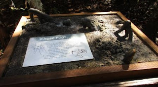
Good
info boards along the way.
Nature’s
spectacular bit of artwork.
Lots
of pretty plants and not so nice spikes like on the Wait-a-While.
More
info about the plants.
Another
couple were peering in the pool so we had a look too. There was a sleepy cod.
Not
so nice to walk through – hard mangrove roots.
Lots
of different ferns hanging off the trees.
We
had told Malcolm about eating green ant bottoms – apparently he had a taste of
a few back at the house. He got one from here and said it wasn’t as sweet as
the Cairns ones!!
Cannonball
Mangroves – interesting information.
End
of this section of the boardwalk at Noah Creek. Found a fish and lots of
midgies – should have put some spray on.
More
info about mangroves.
Turned
around then continued on the boardwalk.
More mangroves – didn’t realise there
were so many different types.
I
think this is the lily the sign is about.
Looks
like a boa constrictor going up the tree.
Reminder
of the logging days.
There
are still some big trees in here like this Yellow Penda.
Continued
onto a new ‘plastic’ boardwalk. More info boards.
Continued
on and up Noah Range to Cape Tribulation.
Lovely
wide beach with mangroves at one end.
Malcolm
and I got our feet wet again. Then Bob joined us.
Now
the fun as we head onto gravel road and up Donovan Range.
Then
our first creek crossing at Emmagen Creek. I got out and took photos of the
everyone crossing the creek.
They
pulled over to wait for me and then 10 vehicles zoomed by. Another little creek
then the steep climb up.
Fabulous
view at the top of Cowie Range (202m altitude). Bob was having issues with his
car’s flat spot and it was struggling with the climb but eventually he made it
up.
Up
and down then climbing up to 262m. Down to 180m then a 21% descent down beside
Woobadda Creek as it weaves it way down to Bloomfield.
Crossed
over the new bridge over the Bloomfield River – we used to use the causeway
below us. Green, neat and tidy at Wujal Wujal Community.
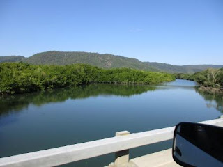
Continued
on with the river on our right – keeping an eye out for crocodiles which we did
spot on the bank so I alerted the others to look out for it.
Through
little community of Ayton then through Mt Louis Station. The cattle are knee
high in the lush grass. Such a contrast to Muloorina Station near Lake Eyre.
Pulled
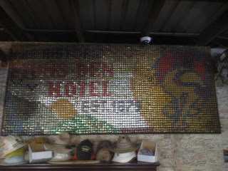
in the Lions Dens Hotel at Helensvale. Another one covered in signatures,
coasters etc. Apparently this started years ago when some miners would leave
their pay packets at the public house and write how much money they had spent,
or still had, up on the wall. An iconic stop on the Bloomfield Track where tin
was mined back in the day. The hotel was built in 1875. Had a look around and
paid our camp fee. Interesting sign made of bottle tops.
Lots
of people here but we found a spot for the three of us to set up for the night.
First night of setting up the roof-top campers. All good and no arguments!!
Our
route for the day.
Drinks
then dinner. Cool evening with bandicoots running around.


No comments:
Post a Comment