Remembering our middle son, Anthony, who would have been 32 years old today.
6.45am only 8 degrees so on with the heater. Slow start this morning, clear sky.
As we were packing up I saw my tennis ball I use on my back was a bit chewed and some tissues out of my rubbish bag were on the floor - we’ve had a visitor. Steve leaves the windows down a bit to let out the hot air from the car fridge. Then we noticed little footprints in the dust on the door trim and across the dash, probably just a little field mouse. Left all the doors open and Steve started the truck up just in case he was still in there.
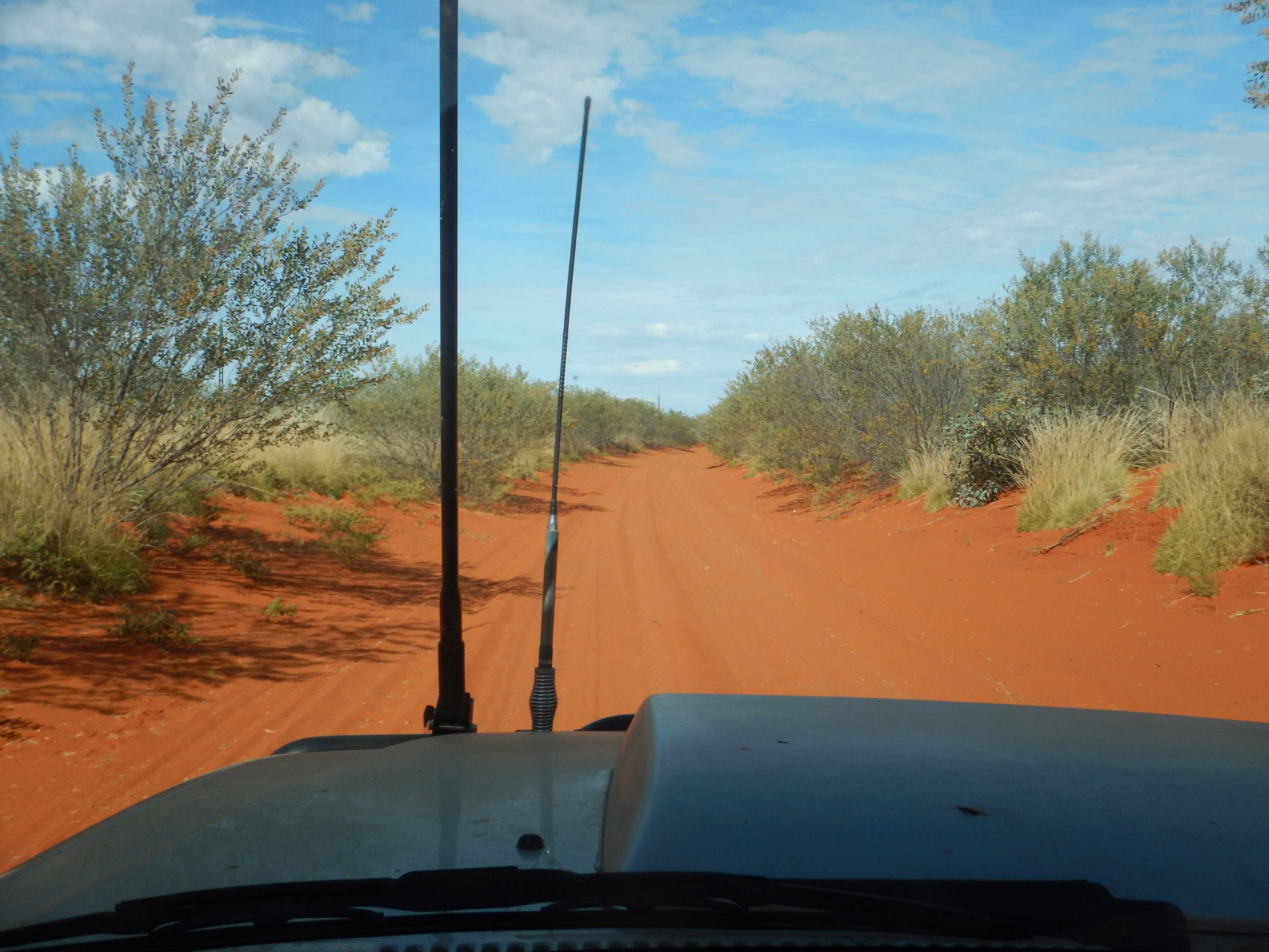
Continued on down the Binns Track along the creek bed which had a puddle or two.
.JPG)
.JPG)
More pools of water as we climbed out through soft sand then back onto river rocks.

Big eroded hole on other side but the truck climbed up and over no worries. More river rocks through grass and trees with hills on either side.

Left the National Park. Long sandy stretch.

Back onto the river rocks again for a while which is slow going. Across Coulter Creek bed with a small waterhole on the right. The hills are closer beside us now.

Crossed the creek again and through the hills to the next open valley of spinifex.
.JPG)
.JPG)
Lots of creek crossing alternating from river rock, sand, red soil on the track as we continued south along the valley. Up onto the edge of the hills on granite quartz type rocky track. The hills are getting smaller.
Gate to enter the next station of Murray Downs. The sign has a phone number to call re biosecurity which is a bit of a laugh as there is no phone reception out here.
Spotted a chopper in the distance when we pulled over to have a cuppa. Bit chilly outside. Continued on but didn’t get stuck behind any cattle this time. A tree has fallen onto the track so a new track has just been made around it. Shrubs line the edge of the track now so no view out.

With the washouts and rough track we are only averaging 15 to 20k/h. Found where they will be herding the cattle too - portable yards with a semi with 3 cattle trailers. No one was about though. Wider sandy track.
Through a gate to the turn off - 14km right to Murray Downs homestead. Left goes south 100km to Ammaroo Station on the Sandover Highway which is our destination. The sign says we have just completed Section 4 of the Binns Track, so now we are on Section 3. Wider, smoother road - because of the station I suppose so we can scoot along at 70km/h for a change.

Lots of cattle around No. 10 bore, just before we cross a dry South Creek.
Open country though we can’t see too far for the tall she-oaks. Sections of corrugation now. Across a grid. Clouds in the south. Phone reception is back - got an email saying the engine is ready - yeah. A vehicle came towards - the first one in a while. We turned right at the T intersection, 20km to Ammaroo.
Honeymoon Bore - windmill frame but no blades on it. They have nearly all been replaced with solar panels and pumps now.

Reached the Sandover Highway which is gravel and heads east to Queensland (Mt Isa). It goes west then drops down onto the Plenty Highway. Not that you would know its the Sandover from these signs.

We travelled this one in 1986 when we came across for Steve to compete in the Formula 500 Australian Titles in Alice Springs. We pulled into the rest area for lunch. A car load of locals spotted us, drove in and around us then back out again.
Turned off just along a bit for 2km drive down to Ammaroo Station homestead to top up with diesel ($2.90/L - a fair bit dearer than at Kurundi Homestead @$2.15/L).
Back out to the highway then westward for 28km to the Binns Track turn off. Nice wide road.

Wide track with extra lanes around the rough bits.

Reached the next community then back to the two wheel track again.

Across wide flat and dry Sandover River which had two posts sticking up like a football goal, which it probably was!
.JPG)
.JPG)
Back to the slower speeds now - grass & she-oaks again.
Track is wide and flat again with corrugations running beside a power line - must be another community around here so we can zoom along again.

We have passed a heap of dead cars and car parts which is another indicator of a community nearby! Though there hasn’t been a lot of bottle/can rubbish about which is good. The track narrows and is sandy red dirt.
Soft sand section ahead where we spotted 3 donkeys on the track.
.JPG)
.JPG)
One was sitting in the middle and Steve had to go around him without getting bogged. There was a horse standing under the tree near the donkeys too. We realised we had missed the Binns Track turn-off so he then had to turn around, luckily on harder ground and go back past the donkeys again who were definitely in no rush to move anywhere. The one in the middle got up but didn’t move off.
.JPG)
.JPG)
Up the side of the track and back on the Binns Track again. There was another track off to the right which was probably a detour around that soft section down to the next community.

Back onto harder red sand then more soft sand sections in between. Just two ruts with the sides high so only room for one vehicle so we are hoping we don’t meet anyone coming north.

Nice section for a while so we zoomed along again then back to the narrow two wheel track again through grass, shrubs and taller gums as we near a creek area.

Back to low shrubs again as we leave the creek.
The shrubs are closing in. We stopped for a cuppa in a grove of gnarly trees.
.JPG)
.JPG)
Track getting narrower as the shrubs crowd the sides and brush the side of the camper and truck. Luckily no hard things to scratch us though.
.JPG)
.JPG)
Continued on the narrow track with shrubs with bright red flower pods.
.JPG)
.JPG)
There are always willy wagtails flittering around beside us on the tracks wherever we travel. Lots of wattle trees in bloom which fall onto the truck as we pass covering the windscreen wipers.

A detour has been put in around Derry Downs Station - must be only recent as it isn’t on the map. The clouds look a bit dark to the south and west which isn’t a good sign.
Through a steep gully ten a dry creek and continued on with spinifex and she-oaks and those gnarly trees. Over a grid then through narrow windy section with the overhanging branches brushing down the side of the truck and camper. The marks should polish out ok. Better than burnt areas where the sticks become hard and really scratch - we had plenty of sections of that on the Canning Stock Route.
A hill appears on our right and the track is all rock so slow crawl here. Up and down the hills then back to the red sand and overhanging trees and shrubs.
Through another section of rough rocks and yellow wattles.

Through an eroded section then back onto the rocks again as we run along the side of Bundey River which has a wide river bed.

The track crosses the river here so Steve got out to check the track. There is a big lump in the middle to negotiate whilst trying to keep the speed up over the sand. Others have driven up the creek bed.
.JPG)
.JPG)
.JPG)
Diff locks and low range and off we go. Got over the first bump and halfway to the next one then we stopped.

Out with the smaller recovery tracks first but they just disappeared so the bigger ones came off the back of the camper.
.JPG)
.JPG)
.JPG)
.JPG)
Using the two at the back helped to get us moving.
.JPG)
.JPG)
.JPG)
Unfortunately we didn’t go far so we dug them out then relaid them and eventually reached the next ridge. Up and over and he went a far way till he bogged again. I dug out the tracks and he came back to help me carry them back up to the truck.
.JPG)
.JPG)
.JPG)
.JPG)
Laid them down again and off he went over the next section where he stopped again. Tried reversing but he wasn’t going anywhere.
.JPG)
.JPG)
.JPG)
.JPG)
.JPG)
.JPG)
.JPG)
Dug out the tracks again and walked them back up to the truck. Glad it isn’t hot or the sand would be burning our feet.
.JPG)
.JPG)
The tyres were spinning on the recovery tracks and we weren’t going anywhere, we have bellied out.
.JPG)
.JPG)
Luckily there are lots of big gums so out with the winch rope and Steve pulled the truck out and onto the harder ground.
.JPG)
.JPG)
.JPG)
.JPG)
Just put the recovery tracks in the camper as there was still a couple more sandy bits ahead but they were no problem.
.JPG)
.JPG)
.JPG)
.JPG)
Back onto the red eroded track.

Our route on the Hema. Met the main track again to the station which is nice and wide! The section certainly added to the ‘adventure’ of the Binns Track.
.JPG)
.JPG)
4x4 signs mark the Binns Track.

5pm now as we zoomed along the wide road. Some of the ‘locals’ were playing chicken on the road but we didn’t hit any.

Dark clouds seem to be heading our way which isn’t good on these roads if it rains.

Passed the yards where I spotted a couple of bulls having a head to head tussle. The road is covered in dung and more cattle hanging about on the road. Some cute little calves were the last to get off.
Through a gate and onto Macdonald Downs Station.

The good road continues. Across a dry creek bed and we didn’t get stuck!
.JPG)
.JPG)
Flat grass country with some shrubs and trees here and there. More ‘locals’ on the road - there is always one who just doesn’t want to move off.

Reached an intersection near the yards and an old truck - Old Macdonald Downs Outstation according to our Hema.

We continued south. More cattle and a new set of yards. They appear to all be ‘boys’ with a few calves.

Flat country with a range in the distance (Mt Ultim and the Dulcie Range which is a National Park) to our left and a long hill on our right. There is a road on the Hema that heads to a community but doesn’t appear to reach the national park.
It was 6pm and we didn’t want to play chicken with any cattle as it got darker so we pulled off onto a flat open clearing to park up for the night. Only 40km to go down to the Plenty Highway in case the rain comes and we have to get going before the ground gets too boggy.

Inside for a drink then dinner and a movie - hard life!!
No comments:
Post a Comment