Woke
at 5.30am and saw the amazing colours in the sky as the sun rose. It was 12.5
degrees in the van.
.JPG)
.JPG)
By
8.30 the clouds had moved in again so it felt colder than the 14 degrees.
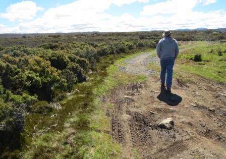
Packed up and the clouds started to part so enjoyed the sun’s warmth. We have
to go back up the narrow dirt road past the turn off to the top car park so we
can get back on the Lake Highway and head down to the Great Lake area.

Climbed
up to 700m and onto the main road. Luckily we didn’t meet any cars on the dirt.
Looking at Drys Bluff and the timber plantations.

Now
we climb up through the Great Western Tiers to a pull off area with a great
view (1050m). Decided to have a cuppa and reply to messages that came when we
got back into range. Erica had called so I rang her back. It wasn’t important
but she said that the thieves had also stolen the green glass from Millaa house
that Erica’s friend had cut for Mum & Dad. Little “!!!” She also said there
had been a terrible murder in Manoora, a mother killing her 7 children and a
niece. I then rang Mum but she wasn’t home. Text from Craig & Kathryn too,
they are just behind us in Deloraine – we might catch up for Christmas. The
birds were having a lovely sing here – it sounded like a whoof whistle too
which was cute.
Amazing
mountains around here. Trying to work out where we are from the map and am now
confused if this is Liffey Bluff or the other side of Drys Bluff (1298m).

Looking
down into the valley.

Ahead
was another set of mountains but it is all mountains here. They look great too
and would look amazing covered in snow.
.JPG)
.JPG)
I
do know this one is Projection Bluff (1100m). We had driven a bit further up
the road and there was an official scenic lookout and a sign about the 2hr
return hike up Projection Bluff escarpment.
.JPG)
.JPG)
I
jumped out and walked through the scrub to a lookout platform. Great view,
zoomed down to the valley.

.JPG)

.JPG)
Amazing
where people will go to the toilet – couldn’t they do a better job hiding their
toilet paper though!! Passed a few more good pull off area – would be great for
an overnight stay.
Up
onto the Central Plateau Conservation Area (1200m). This is all World Heritage Area since 1982.
Just passed a sign that said “Highest Point 1210m”.

Then
we see Pine Lake. It is a short boardwalk through the open area and Tasmanian’s
rarest trees – the Pencil Pine (only found in Tassie highlands).

Info
boards along the way to teach us about the plants, animals and how they survive
in this harsh environment etc.


Cushion
plant.

Pencil Pine


Lots
of rocks here called ‘Block Streams”. They were formed during the past ice ages
in areas that were not covered by glaciers. Water seeped into the cracks and
joints in the dolerite rock and at night froze and expanded. This enlarged the
joints and eventually broke off large blocks of rock which slowly migrated
downhill. In high exposed areas, such as the Central Plateau, this process is
still going on.


View
across to the Great Western Tiers.

Good
stand of pines beside the creek.

The
board said to sit and rest for a while if weather permits – it didn’t – the
wind was freezing!!!


The
rocks are all so neatly around the lake it looks man made.

Heading
downwards a little as we descend to Great Lake which is 25km long.

Pulled
over and I got a nice photo.

Then
stopped at the Info Hut.
.JPG)
Not
that we are going to fish but it is interesting to know. We think the ones we
saw at Liffey Falls were Brown Trout. They were introduced to Tasmanian in 1864
from England.
.JPG)
.JPG)
It
is a massive lake and there are so many other ones around this area, called the
Highland Lakes. When full the Great Lake as the capacity to cover 17,610
hectares and hold 3,178 million cubic meters of water. In 1922 as part of the
hydro electricity development at Great Lake, a multiple arch dam was completed
to replace the first dam wall built in 1911. This wall of 27 arches was the
first built outside USA, was the longest in the world and is still recognised
as a world-class engineering feat. To further increase storage potential the
height of the dam was further increased in 1967 and 1982.
Interesting
though we now go onto a dirt road down to the lake.

Past
lots of shacks on Crown Land – presumably on leases. Lots of shacks further on and a lot for sale
too. No power or water here though.
.JPG)
.JPG)
Stopped
to drop off some rubbish in the big bins here so rang Mum. All good there. They
had heard lots of noise with helicopters etc about lunch time on Thursday.
Certainly
looks lovely though the only entertainment is trout fishing as nobody would be
swimming!!!
.JPG)
.JPG)
Continued
around the edge of the lake till Reynolds Neck then headed inland to Liawenee. It
is the coldest place in Tasmania so hopefully December will be a good
temperature!! Alan from Burnie had said there was good free camping here and to
turn onto Boundary Bay Road at the Liawenee canal. One road lead to the
Information place and the other went done beside a fence line. We drove on for
a bit but decided to turn around and try the fence line one. It wasn’t very
good and it looked like it just went out into the plains ahead. Crossed the
canal again and saw the Info Board so stopped and found out that the camp area
is further on past Lake Augusta to Lake Ada. We decided what the heck we will
go as the motorhome in front of us headed in that direction. Grabbed this
brochure and map.


Left
the canal and now going through flat low shrubs that go for miles to the edge
of some hills. Looking on the map we are heading for the other side of the
Walls of Jerusalem National Park. There is also the Ouse River in there
somewhere but hard to see as it is all so level.

Found
our own Walls!!! Looks like they are
falling down. They were fenced off too.
.JPG)
Arrived
at Lake Augusta where the canal starts from. All the waters, except for Augusta
Dam, in the Western Lakes region are natural, formed by glacial activity during
the last ice age. Apparently due to the altitude of 1150m it is very common for
extreme weather and snow and poor visibility can occur at any time of the year.
Last Christmas they had snow here. The sky is clear so hopefully we will be ok.
.JPG)
There
is a very large building but it says no entry and a few cars beside the canal
that look like they could be canoeists. No signs about though.
.JPG)
Drove
across the dam wall – water level low but there was a lot of water flowing down
the canal.
.JPG)
.JPG)
.JPG)
.JPG)
Further
on is a second lower dam wall.

Further
on is an intersection where you can head up a 4WD road to lots of little lakes
which are just east of the Walls of Jerusalem. I remember someone saying that
they have hiked into the Walls from this side as it is flat, 1100m to 1250m
elevation whereas from the other side you start at 680m and it is a hard climb
up. Passed the second half of Lake
Augusta there is a rocky dry section between the two halves. It looks like we are in the desert with the
sand dunes.

On
the map there were only two camp areas but it seems you can do what you like if
you are a local!! Saw someone in a boat fishing. Another road heads off to two
other lakes, they certainly have their choice of where to catch trout here.
Arrived
at Lake Ada and set up in the car park with the motorhome. A chap from Noosa.
There are three other little cars here but no one about. Quite windy and cold –
we have two long sleeve shirts on and a coat!! Lunch in the van but the view
out our window is lovely.
.JPG)
The
map to show where we have been and how close we are but it is still a long walk
in so we won’t be doing it.

A
shot of our camp for the night.

The
boat ramp is just near us so checked out the water temperature – a bit nippy!!
The water is lovely and clear.
Decided
to walk the 1km into Ada Lagoon and might do the 5km drive tomorrow to other
area as it is 4WD only. One car came, drove in and then back out again while we
were having lunch.
As
we walked along I saw this poo which is full of hair. We were told Tasmanian
Devils eat all the remains of dead animals, hair and all, so you can tell if
they are around by the poos left behind!!!

Feel
like David Attenborough – look here there must be a wombat around, here is his
poo!!

Climbed
onto a small outcrop of rocks for a look around.

This
is Ada Lagoon and there is a shack here too.
.JPG)
.JPG)
Zoomed
across to the mountains in the distance that I am assuming is the edge of the
Walls of Jerusalem National Park.
.JPG)
.JPG)
This
is intersection to continue onto the other 4WD track. Need to cross this creek
that flows out of the lagoon but Steve said it is very boggy and someone else
has left some sump oil there!!!
.JPG)
There
is a footbridge over it that I am standing on to photograph the creek.
.JPG)
.JPG)
Little
little flowers on the ground.
.JPG)
Round
to the shack which looks like it is well used. The only tall tree around. "Lagoon Lodge" on the door.
.JPG)
.JPG)
And
there toilet facilities!! Bit cold on the old rear end.

The
water is very choppy.

Further
down is a bridge over the canal joining the lagoon to Lake Ada.


The
whole lake edge is lined with these rocks.
.JPG)
.JPG)
Headed
back to the van for a drink.
There
was another shack as we came in that had the road blocked off so we went to
check it out too. Looking back to the carpark.

As
we got closer to the shack there was a wombat waddling in the water near the
shack.


Snuck
up on a wallaby but he soon bounded off when he heard us coming.

Lovely
little bay near the shack though it is very shallow and rocky.

Climbed
over the shrubbery to get a closer look at the wombat. Got a few photos before
he heard me fall into a hole and then he waddled off into the shrub and hid. He
certainly has some lovely grass to eat.
.JPG)
.JPG)
The
only pretty flower I found.

The
remains – we heard devils ate it all but maybe not – there was a hind leg of a
wallaby too.

The
shack is old but has been fixed up and locked up. The road was closed by the
Parks & Wildlife Service so will have to ask when we stop at the Info
centre on our way out. Read a bit more and found out it has lots of info,
gardens, displays of taxidermy and historical photos.

The
dunny was in good nick too. Much better than the other shack.

Decided
to short cut back through the dunes.

Found
the wombats homes. Easy digging for them.
.JPG)
.JPG)
Another
wallaby happy to pose for a photo.
.JPG)
Made
it back after waddling through the clumps of grass etc. Like walking on
trampoline but then it would collapse and you will fall into a little track
underneath.
Enjoyed
a drink looking over the lake but the warmth is disappearing from the sun
(5.30pm).
Into
the van to warm up, it has kept its warmth as we didn’t open any windows etc.
At 8pm it is 10.7 degrees and sunny outside, we are enjoying our stew and hot
cup of tea. The van is 18 degrees. I think tomorrow is the summer solstice –
the longest day of the year.
A
little chap was happy by the boat ramp till we turned up.

The
wind has dropped and there are heaps of bugs flying around. The other chap
likes fly fishing so he is going out for a bit later.

Zoomed
in on a couple of swans floating further up the lake.

Back
in the van to watch the sun go down and duck out and take the temperature. 8pm and it is still very light.

Between 8.30 and 8.45 the sun starts disappearing. I think it is better watching the colour in the east rather than the sun setting. We have the sun setting out the kitchen window and all the lovely colours over the lake out the dining room window. Can’t get any better than that.
Between 8.30 and 8.45 the sun starts disappearing. I think it is better watching the colour in the east rather than the sun setting. We have the sun setting out the kitchen window and all the lovely colours over the lake out the dining room window. Can’t get any better than that.
.JPG)
.JPG)
.JPG)
.JPG)
.JPG)
Got
the bugs flying around.

.JPG)
.JPG)
Played
a few games of Rummiking. It is now 5 degrees outside at 10pm but we are warmer
in the van at 14 degrees as we hadn’t opened any windows or vents.
No comments:
Post a Comment