Rain
has stopped but heavy clouds hanging on the mountain tops. I had a wander to
take photos of the murals on the picnic shed walls then down the road a bit for
information about the 3 mountains walks and the Hydro Electric Scheme.
On
the murals - Gustav Weindorfer (discoverer of Cradle Mountain) and his new wife
Kate, honeymooned on the slopes and summit of Mt Roland in 1906. She was a
botanist and they loved exploring. It was from here that he saw Cradle
Mountain. Other ones showed the plants and animals in the area.
.JPG)
.JPG)
.JPG)
.JPG)
Interesting
man greets us.

Looking
over the camp area. Apparently they used to camp anywhere in the compound but now it is only on the concrete!! Things are changing.

Interesting
information about the area. Gowrie Park was originally the site of the
construction centre for the Mersey Forth Power Development.
Chatted
with the Qld couple about Cockle Creek and other spots they have been.
Picked
up Steve and we headed up a track following O’Neills Creek. There was a box with
a brochure describing things along the way but that hasn’t been maintained –
like the track!! Shame, seems the interest in keeping visitors in the rural
areas seems to be lost on the Councils.
.JPG)
Old
timber cutter slot for his standing plank to be able to chop the tree.
.JPG)
Amazing
big tree.
.JPG)
.JPG)
.JPG)
.JPG)
Came out onto a road that leads to walking track up Mt Roland. Mt Roland is the highest peak at the northern end of the range (1233m), then Mt Van Dyke (1084m) then west is Mt Claude (1034m). There are a few walks but as the clouds are hanging we might give it a miss!!!

Back
across O’Neill Creek little weir just behind our van.

After
a cuppa headed off with the van back up the range to Round Mt Lookout (690m).
Steve turned the van brakes up as it was the truck’s brakes that were smelling,
trying to stop the 3 tonne behind us!! Up and down the narrow road – I was on
car lookout as there are no lines.
Through
Mersey State Forest which is a working state forest (740m). Onto some flat area
for a while through the plantations of eucalypt. Passed the turn off to
Lemonthyme Power Station. Down again, lots of second gear. Passed the lookout
(660m) we stopped at the other day. Still a good view despite the clouds.
Popped my ears at 550m following Ration Tree Creek down with the mountainside
covered in eucalypt forest.
Lovely
and green with the roadside lined with tree ferns and bracken ferns. Down into
the Mersey Valley (310m) and across the Mersey River into the Mole Creek Karst
National Park camping area.
Climb
again to 440m and over and down to 410m (having fun using the elevation thing
in the VMS) to the intersection. We went right the other day to Devils Gullet
and Walls of Jerusalem NP. Heading left today towards Mole Creek NP and the
Caves. Lines on this road as we climb along the edge of the Mersey Valley past
big open dairy pastures and more timber plantations. Have the window down as it
is a lovely temperature at the moment.

Passed
the turn off to King Solomon Caves as we decided to do Marakoopa Cave which has
the glow-worms. King Solomon is a dry cave but great as well. At $19 each
thought we need to choose just one.
Passed
a poppy field on the way in with it’s big “danger, no entry” signs. Could see
the poppies a lot better.

Passed
Stephens Road but didn’t get the camera out in time!! There is a shack for sale
there!!!

Crossed
the valley from one side to the other, about 4km. Not a lot of room for vanners
but got it turned around and parked. Paid for the Underground Rivers &
Glow-worm Chamber tour which is about 45mins. Found a stuffed Tassie Devil as
we haven’t found one of these yet.

Back
to the van for lunch as the tour is at 2pm. Had to walk up 700m Fernglade
Walking track beside Marakoopa Creek to the cave entrance.

Nice
walk beside the very, very clear creek. Comes out of the mountain caves. No tainted colouring here like at Dove Lake etc.
Lovely
mossy rocks in the creek make a lovely photo.
.JPG)
Huge
old tree.

Lots
to read about how the caves were formed while we wait for our guide. Took our
Bathurst coats as it is a constant 9 degrees in the caves all year. Very
interesting. Can’t take photos in the glow-worm section but took heaps
everywhere else. The hungriest glow-worms are the brightest. They need to be
near water. This is the entrance.

The
caves were discovered in 1906 by two young lads, skipping out of chores, from a
nearby farm. They kept them secret for two years while they explored the area.
They then applied for a permit to have them as display caves. They have been
functioning like that and being well preserved for over 100 years.
.JPG)
.JPG)
.JPG)
.JPG)
.JPG)
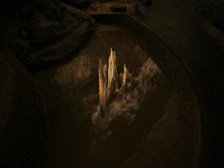
The
pure white ones are pure limestone and beside it the limestone is tainted with
the soil from above that comes down with the water.
.JPG)
.JPG)
A
bit narrow in some parts.
.JPG)

The
skinny Pencil Tube.
.JPG)
The
“Tuning Fork” was measured in 1906 and 100 years later measured and had only
grown 2.5cm so things are very slow moving around here. It had originally been
feeding the right tube but something disturbed the tube and it bent so it has
been feeding the other one.
.JPG)
.JPG)

The
river runs along way below us, goes underground and then comes back out where
the glow-worms are.

This
was an unusual feature in the pool – they call it Winston Churchill’s cigar.
.JPG)

.JPG)
This
pencil must have gotten blocked!!

These walls were formed when the river originally flowed through here, depositing the limestone in ridges.

Interesting
glow worm info. Oops around the wrong way - sorry.

Great
reflection in the clear pool.
Marakoopa
Creek makes its way out after disappearing under the ground again then up
again.

Certainly
was worth coming. The sun was lovely and warming as we walked back down the
fernglade walk to the truck.

A
cuppa to warm us up then off to find a camp for the night. Around the edge of
hills then into a wide valley (250m) with the Great Western Tiers to our right.
.JPG)
Gog
Range to our left.

Passed
some sheep and into Mole Creek. Lovely little town.

Found
a Gum Boot Tree.
.JPG)
Info
plaques about a chap who built mountain shacks. They dismantled his from Liena
and reassembled here for display.
.JPG)
.JPG)
.JPG)
Info
about possum and wallaby hunting for their skins. Big business back then.
.JPG)
Cute
little people.

Stopped
at the Info Centre which was in a Café – not the friendliest but I got some
leaflets and off we headed to little place called Caveside.
Passed
this cleared forest area.
Great
view of the mountain – I think this is Mother Cumming’s Peak we saw from the
range over the Mersey Valley.

This
camp is not in my book but was on the Council recommended ones we got in
Burnie. It is actually National Park but looks like they don’t do much with
anymore. Suits us. Parked and had a look around – found the entrance to a cave
with a river running through it – hence it is called “Wet Caves Reserve”.

.JPG)
.JPG)
.JPG)
Further down the track which follows the river we parked in a clearing beside the hill and the river.
Further down the track which follows the river we parked in a clearing beside the hill and the river.
Very
nice open area, away from falling limbs, which seems a problem at the entrance
where they have sections roped off. There are also problems with sink holes in
this area as in the Mole Creek National Park there are a few hundred caves etc.
Must be where the name Mole came from – holes everywhere.
.JPG)
.JPG)
Set
up camp and enjoyed a peaceful happy hour enjoying the birds and the sound of
the creek tumbling past and the tall mountains of the Great Western Tiers
towering beside us.

Steve
collected wood and made a fire while I cooked dinner. Then he commented that I
mightn’t get to enjoy the fire as there was a big black cloud coming.

Next
minute there was thunder and down she came. Steve had put up the rain catcher
(normally stops the rain) but this time it got a good working.
.JPG)
.JPG)
The
fire kept going though. Well for a while anyway.

Got
TV reception so settled in for the night.
No comments:
Post a Comment