15
degrees at 6.30am, clear sky and no wind – a bit chilly!! Forecast for a top of
25 today.
Hooked
up and headed out. Stopped at the camp kitchen ‘with a view’.
The
inlet is lovely and calm today.
Back
up to the highway then headed west. The highway is still closed just passed the
Oldfield River so we turned down Jerdacuttup Road (bitumen) and followed it. We
passed the road down to Mason Bay etc as I thought they might still have road
damage. Crossed over the causeway over the Jerdacuttup River – lots of damage.
Turned
onto the Hopetown-Ravensthorpe Road then a little way along we turned onto the
narrow dirt road to Lee Creek rest area. The railway heritage trail goes
through here. Made a cuppa and read the info.
Continued
on to Hopetoun – nice entrance. This coastal town served for many years as a
retirement village and holiday destination for Goldfields people but since the
inception of the Fitzgerald River National Park, improved town services etc it
has become a tourist destination.
There
are a couple of old buildings highlighting the town’s history.
Drove
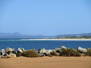
down to the jetty which is a wide road out on a rocky point.
Looking
across to the National Park where we explored before going through
Ravensthorpe. Across Flathead Point to the beach then over the jetty road to
the beaches to the east – aptly named 2 Mile, 5 Mile and 12 Mile then to Mason
Bay and finally Starvation Bay or as another map says Starvation Boat Harbour.
Followed
the Esplanade along past some railway buildings and other bits I will have to
check out later. No road closed signs which was good so we continued east. Travelling
with trees on either side so no view on the Southern Ocean Road!! Stopped at a
lookout past 2 Mile Beach.
Further
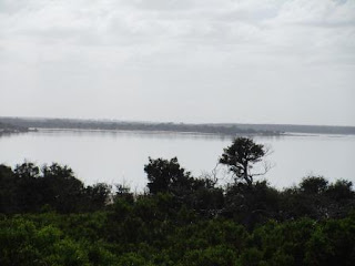
along opposite 5 Mile Beach area we spotted Jerdacuttup Lake which is very full
from all the rain in January.
Then
we found the Road Closed sign!! Turned around and then walked down to the
water. Because the lake and the ocean are separated by big sand dunes the water
can’t break through and get out to the ocean like the other inlets, hence it is
called a lake!! Obviously we aren’t getting to Mason Bay this way!! Should have
taken the other road!!
Chatted
with another couple who drove out for a look then headed back to Hopetoun and
the Info Centre. Chatted with the lady from the Shire Council first and
suggested they could put a sign this end advising Mason Bay can’t be accessed
from Hopetoun. She thought that was good idea. I got a map showing which roads
are still closed so it looks like we have to all the way back to Fence Road and
then down to Starvation Bay first.
Back
past the Farm Art again – still didn’t get a photo!! Back across the river
again – got photos of the northern side this time. Stopped just past the river
at a rest stop for some lunch. Steve found some more timber and a lot of birds
that got upset about him walking through the bush.
Steve
spotted a big machine coming and got off the road. Looked like something out of
War of the Worlds – it was a big sprayer.
Back
to Fence Road (runs beside the No. 1 Rabbit Proof Fence). Lots of roadside
damage along this dirt road but they are fixing it up.
Turned
east onto Springdale Road for a little bit till we found the No. 1 fence.
Looking north.
Then
the track south to Starvation Bay with the fence running parallel with the
track. Now they control the pests with poisons.
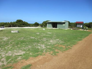
Parked
the van in a big space with a small view of the bay.
Went
for a walk to check out the other sites which are back amongst the trees.
Further east around the bay is another nice spot, even has grass but no view
either.
Decided
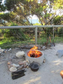
we liked our spot and it has a concrete fire pit so we can have our fire
tonight. Wandered down to the boat ramp area. A big truck/camper and a tractor
and boat which bags of abalone shells beside it and what appears to be a cage
in the back. I suppose to protect the diver from the sharks while they collect
the abalone off the bottom.
The
bay looks nice though it has the usual sea grass on the edge. Chatted with some
guys filleting their morning catch (from a boat) and they said there is a
residence stingray who cleans up all the scraps that the birds don’t deal with.
Continued
along the beach then climbed up the hill into another camp area under the trees
– tents but there is space beside the road where a small van has set up. The
dump point is up on this ridge too. Further along to the Powell Point which is
very rocky.
A
few guys walked down taking photos then some more and more – I thought it was a
fishing group but after chatting with one guy we learnt they were geologists on
a field trip. I asked him about the black rocks and he said it was a molten
rock that is squeezed but through the cracks well after the main rocks were
formed and the sparkle to it is lithium. They had been to the lithium mine
earlier. Steve quizzed him about finding where to find gold.
Back
to camp for a cuppa then got the fire sorted. Camp oven roast tonight – first
time in 6 months!!


No comments:
Post a Comment