Clear
blue sky today. Drove back to South Bruny to Alonnah to do the walk there to
Sheepwash Bay. Nice calm day here today.
.JPG)
.JPG)
It
was a nice walk but not too exciting. It follows the historic road that once
linked the jetties at Alonnah and Sheepwash Bay. Lovely picnic area (no signs letting
anyone know it is there though) along the way – we could have snuck in here
with the van.
.JPG)
Followed
the old tramway – the old rocks line the side.
.JPG)
.JPG)
Followed
the track to Sheepwash Creek. Wouldn't want to wash sheep in it now!!
.JPG)
.JPG)
Looking across to mainland Tassie.
.JPG)
Headed back to the truck as the rest of the track followed the road. This
looks like simple looking beach shack.

Great view from
up the hill over Satellite Island to Tassie mainland.

Passed
some old farm machinery.
.JPG)
.JPG)
Drove
then to end where the old jetty was originally but there was nothing there
anymore.

Certainly
a warmer day – no need for a jumper today. Back across South Bruny to east side
to Adventure Bay. Lovely look over Coal Point across to Penguin Island.


The
rocks look like coal.


Lots
of crayfish pots and kelp.

Stopped
at the Adventure Bay Coastal Reserve where the school children are trying to
protect the habitat of the hooded plover.

.JPG)
.JPG)
The
trees come right down onto the water’s edge.

Further
along was a very popular spot where the shop is. This monument was getting lots
of attention. It was the earth with two whales inside it. At least they
remembered to put Tassie on it but they forgot New Zealand!! It is situated between the site of two
whaling stations.
.JPG)
.JPG)
.JPG)
A
lot of businesses used the 40 degrees thing here, Roaring 40s winds, 41 degree
Salmon Farm, 42 degree real estate and 43 degrees restaurant.

Captain
Cook & Captain Furneaux monument. Furneaux discovered the bay in 1773. Cook
landed here in 1777.
.JPG)
.JPG)
.JPG)
This
wall was erected in memory of Bruni C’Entrecasteaux. Bruny Island was named
after him.

Across
Captain Cook Creek – popular swimming spot.
.JPG)
.JPG)
Another
monument for Captain Cook Bi-centenary.
.JPG)
.JPG)
There
was a boat out front and a guy was diving for either crayfish or abalone. We
stood there waiting for him to catch something but he didn’t.

I
don’t think I would like swimming around in that kelp.

Stopped
at the boat ramp at the very end of the bay and made some lunch. The beach here
is not as nice – very black.
Got
our drink bottles and headed off for the walk to Grass Point (1 hour return)
and Fluted Cape (2.5 hours return). Not sure what that will be if we do them
together. Easy walk down the beach and along the bay edge.


Information
about the whaling stations around here.

Rocky
path to the next information board about another whaling station.


Nothing
left of the old days.

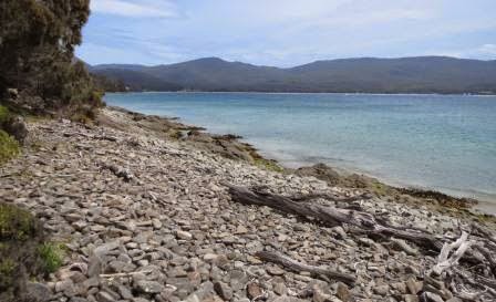
Mainly
rounded rocks here. Kids having a ball balancing the stones. Piles everywhere.
.JPG)
.JPG)
Nice
walk through the casuarinas though they all look dead.

Reached
the end, lovely view back.
Grass
Point, site of another whaling station. It certainly would have looked different back then with all the dead whales rotting in the sea etc.

.JPG)
.JPG)
Time
has started covering up the archaeological dig of the old house remains.
.JPG)
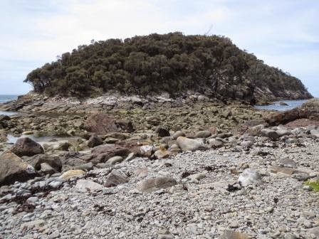
Walked
to the very end where the rocks were exposed that joined Penguin Island to the
rest when the tide is out.
These
casuarinas are nice and healthy.

Great
views over to Cape Queen Elizabeth, around the other edge of the island to the
open sea.
.JPG)
.JPG)
Headed
off to follow the Fluted Cape track – started off straight up hill.

We are
following the edge of the cliff. Great views – glad I have to stop a lot and
take photos. Should have bought my stick so found another on the ground.
.JPG)
Out
onto a point.
.JPG)
Looking
left,
.JPG)
Then
right.
.JPG)
Further
around an open space for a good look at the cliffs, they do look spectacular.
.JPG)
.JPG)
Looking
straight down makes my knees weak.
.JPG)
.JPG)
Boy
is it steep. The photos don’t do it justice. The wind is picking up too but luckily onto us
off the sea so I don’t feel it will blow me off the cliff. Wish I had the VMS
so I could see what height we are climbing to.
.JPG)
Another
look at the cliffs and the rock pillars balancing.
.JPG)
.JPG)
.JPG)
Looking
back down.
.JPG)
Then
up again.
.JPG)
Back
at Penguin Island
.JPG)
Up
further, you can see how far by the photo of Penguin Island again.
.JPG)
Looking
back over the Neck.
.JPG)
Zoomed
in on the Big Hummock (penguin rookery).
.JPG)
Rest
stop – time for a selfie with Penguin Island behind and Cape Queen Elizabeth in
the background.
.JPG)
.JPG)
Zoomed
in on Mount Wellington and the tower on top.
.JPG)
.JPG)
Down
hill for a bit.
.JPG)
Then
climb again up the next hill.
.JPG)
Looking
back over the Neck to the north part of Isthmus Bay.
.JPG)
And
to Simpsons Bay to the south of the neck.
.JPG)
We
can see Tasman Peninsula in the distance. It is hard to see in the photo
because it was quite hazy.
.JPG)
Looking
down to the Bruny Island Cruise boats zooming around under us. They disappear
under the cliff face.
.JPG)
.JPG)
.JPG)
Onto
an open area which has been cleared – maybe for helicopters to collect hikers
who are having heart attacks after that climb!! It was slippery climbing up on
the needles from the casuarinas so I am glad we aren’t going back down that
way.
.JPG)
.JPG)
Steve
noticed something white in the ocean. The sea is quite calm with no white caps.
.JPG)
.JPG)
All
of a sudden the boats all turned and headed out to what we had seen. It disappeared after the boats got too close.
.JPG)
Some
younger people arrived and walked straight out to the edge and sat. My knees
wobble too much to get that close. The boats are just little dots in the
distance where the whale had been.

There
had been a fire through here and there are lots of trees down. Nobody has been
up lately to clear the path!!

A
bit of art!!

Another
column of rocks.

Continued
up again.
.JPG)
Eventually
we made it to the top – another pile of rocks with a note.
.JPG)
.JPG)
Spectacular
views – so glad we did it.
.JPG)
Zoomed in to the edge of Penguin Island again.
.JPG)
Panned
from left to right from the south edge of the Neck around to Cape Queen
Elizabeth.
.JPG)
.JPG)
.JPG)
.JPG)
.JPG)
Steve
added a couple more rocks to the pile.
.JPG)
The
sun was very hot but the breeze off the ocean was getting cooler. Steve got
adventurous and went out onto a point – hanging onto that tree tight though.
.JPG)
.JPG)
Then
it was my turn!!
.JPG)
Just love the view.
.JPG)
The rock formations continue around the corner.
.JPG)
.JPG)
Peered
down through the boulders to the beach below. Long way down.
.JPG)
.JPG)
Headed
back down the other way through the grassland and scrub. It is a steep walk
down but not as bad as the cliff side. The clouds have come over which is good
as when the sun is out it would have been a hot walk as there is no breeze
here.
.JPG)
.JPG)
I
can see Adventure Bay again. Still a long way to go back to the beach though.
.JPG)
Rocky
track so have to watch where we put our feet.
.JPG)
.JPG)
Back
to the beach at last – big walk but the views were spectacular so glad we did
it.

Cuppa
at a beach called Quiet Corner.

A
chap had been diving and had a few Abalone so we asked him about them and I got
a photo. He said they taste like calamari so I might give it a go.

Some
guys were playing a different kind of cricket. The batter was on the beach and
the fielders in the water – they were having a ball.

Looking
back across the bay to where we just hiked.
.JPG)
There
were a couple more walks through rainforest and to the summit of Mt Mangana but
we decided we had had enough for today. Turned onto Coolangatta Road which goes
back across the island to Lunawanna on the west. There was a sign 4WD only –
was a bit rough but that didn’t stop the people in front of us in their Falcon
sedan. Over the top (420m – the height at summit was 571m – highest peak on the
island).

Stopped
at a sign about Clennetts timber top mill site (there is another one down on
the flat). Luckily it was only a 10 minute walk. Lots of old machinery and info
signs. It was set up by the Forestry Department but hasn’t been maintained and
there is nothing in any of the info brochures about it. What a shame.
.JPG)
.JPG)
.JPG)
Amazing
this pile of sawdust hasn’t disappeared after all these years.
.JPG)
.JPG)
.JPG)
Turned
off towards Cloudy Bay again to see how many people are camped at the Pines. It
wasn’t too crowded.
Everyone
was down at the bay surfing. They even started parking on the beach – the car
parks are too small for the growing number of tourists.

Decided
not to drive along the beach down to the other camp area, though others head
down in their normal cars. Apparently it is a lovely camp spot, right round to the other end of the beach. 4WD used to go up onto the point but that has been closed off now. Like a lot of areas.

Parked
and walked up the hill, great waves rolling in.

Spotted
the surfers so headed around to Whalebone Point to watch them.
.JPG)
.JPG)
Someone
laid heaps of rocks and some planks to make a path around to the point where
there is a platform with seats. The sun was so hot at 6pm.


Headed
back north again looking out for more White Wallabies. Apology to Erica – they
do look albino but I googled them and couldn’t find anything about them except
they are called Bennett’s White Wallabies and are rare. Found this photo of one
with its normal looking joey.

Back
to camp where a lot more people have arrived. Mainly in tents. Another wander along the beach (just to keep
the legs moving!!) Picked up some more shells – not that we need any more.
I
got dinner ready while Steve prepared the fire. Don’t need it for warmth
tonight but it is lovely to be outside and enjoy it. Even stayed out for a
cuppa til the sun set and the moon was shining brightly. Kookaburras having the
last laugh.
No
need to close up the van tonight 25 degrees in here – no blankets needed. So
nice for a change.
No comments:
Post a Comment