7.30am
15 degrees and a lovely blue sky. Might have to get the flannelette sheets
out!!
A
hawk was upsetting the Glossy Black Cockatoos. The male has a brownish head and
clear red tail panels. Females have black bands on red or orange tail panels
and yellow marks on their heads. Numbers of these endangered birds are
increasing due to revegetation of Drooping Sheoaks and protection of nesting
sites from predation by the common Brushtail Possum.
So
nice to see the sun even though the wind is strong and cold – back into jeans
and jumpers.
Great
day to head into Flinders Chase National Park to explore. Stopped at the Centre
and paid for our entrance permits. Headed south towards Cape de Couedic. Great
view at the lookout over the vast area of the National Park.
Down
to the Lighthouse. Although there was a lighthouse at Cape Borda, ships were
still wrecked at Cape du Couedic because their captains chose to sail south of
Kangaroo Island in preference to using the hazardous Backstairs Passage.
Construction of the Cape du Couedic light began in 1907. The light was first
lit in 1909 with a visibility to 27 miles seawards.
Where
they stored the kerosene.
Steve
seeing if anyone is home.
Amazing
the work they did when they built this lighthouse.
View
down to Admirals Arch where all the fur seals live and Casuarina Islets (The
Brothers) and the Southern Ocean.
Signal
flags were also used.
Three
keepers looked after the light – hence the three cottages.
Walked
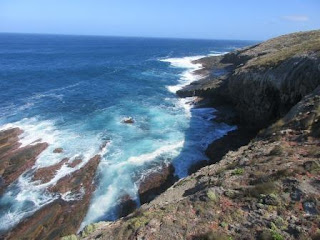
down to the lookout on the cliff edge.
Fabulous
coastline.
The
wind is so strong.
Looking
back to the lighthouse.
Back
to the cars then down to the car park to walk down the boardwalk to Admirals
Arch and the fur seals. Looking back up to the lighthouse.
Another
shipwreck – the ‘Loch Sloy’.
Long
boardwalk. Stopped at another lookout.
Spotted
some of the New Zealand fur seals sunbaking on the rocks.
A
few were moving around and playing in the water.
Another
wonderful view.
Rick
trying to keep his hat on as he was reading the signs.
Going
down the boardwalk, reading the info boards along the way.
Spotted
more seals warming up on the rocks.
Bubby
wants a drink.
More
info boards.
Down
further to Admirals Arch.
The
seals were having a ball in the water under the arch – got lots of videos of them leaping out
of the water.
We
walked over the top of the arch.
Took
my selfie then a chap offered to take our photo. Cape du Couedic is the most
southerly point of Kangaroo Island.
Looking
along the coastline towards the Remarkable Rocks.
Back
up the boardwalk.
Looking
down on the other side of the Arch.
A
big wave came over the rocks and disturbed the sleeping fur seals.
He
wasn’t impressed so went to find a drier place.
How
the plants cope with the salty air.
Walked
around to another lookout. Looking back to where we walked down to the Admirals
Arch.
More
fur seals below the lookout.
A
few were playing in their own little swimming pool. I got some great videos.
Then
a wave crashed over and turned their pool into a spa.
One
guy was out frolicking in the churning waves.
Back
to the car and up the hill. Great view back up the coastline of Maupertuis Bay.
Headed
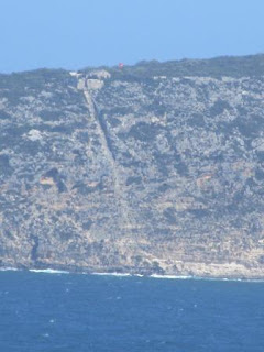
east to Weirs Cove for lunch. This was where the lightkeepers stored their
goods after they brought them up the steep cliff using a flying fox.
Each
keeper had a separate room.
Got
out our lunches in the shelter of the trees.
Fabulous
view of the cliffs from the lookout to the Remarkable Rocks.
Straight
down to the jetty.
Spotted
some more seals.
Zoomed
in on the caves in the cliffs.
Looking
back to the lighthouse. Would have been a long way to take their goods back
there.
Following
the road to the Remarkable Rocks.
Stopped
at the lookout.
Parked
the car then followed the track to the info area and toilets. Great to see the
comparison photo from 1912 to 2000.
Sad
to think someone falls in and lives but his rescuers both died.
I
waited to go in to the toilets and two Asian ladies left, unfortunately they
obviously couldn’t understand the sign showing ‘not to stand on toilet seat’!!
What a mess they left.
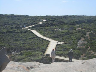
Headed
down the very smelly boardwalk – they are oiling it!! Info on reading the tracks.
Looking
back where the flying fox came down at Weirs Cove.
Info
explaining how the rocks were formed.
Along
the long boardwalk – workers stopped for lunch!!
Amazing
rock formations.
Even
room to hide.
The
eagle’s beak.
Looks like the whale’s mouth. Inside it was
curved and smooth.
More
rocks further along.
Fabulous.
The
acid from the orange lichen eats away at the granite when it rains making the
channels in the rocks.
Not
going any closer to the edge!!
Piggy
face.
Added
to the hole and it now looks like a fish.
Lots
of people crawling all over the rocks.
Rick
found a comfortable one.
Getting
better at our selfie photos.
Looking
back up the boardwalk.
A
group decided this rock was great for couple photos so we lined up too.
So
glad we had the clear sky for all the photos today, even if it is blowing a
gale.
Back
to the truck then back to the National Parks Centre. Found a koala – so cute.
This
guy had a hard night.
I
had asked the lady about the road to West Bay and she said it had just been
graded so we headed off. All this area is regenerating after the 2007
bushfires.
It
was great till we got past Sandy Creek (which was dry) then the road was very
corrugated. Rick and Leanne turned around but we kept going.
Lots
of black boy bushes (Tates Grass Tree) but only a few had the big spike. They
were harvested extensively for Yacca Gum from 1843. Hundreds of people were
employed in the industry by the early 1900s. Flowers after being affected by
fire.
Spotted
where someone else had turned around. Got to the camp area – nobody camping. A
big anchor dedicated to the 25 men who died when the ‘Loch Vennachar’ was
wrecked out on the point in 1905.
Looks
like a lovely bay.
Walked
around to the lookout where there was more information on the wrecked ship.
Beautiful
– a cray fisherman thinks so too or he is just hiding from the strong winds.
The
waves were crashing on Vennachar Point.
We
are on the most westerly point of KI – time for another selfie – bad hair day!!
Back
to the truck to make a cuppa and sit under the shade of the sheoaks.
Headed
down the track to the beach – glad they have the mats.
No
one has been on the beach for a while.
Looking
back up the track.
Looking
back up a valley – maybe a creek might flow down to the sea in heavy rains.
Steve’s
left me behind.
Changing
rock formations on the south side.
The
waves were rolling in – the sign at the carpark said ‘No Swimming’ but fishing
was allowed.
The
water is so clear.
Wind
creating the lines on the beach.
Only
a couple of shells on the beach.
Across
to the other side.
View
back.
Nasty
sharp rocks.
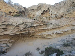
Interesting
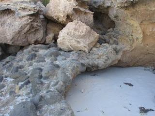
rock layers here.
Historic
graffiti!! One day I suppose it will be.
A
piece of cuttlefish – looks like a fingerprint. Lots of big ones here.
I
did my ‘Clean Up Australia’ bit.
Back
to the other side – Steve climbed up to check out a cave. Someone has had a
fire in there.
A
narrow section between the rocks.
Back
up to the truck then back over the corrugated road again to the National Parks
Centre. Went in and let her know that the road hasn’t been graded. Walked
around the back to follow the History Trail. Lots of plaques to read along the
way through the Black Swamp.
Lots
of Cape Barren geese.
Info
about another shipwreck ‘Loch Sloy’.
Spotted
an echidna in the distance. During the mating season from May to September,
echidna ‘trains’ are formed by up to 10 males following one female!!
A
few wallabies and kangaroos grazing.
Charles
May took up the remote Rocky River pastoral lease in 1893 and lived here with
his family until 1914. Charles built the homestead to house his wife, Annie and
seven children, and as his family grew (another three children), he constructed
the cottage for his sons. The cottage was later renamed after the postman, who
stayed overnight on his fortnightly round trip from Kingscote. The postman was
so punctual, arriving exactly at 4pm, that the neighbours could set their
watches by him.The Mays planted many trees that reminded them of ‘home’.
Continued
on the trail where Steve spotted another koala. He was sound asleep so Steve
jumped up and down in the twigs and leaves waking the koala up!!
He
doesn’t look like he was very impressed.
A
Tammar Wallaby sat watching us then proceeded to have a scratch.
Back
to the truck and a parrot landed near us singing his ‘ding ding’ song.
Drinks
and games in the camp kitchen area when we got back. The girls won Sequence
again.
Got
an email from the magazine editor and she wanted some other Australian travel
photos as I had just sent her Tasmania – how do I chose which ones!! There are
so many.
After
dinner we rang Rebecca and Clive then Mum and Dad – raining at home.
Clear
sky as we went to bed.












No comments:
Post a Comment