Minimum of 4 degrees this morning in the camper but I think it’s a lot colder outside as the wind is blowing hard. Very cloudy too. Mum wouldn’t have like this cold weather.
We read after breakfast waiting for it to warm up a bit so we can go wandering. Steve decided it was too cold to go fossicking here. Had a cuppa then headed back to check out the old mines. The sun is shining now and the sky has cleared up.
Back to the cross roads then up the track to do the self guided tours of the two mines here. Followed the track to the Golden Chance first following the leaflet’s map.
.JPG)
.JPG)
.JPG)
.JPG)
.JPG)
.JPG)
.JPG)
Up the hill to the mine. Checked out the covered shaft first then walked back down to the incline entrance. Lots of copper carbonates on the quartz but no gold!
.JPG)
.JPG)
.JPG)
.JPG)
.JPG)
.JPG)
.JPG)
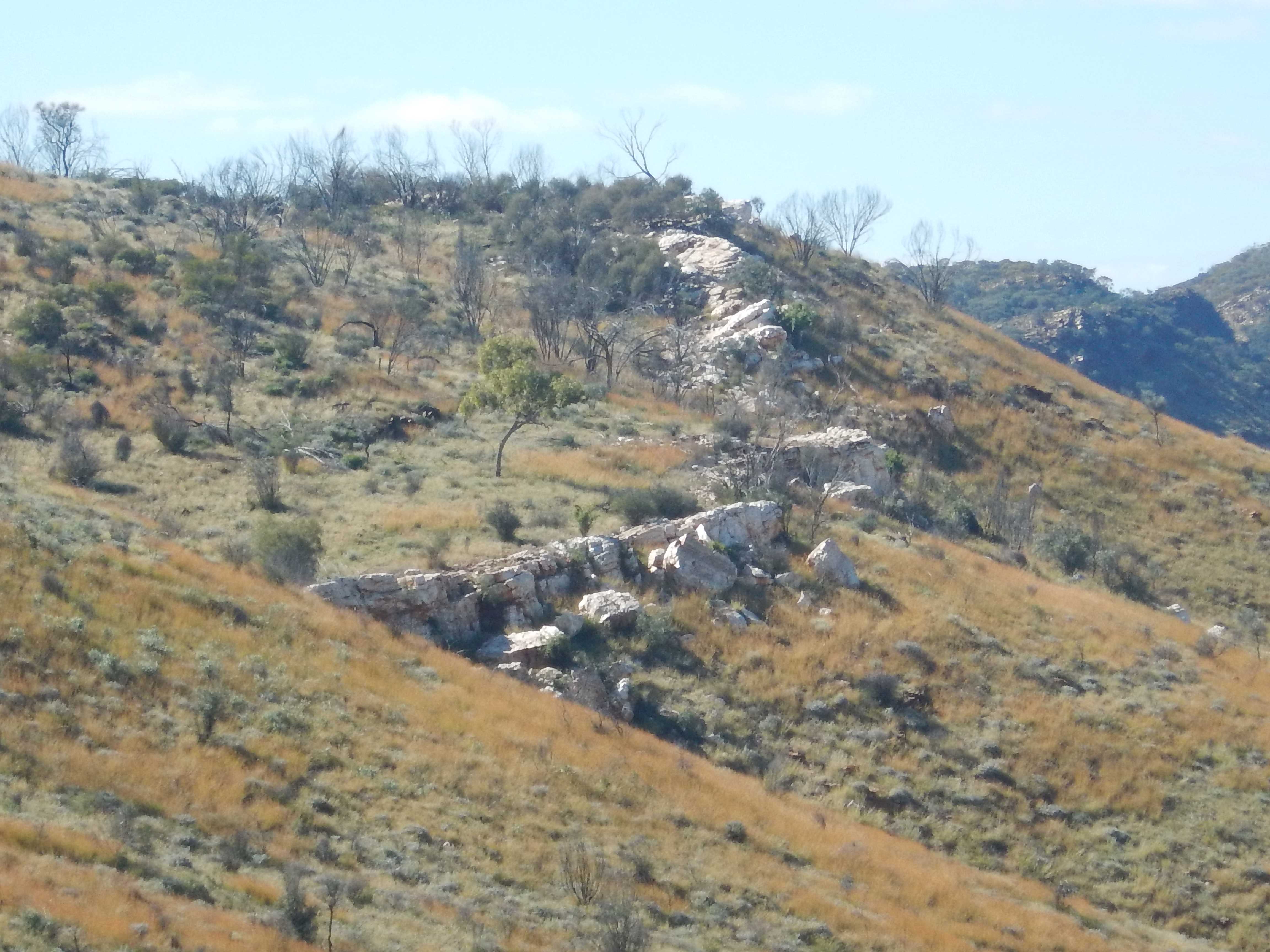
Looking back over the quartz wall.
Went up the hill further, we can just see the camper. Great view. We didn’t walk all the way to the top though so couldn’t see the Government area as mentioned in the leaflet.
.JPG)
.JPG)
.JPG)
.JPG)
.JPG)
Down the other side past a couple of other mines. Big quartz vein and squiggly on on the roof.
.JPG)
.JPG)
.JPG)
.JPG)
.JPG)
.JPG)
A better view of the quartz wall.

Back down along the creek where you could see little piles from where they used dry blowers to find the gold in the dry creek.
Back to the car park then along to other end for the walk to the MacDonnell Range Reef and Christmas Reef Mines.
.JPG)
.JPG)
Along the track to Christmas Reef Mine. Old ‘house’ nearby.
.JPG)
.JPG)
.JPG)
.JPG)
Continued along the track and up the hill. Another old shack. The info board shows why these shacks have only low walls.
.JPG)
.JPG)
.JPG)
At MacDonnell Range Reef Mine area - looking back we can just see the camper.

Wandered around over the piles and checked down the shafts through the grills. Previously you could climb down into these mines.
.JPG)
.JPG)
.JPG)
.JPG)
.JPG)
.JPG)
Down into the creek where a wall of rocks has been made.
.JPG)
.JPG)
Up the other side to another shaft area.
.JPG)
.JPG)
.JPG)
Back to the camper. Another ‘stone treasure’.

Back down to the crossroads. Parked beside the info board - the house we saw yesterday afternoon was the bakery.
.JPG)
.JPG)
Had lunch then headed out to the Joker Mine and Gorge to the east. I noticed on the Hema that we are travelling along the Tropic of Capricorn line.
Parked and headed along the track and across Joker Creek.
.JPG)
.JPG)
.JPG)
Found the stone buildings - this one is round.
.JPG)
.JPG)
.JPG)
.JPG)
.JPG)
Further along we took the track up the the mine - should have read the note better. Very steep climb!!
.JPG)
.JPG)
.JPG)
At last we reached a ‘paved’ area. We can just see the camper.
.JPG)
.JPG)
.JPG)
Looking across to a lump on the hill.
.JPG)
.JPG)
Lots of different trees here. Steve went down the slope and into an audit - wasn’t very deep. The notes say this yielded 12 oz of gold from 20 tons of ore - imagine carting it back down the hill!
.JPG)
.JPG)
.JPG)
.JPG)
.JPG)
Very rugged - not the usual place we would think to look for gold in.

Continued up and found the ‘forge’.

Further across is the vertical shaft. In 1905 it was 70 feet deep.

Gingerly we went back down the hillside - very easy to slip.
Back down we followed the track to the ‘gorge’. Didn’t find any of the rock wallabies mentioned in the leaflet but found their droppings. Lots of birds about but they hide well in the trees.
.JPG)
.JPG)
Wouldn’t call it a stunning gorge.
.JPG)
.JPG)
.JPG)
Back to the camper then continued along the road to the Great Western Mine.
.JPG)
.JPG)
.JPG)
Another stone house.

Up and down we went. The area was named White Range because of the light coloured rock looked white in the distance.
.JPG)
.JPG)
.JPG)
.JPG)
Found the forge and a bit further along was the wooden building which has fallen down. We think this may have been a bed.
.JPG)
.JPG)
.JPG)
Spotted a shaft further along the hill but the track continued down into the creek.
.JPG)
.JPG)
Then we saw all the piles of the mine area. It was a walk for us to get in here so they were amazing men to think what they achieved in digging it out, sorting it down to ore with gold in it and then carting it down to the Government Works to have it processed. We wandered all over checking out the different ‘caverns’.
.JPG)
.JPG)
.JPG)
.JPG)
Great view too.

I climbed down into one to check it out.
.JPG)
.JPG)
.JPG)
All the rock they pulled out was piled up near the entrances.

Another cavern.
.JPG)
.JPG)
Further down I found a huge opening. I called to Steve and he was further along at the entrance to the other side of this cavern.
.JPG)
.JPG)
.JPG)
I thought Steve had fallen over but he was just stretching his back! I slowly got down through the loose rocks - he had come down the other side which was an easy walk.

We went inside - amazing. They did a great job - couldn’t find any gold left behind.
.JPG)
.JPG)
.JPG)
.JPG)
.JPG)
Around to where I had just been peering into. Rocks have been stacked up at one end.
.JPG)
.JPG)
.JPG)
Still quartz seams in the roof.

Climbed back out. This is what I climbed down compared to Steve easy access.
.JPG)
.JPG)
.JPG)
Onto a flat platform of the discarded rock beside the creek.

Back along the track to the camper. Continued on the road further to the White Range Cemetery which has been well preserved and great information board. Joseph Hale found the first gold in this area in 1887.
.JPG)
.JPG)
.JPG)
Up the track behind it to the lookout. The shadows were on the sign so it was hard to photograph. In the distance is the White Range Open-cut Mine that started in 1990. It was only worked a year or so but has been worked occasionally over the years since then as well as the waste dumps being reprocessed.
.JPG)
.JPG)
.JPG)
.JPG)
.JPG)
.JPG)
.JPG)
.JPG)
This is the end of the road so we turned back and headed back to the cross-roads. Stopped at the small cemetery there. James is born on my birthday and died on Brians’ birthday - just a few years difference.
.JPG)
.JPG)
.JPG)
Very interesting area. We headed out via the Binns Track/Arltunga Road to get back to the Stuart Highway. Crossed a dry creek - must have been the Hale River as we then passed the turn off to another accommodation place - Hale River Homestead.
Across a grid to enter Ambalindum Station. Winding up and down through the hills.
I’m back on gate duty. Spotted another big quartz wall on the hill ahead.
.JPG)
.JPG)
More open country. Lots of cattle around a big waterhole.
Through a wide sandy creek but no name on the Hema. Up the rise to two homesteads, big sheds etc of Claraville which is still part of Ambalindum.
Opened another gate and continued westward on the red dirt road. Flat open grazing area with lots of new green shoots. A lot of cattle about.
Around the edge of the Ambalindum Homestead which also has van parking and accommodation.
Smooth dirt road. Mr Bull just sauntered across the track.

Views across to some hills - might be Georgina Range.
.JPG)
.JPG)
Through another gate and then passed the turn off to The Garden Homestead to the right. The track to the left goes down to historic Winneckie Goldfields but there are no signs so probably not accessible to travellers.
Into more hilly country. Passed the turn off to continue on the Binns Track up to the Zircon Fields where we were before.
We continued westward on the Arltunga Tourist Drive. No more station homesteads along this section. Flat open country.
Lots of little purple then yellow wildflowers as we got closer to the Stuart Highway.
Onto the highway and then down to Alice Springs (back over the Tropic of Capricorn line again).
Topped up with diesel and loaded up with our grog (shops are only open 3pm to 7pm Wed, Thurs, Fri and 11 to 7 on Sat so we had missed getting some the other day).
Headed out the Larapinta Drive as the sun started to set against the first part of the West MacDonnell Ranges.
.JPG)
.JPG)
Out to the turn off to Simpsons Gap but we turned left down the road to Honeymoon Gap.

Pulled into one of the many dirt tracks beside the Roe Creek and found a spot for the night between two dead cars. There were a few other travellers parked along the edge of the creek too. Big wide creek which I think comes down from Simpsons Gap.
.JPG)
.JPG)
.JPG)
.JPG)
Just getting phone reception here. Checked in with the Tassie friends to see how they are going on their drive to meet us up here. Doing ok, should be here on Sunday.
Had dinner and listened to the Mopokes (owls) calling each other.
No comments:
Post a Comment