The birds started at daybreak - 5.45am!
We ran the truck for half hour while we had breakfast at 7am. Luckily we don’t have anybody near us.
Headed out to meet Dave & Wendy at the Cornwells Road intersection near Kingfisher Bay. We had our first close head-on as a car came hurtling down the road near Pile Valley and just stopped in front of us until we backed up - no wave or anything! Luckily we were just putting along as usual.
Arrived at the intersection at the same time as Dave & Wendy - both half hour earlier than our agreed time. Hard to judge how long it takes to get anywhere.
Onto a new track today.
Down the hill which was narrow. More boards to protect the track.
Through banksia scrub. Turned off onto Northern Road (north bit) via taller thin trees around Leading Hill. Very rooty track!
Across the top into scrubby country again - no view because of the trees. Down slope along straight stretch.
Lots of thin trees fallen across the road - just drive over them.
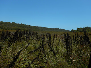
Onto Northern Road, heading up north-west. Lots of grass trees. Narrow and windy as we climb up to open dead trees so better views across the valley and hills.
Following the track to an old logging site that Sarah’s friends had told Dave & Wendy about. The sign says we are on the road to Moon Point. There is an area to park and a sign with surveillance camera over the locked gate. Got out our Tassie walking sticks just in case we meet a dingo.
Headed up the slope following the road (I found out later that it was called Postans - a name of one of the tracks on the Hema too). When I texted David later about the commando camp and said we found this, he said he had a map and sent this through. It is under the National Parks control.
No information about it here - just a ‘historical - don’t take anything’ sign. There was so much stuff scattered over a large area. Old trucks, machinery, a bus, houses, swing. According to Goggle it operated from 1935 to close of logging in 1991. It was a base for logging contractors, firstly Neville Smith and A.R. Postan (who was the employee). Postan then bought out Smith in 1940.
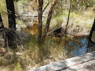
Back to the trucks and we headed off again. Stopped for a cuppa in the shade by the swamp near Poyungan Creek.
When we started driving again we drove over the creek which was flowing well. Spotted two ducks under the tree too.
Continued on to the turn off to an old hangar and air strip. Open area. Drove over a pipe and realised it is all a marshy area.
Spotted a tower up on the hill.
Found the hangar or is it just a shed for when they built the tower on the hill as the air strip is over the other side of the hill according to our map.
We tried to follow the track to the air strip but it was over grown and we certainly weren’t going up the tower track!!
Turned around and headed back out. Further along we followed the edge of a hill to the end where we crossed a wooden bridge over Urang Creek which flows to the west coast.
Further on we found the creek again and mangroves. We are near the coast but there is a wide section of mangroves here.
Turned left at the intersection to go down to Urang Creek. Another vehicle was there but I said to Steve to wait till I walked down. Took a photo of the ramp and creek and decided we didn’t need to get bogged so told Steve to around. Dave & Wendy zipped down in their car for a quick look but it was only a creek - not the coast.
Headed back and continued northward to turn down a track to find Bellert’s Hut ruins. He was a linesman that maintained the telegraph line to the lighthouse on the northern point of the island. Nothing much to see.
Two old trees which I thought were mangoes but there was no fruit. We parked and Wendy and I walked down over the roots. David & Steve decided to continue on and David dropped Black Betty straight down over the roots and off they went.
Steve took the camera. The track continued on and sand got softer so they turned back with only a glimpse of the beach.
Back to the main track and left turn which was very loose so Steve had to put his foot into it but we got around.
We continued north for a bit then turned east onto the Happy Valley Road through banksia scrub. Up and down hills. Some soft bits but mostly it was corrugated. Through more trees. Across another creek (Bogimbah Creek). Climbing up a hill - glimpses of the strait through the trees.
Back into the tall tree forest. At a Y intersection - left to Moon Point (will have to check that out another time) and R to Happy Valley. On we went on a very narrow track. Another Y intersection and left to Happy Valley and right to Lake Garawongera but we will do that another day. Met our first car that we had to pull over for.
Back into coastal scrub then another intersection - another track to Moon Point and right to Happy Valley where we are heading. Up and down for a slow 3km down to the east coast. Luckily we only met two cars as it was narrow and sandy.
Stopped for lunch at the Rotary picnic area. A bit of information about Happy Valley, established in 1934 as a tourist resort.
Lots of lovely homes and accommodation places here.
Headed out to the beach - long boardwalk for people on foot.
Onto the beach just after low tide (1pm). We headed north. The wind is blowing north-easterly. We let Dave & Wendy go ahead.
Lots of cars at Eli Creek. Wendy had been having a drive - Dave wasn’t game to watch!!
As we drove up we spotted our first dingo sniffing around the vehicles. He wasn’t worried about anyone and wasn’t worrying anyone either - just looking for leftover food.
We decided to cross the creek now continue on to check out the ship wreck first. We had read lots about people getting stuck here but all good at low tide.
Snapped photos as we went along.
As we neared the Maheno wreck we saw the scenic plane taxi back down the beach. Should find out how much the flights are.
Pulled up to wander over to the wreck. Cars and people everywhere. Have to keep your eyes peeled for the vehicles continued northward. They are supposed to slow to 40kph here! Then the plane took off over the wreck.
The bus took off with all its passengers. Walked to the ‘rudder’. Great the tide is out as we can walk right around it. Wendy & I looking very windswept. The boys were doing their own meandering.
Wendy got a photo of me doing the ‘Titanic’ post.
Coloured sand on the hill.
A few more shots of the wreck then we walked across to where the boys were behind the dune reading all the information. The poor ship has been rusting away here since 1936.
Further over was a great engraved plaque tribute to the Maheno when it was a hospital ship during WW1.
We drove back to Eli Creek. A guy zoomed past us having a good splash in the creek.
Pulled up and had a look up the creek.
Drove further along to the main ‘pool’.
There are some big ants on the island too.
Had a cuppa and blew up our ‘floaties’. Across the pool then up the sand and onto the boardwalk and to the end to float down the creek.
Steve took the camera to get photos of us then he just walked down the creek with us. It was a bit chilly in the shade but very relaxing as the water slowly carried you down. Great fun with Wendy & David as we waited for Wendy to fall out of her do-nut but she stayed upright to the end.
Some boys were catching march flies and feeding them to some fish. Near the end we saw a few fish and a small eel near the steps up to the boardwalk. Its amazing how much water is flowing out into the sea. (Terry said later that politicians tried to implement a scheme to pipe the water from Fraser Island over the mainland but it was vetoed by the greenies.)
We went back up for another float. This time I had the camera. We were all chilled by the time we got to the end.
As we came out we spotted the dingo again near our truck. He wasn’t worried about Steve getting a towel.
Headed south past Happy Valley. Around Yidney Rocks which has a couple of accommodation places. Continued on - lots of little freshwater rivulets crossing the beach. Still plenty of beach to drive on - 2 hours after low tide.
Continued on but chose the bypass around Poyungan Rocks as we don’t need any extra salt on the truck.
Back to Cornwells Gap Road. Dave & Wendy can head up this track and straight across to Kingfisher Bay. We arranged to meet tomorrow morning at Eurong to head up to Indian Head.
Dave & Wendy headed up the sandy beach track - bit bouncy in the soft sand but they disappeared around the corner so we hope they are ok for the rest of the track.
We had a try and it was very soft and after watching Dave bounce up we decided to head back to Eurong and go home that way.
Back to camp by 5.30pm. Only a few campers in the campground tonight.

.JPG)
.JPG)


.JPG)
.JPG)
.JPG)
.JPG)
.JPG)

.JPG)
.JPG)
.JPG)
.JPG)
.JPG)
.JPG)
.JPG)
.JPG)
.JPG)
.JPG)
.JPG)
.JPG)
.JPG)
.JPG)
.JPG)
.JPG)
.JPG)
.JPG)
.JPG)
.JPG)
.JPG)
.JPG)
.JPG)
.JPG)
.JPG)
.JPG)
.JPG)
.JPG)
.JPG)
.JPG)

.JPG)
.JPG)


.JPG)
.JPG)


.JPG)
.JPG)
.JPG)
.JPG)
.JPG)

.JPG)
.JPG)
.JPG)
.JPG)
.JPG)
.JPG)
.JPG)
.JPG)
.JPG)
.JPG)

.JPG)
.JPG)
.JPG)
.JPG)
.JPG)
.JPG)
.JPG)
.JPG)
.JPG)
.JPG)
.JPG)
.JPG)
.JPG)
.JPG)
.JPG)
.JPG)
.JPG)
.JPG)
.JPG)
.JPG)
.JPG)
.JPG)
.JPG)
.JPG)
.JPG)
.JPG)
.JPG)
.JPG)
.JPG)
.JPG)
.JPG)
.JPG)
.JPG)
.JPG)
.JPG)
.JPG)
.JPG)
.JPG)
.JPG)
.JPG)
.JPG)
.JPG)
.JPG)
.JPG)
.JPG)
.JPG)
.JPG)
.JPG)
.JPG)
.JPG)
.JPG)
.JPG)
.JPG)
.JPG)
.JPG)

.JPG)
.JPG)
.JPG)
.JPG)
.JPG)
.JPG)
.JPG)
.JPG)
.JPG)
.JPG)
.JPG)
.JPG)
.JPG)
.JPG)
.JPG)
.JPG)
.JPG)
.JPG)
.JPG)
.JPG)
.JPG)
.JPG)
.JPG)
.JPG)
.JPG)
.JPG)
.JPG)
.JPG)
.JPG)
.JPG)
.JPG)
.JPG)

.JPG)
.JPG)
.JPG)
.JPG)
.JPG)
.JPG)
.JPG)
.JPG)
.JPG)
.JPG)
.JPG)
.JPG)
.JPG)
.JPG)
.JPG)
.JPG)
.JPG)
.JPG)
.JPG)
.JPG)
.JPG)
.JPG)
.JPG)
.JPG)
.JPG)
.JPG)
.JPG)
.JPG)
.JPG)
.JPG)
.JPG)
.JPG)
.JPG)
.JPG)
.JPG)
.JPG)
.JPG)
.JPG)
.JPG)
.JPG)
.JPG)
.JPG)
.JPG)
.JPG)
.JPG)
.JPG)
.JPG)
.JPG)
No comments:
Post a Comment