Cooler
night alright, 18 degrees at 7.30am. Headed back to Busselton via the Port
Geographe Marina Road which took us around the north end of Vasse Estuary to
the coast.

This
is a river surge barrier.

Running
down beside the estuary on the left and the coast on the right.

Stopped
at the dump point again and topped up with water – used our code from the other
day to unlock all the locks.
Out
to the Busselton Bypass then into the little village of Vasse to top up with
fuel. Don’t need a gas cylinder so it is cheaper at the Gull Servo than the
Coles Express. Interesting artwork on the corner. Didn’t stop to read the info
plaque.

Down
the Bussell Highway, through Cowaramup – lots of cows to check out here. Just
entered Margaret River then turned west to the coast and then travelled down
Caves Road to our campsite turnoff in the Leeuwin-Naturaliste National Park,
Conto Campground. The national park runs the full length of the coast (except
for a bit near Prevelly) from Cape Naturaliste to Cape Leeuwin. You have to
book online but then choose your campsite when you arrive. Set up for the next
3 nights. There is a big covered camp kitchen area and drop toilets.


Before
lunch we drove down to the beach – or so we thought. It is 4km away and there
are a few tracks – all corrugated of course since it is National Park!

Whaling
was a main industry along these waters in the early years.

First
track was to Conto Springs – didn’t find the springs but it looked like a nice
beach though a bit of a hike to get to it.


The
limestone ledge along the coast has lots of caves.

Next
track heading south lead to Round Rock.


Had
to wait a while for another big wave to crash on the rock.

Next
stop was Merchant Rock. Dangerous fishing off the rocks around here too.


A
rock was causing the waves to eddie around making a great swirl picture. Used
the continuous shot for these.


Next
was The Point. Looking north past Merchant Rock then up the coast.


A
plaque marks Cape Freycinet named by Baudin in 1801.


Looking
south to Hamelin Bay (I think).

Walked
around the big rock for a view back to The Point.


At
last we reached the end of the road and South Beach but it is a long walk yet
to the beach!!

Back
to the van for lunch then we headed off to explore the north bit above Conto
(just under the Lakes Caves sign).

Up
to Margaret River township along the Bussell Highway. The first European
exploration of the Margaret River district occurred in the 1830s, when settlers
from August travelled overland in search of more fertile farming land. During
his 1831 expedition to the Vasse River, John Garrett Bussell of Augusta
observed ‘several small streams – to the West’ and wrote in his journal: “one
very large and in it a basin into which rapids fell about 15 yards across –
very deep. We forded it at the rapids but no dry footed; this stream which
rolls along much more water than the Vasse can never fail…” It is believed he later named this river in
honour of his cousin Margaret Wyche. Settlement in the Margaret River region
began when John Bussell’s younger brother, Alfred and his wife, Ellen, established
properties at Ellensbrook (1855) and Wallcliffe (1865). Other settlers soon
followed taking up pastoral leases in the surrounding district. Stopped at the Rotary Park on the banks of
the Margaret River. Lots of walks to do.


Checked
out ‘Kate’. Maurice Coleman Davies brought ‘Kate’ to Karridale (further south)
in 1890 and he named it Kate after his daughter. Davies was granted a
concession licence in 1878 to cut karri timber at Coodardup (now Kudardup),
near Augusta. Timber would run on wooden rails from the mill to the winter port
of Flinders Bay (August) or the summer port of Hamelin Bay. Davies’ operation
at Karridale introduced the long length karri timber to the world. Settlers had
to ford the Margaret River then the Burnside Bridge was built in 1878. Maurice
then built a new bridge (below the current bridge) for traffic passing through
the district to his mill settlement at Karridale. With travellers journeying
from Busselton to Karridale and Augusta, Margaret River was soon operation as a
wayside depot. Tom Higgins established the first residence and changing post
for horses. In 1912 the townsite was surveyed and gazetted in 1913 with
Higgin’s house operating as the local post office.


Walked
across the bridge over the Margaret River, very brown with tannin - upstream
then downstream.


Steve
spotted some Marron (they are protected in this area and they must know it as
there are heaps).


Across
the river is the site of the old Group Settlement which has been restored. In
1921 the government introduced the Group Settlement Scheme. Designed to
encourage immigrants to take up land in the south-west, the scheme subsidised
the settlers’ land, stock and general agricultural costs. It was so successful
and it was discontinued in 1930 though many of the settlers struggled on to
make the town their home.


The
blacksmith’s shop.


The
Group House.


School
House.


My
batteries are going flat – will have to remember to carry spares (they are in
the truck). The Hairy Marron and other river dwellers. The pouched Lamprey
looks creepy.


Grabbed
some groceries from Woolies then headed north to Adinfern Estate Winery. We met
the couple who own it at Running Waters but didn’t get their names. Thought if
we did one winery we would visit theirs. They used to run sheep but when the
wool prices dropped then the lamb prices they went into wine. Licensee name –
so we now know it is Merv and Jan Smith. Janis was behind the counter and we
introduced ourselves and she remembered us which was nice. We tried a few white
wines (all lovely) and I chose one then we tried some port (now called
fortified wine as the Portugese have patented the name Port). They had a white
one which was delicious and the traditional one, Campfire, so we got one of
each. Nice bottle for the white one too. She said they had 20,000 sheep and still
have a few thousand. Mervyn got a diploma in making wine (whatever that was
called) and the rest is history. They even have a couple of cottages for people
to stay in. She highlighted some sights for us on my map and said to make sure
we visit Leeuwin and Voyager Estates as their gardens are amazing. Chatted with
Merv as we headed out with our goodies.


Next
stop was Cowaramup, lots of dairy cows in the fields and lining the street. The
town’s name means ‘place of cowara’ which is the aboriginal work for the
purple-crowned lorikeet – but the town as embraced the dairy industries hence
the cows everywhere.


Cute
little church in the Pioneer Park.

Jan
had said to check out the ‘Rump on a Stump’. We said we had seen a girl on a
pole in front of one of the wineries up north and she said that lady didn’t get
council permission to erect it so it became known as the ‘chick on a stick’ and
this one is a copy of that. It is actually called ‘Free as a Cow’ by the
artist. It was part of the Cow Parade (we saw lots of them in Perth).

This
town started as a Group Settlement town too like Margaret River.


The
23 Mile Well.


Walked
down the main street – lots of yummy things here too – chocolate, fudge,
icecreams but we were good!! A memorial garden to the settlers of this area.


Around
the corner was more history and information about how the cows came to be.


From
here we headed west to Gracetown on the coast. Very popular holiday
destination, Jan said this is where they swim in summer. On the rise before
descending into the township we pulled into a National Parks Lookout called
North Point.


Great
view north (lots of surfing spots along the coast) then over the rocky point.
Got a good wave action shot.


Walked
to the other side for a view over Gracetown and the bay and South Point.


Drove
into the town and around to watch all the surfers catching the waves off
Huzza’s Beach.


A
memorial to a lot of people of various ages - says cliff tragedy. So sad.


Followed
the track along the cliff top.

Stopped
at a lookout, called Volunteers Rest.


Looking
back at North Point.

Next
clearing was the site of the tragic cliff accident in 1996. So, so sad to think
all those people were happily watching family and friends surfing below us and
the cliff above them came crashing down on them. Hence the Volunteers Rest site
as there so many people helping to rescue those trapped.


Looking
back over Huzza’s Beach to the stairs you can see the limestone ridge sticking
out.


Up
to the houses at the top of the ridge – fabulous views from here.

Back
to Caves Road then south past a venison farm. Lots of little bambies.

Turned
back to the coast to Ellensbrook – one of the homes of Alfred and Ellen
Bussell. The site is under the National Trust and you can view the house during
normal hours for a gold coin and wander around the gardens anytime. We are too
late for the house (after 5pm) so we wandered through the grounds down to the
house.


An
old water wheel at the other end of the house near the creek.


The
site where the water wheel once stood in 1948 on the other side of the
building.


Followed
the channel upstream to the weir.


The
water was fed into the channel via this pipe.


Back
to the house I peered in the end room where there was some information. Might
come back and have a proper look inside.


Followed
the trail to Meekadarribee Falls. Getting a bit cool now – should have brought
a jumper!! Mr lizard is enjoying the warmth of the pavers. Nice easy walk.


Nice
pool under the rock which had a book called “Ellen’s Diary” which told the
story of their arrival here and the aboriginal story of this pool.


Followed
the track around the hill where you could see a dry creek bed then we heard the
sound of falling water. It must be coming off the top of the hill and dribbling
down the side and through a cave to the pool on the other side. Quite
intriguing. Took photos of the water cascading down – have to peer through the
reeds.


Looks
like a cave goes behind where the water is coming down.


We
are on part of the Cape to Cape track.


Walked
back to the pool – the water fall is on the other side of the ridge.

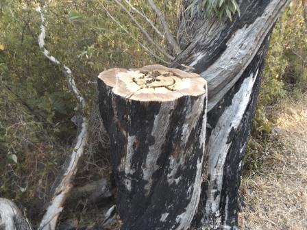
Heard
a lot of buzzing as we passed this recently chopped log. Lots of bees making
honey.


Back
to the truck then around to the beach access. Someone thinks Umbies Surf spot
is the best.

Out
to the coast and there is a memorial to a chap taken by a shark at Umbies in
2013.


Great
view from south to north with lots of rock pools below us.


Should
have packed some dinner as it is after 6pm!! Back onto Caves Road then we
crossed a dry Ellens Brook. I spotted an interesting entrance and made Steve
turn around. It is private property with a fabulous big stone entrance that I
could only get a glimpse of as we slowly drove past. Would be interesting to
see the house if that is just the front entrance.


Crossed
the Margaret River and the turn off to Prevelly but we will to that another day
– too late now. Back to Conto Road but as it is nearly sunset we drove down to
the coast for a photo or two. Took one from the top then Steve thought it would
be better from Merchant Rock so headed down the road.


It
would have been but I had to run out onto the rock and by then it was too far
down and the camera got a bit fuzzy when I put it on continuous mode.


Freezing
and hungry we got back to the van for a quick dinner and hot shower.
No comments:
Post a Comment