Lovely
morning, temperature just right, 24 degrees at 8am. Leanne rang for a chat
which was lovely. She suggested getting some venison from the farm but I said
we couldn’t eat that after seeing all the bambies. Just as we were finishing up
I spotted some Splendid Wrens heading towards us so had to say bye quickly
saying I would post her some photos on facebook.
They
are so cute and these wrens the male is all blue. Bouncy little things but I
managed to get a few photos.
Drove
around to Lakes Cave for a look. Lots of info and they have a replica cave to
walk through and a balcony looking down into the opening of the cave.
The
Suspended Table.
Extract
from the botanist who came with Captain Stirling in 1827. Such beautiful
handwriting.
Brides
Cave – I think that is near Giant’s Cave further south. It said 120 caves have
been found and 11 recommended for tourism – there are only 6 actually open.
Ellen
Bussell found the cave originally.
These
are her two homes - we visited Ellenbrook (photo 1926). Walcliffe was built
1866 (photo taken about 1960) near the mouth of Margaret River.
Outside
onto the balcony.
Watched
the tour group descend the 300 steps into the big hole and down to the entrance
of Lakes Cave.
There
are see-through holes in the balcony to peer down – a long way down!!
I
hung over the balcony for a shot of the actual entrance.
Good
specimens of Karri trees – still towering over us.
Back
north along Caves Road past Mammoth Cave then Calgardup Caves. Called in here
as it wasn’t part of the Caves Works (run by Margaret River Tourism). Calgardup
ones are run by the NP & Wildlife but are still $18 to enter.
Turned
west to Redgate, then down a dirt track to Boodijidup - a popular surf spot.
Not much happening this morning.
Around
to Redgate – lots of people here. Bit of walk to the beach again though lots of
people are enjoying the pools around the rocks.
Walked
down towards the beach. Don’t know how they are swimming as the wind is
freezing.
Back
up to the carpark and out onto the point to the information (needs a clean) about
the ‘Georgette’ which was wrecked here. It is the shadow left of the smaller
rocks.
Good
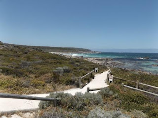
view from here too – south then north to Boodijidup Beach.
From
here we headed back east then turned up a dirt road – Stevens Road, to one of
wineries Jan recommended we visit because of the grounds and buildings -
Leeuwin Estate (it was bitumen again just before the winery – obviously
everyone comes in the other way!) Long drive in with vines on one side and
cleared pasture going down to a brook on the other and a big line of majestic
trees to guide us in.
Further
up the road was Voyager Estate. Grand entrance with the biggest flag I have
seen. It is renowned for its Dutch architecture and rose gardens. You park
right beside the vines.
This
row was planted in 1978.
Wandered
around the garden admiring the roses – lots of bees too. Tried out the ‘flower’
setting on my camera.
Even
a bell but we weren’t game to ring it.
Continued
down the path.
Lovely
building – not going in to try the wines though.
Headed
around to the rose garden. A sign advised that the sprinklers came on at 1pm –
so I had 5 minutes to walk around.
Next
level down was a herb and vegetable garden.
The
Globe Artichoke has a beautiful flower. Got the bee in flight.
The
bees were enjoying the flowers on the Fennel too.
Strawberries,
zucchinis and so much more. At least you know the vegies & herbs are fresh
in the restaurant.
Back
to Caves Road then up to Prevelly on the coast. Drove up to Gnarabup Lookout
for lunch.
The
Margaret River mouth is further up the coast under the cliff face.
Walked
further around to peer under the point at a cave.
Walked
along the Cape to Cape track to the other side of the point looking over more
popular surf spots – Grunters, Gas Bay then Boodijidup. Big flat rock ledges
out the front of the point. Popular for crayfish by the number of pots out.
The
limestone makes lots of great shapes.
Out
onto the point.
Another
great shape.
Down
through the village – home for lost boards!!
Along
Surfers Point Road – bit of art on the way.
Fabulous
new carpark, toilets, boardwalks and information for this very popular surfing
area.
The
kite surfers are enjoying the good wind today.
Looking
over ‘Bombie’ to Gnarabup Beach, then ‘Southside’ and ‘Surfers Point’.
A
shell wall with shells in the concrete.
Took
a photo for a couple so they took ours.
More
info along the boardwalk.
The
next area north towards the river – ‘Main Break’, ‘Fraggle Rock’.
Can
just see Margaret River.
More
info.
Sadly
it doesn’t end well for some.
Around
to the mouth of the Margaret River – but it hasn’t broken through at the
moment. They like it that way to keep the water in the river during the summer
to protect the ecosystem.
Surfing
info.
A
few surfers were out waiting for the right wave. One guy was impressive doing a
360 on the top of the wave then riding it in doing twists and turns etc.
Walked
back up to ‘Fraggle Rock’ viewing spot.
Drove
back down to a carpark near a big open park area – well it wasn’t that near as
it took me a few minutes to walk in. Left Steve making the cuppas. It is known
as Riflebutts and established in 1909 as a rifle range, recreation ground and
cemetery – no sign of gravestones here. A sign said no competition sport can be
held here due to the potted ground caused by rabbits – we saw a bandicoot run
across the road so I reckon most of the damage would be from them too.
Another
‘art’ piece called ‘The Stick’. Big playground and BBQ facilities too. Access
to the beach is nearby.
Back
along the main road to another Lookout over the area of the mouth of the
Margaret River and upstream.
I
think this is the ruins of Ellen Bussell’s other home, Walcliffe (built 1866)
comparing with the photo I took before at Lakes Cave.
Took
a shortcut back to Caves Road via a dirt road – Wilderness Road, lots of bush
style homes up here. Passed Terry Drive then spotted Brotherton Place. Must
have been the holiday place for Mr Brotherton of Australind!!
Drove
down then across to Witchcliffe to get some fuel but it was already closed,
only 4pm but it is a Sunday!! Two other cars pulled in for fuel. Old witchy
didn’t have much to say but I found somewhere to park my broomstick.
The
businesses here have taken on the witch theme, Witchy Pies and the Flying
Wardrobe.
Headed
back home down Forest Grove Road – the emus were out so stopped for a photo.
There was more in the next paddock.
Further
along is a huge paddock with a miniature railway, complete with houses and a
big station (though only little). Might be an attraction one day or someone
just has loves trailsets – he had laid a lot of track.
It
has been a lovely day though that cold wind didn’t encourage us to have a swim
so the togs go back into the cupboard. Drinks then early dinner so we can go out
to the coast for the sunset.
The
stars were out again by 10pm.


No comments:
Post a Comment