16
degrees at 7am with the van all closed up – Summer is only during the middle of
the day down here.
Headed
off early to explore from here to Cape Leeuwin and Augusta.

First
stop was a lookout over the tall Karri Forest. It was so quiet and mystical
(well until another car zoomed by).


Continued
down Caves Road then turned off to Karridale. It was the timber mill area they
mentioned at Margaret River but there was no historical information here. Mum
rang to let me know how she went with her heart echo. Racing but she feels
fine.
Continued
down the Bussell Highway to Augusta then down to Cape Leeuwin Lighthouse. Jan
had said to take a detour for a splendid view of the lighthouse from the ridge,
and she was right.


Further
down, we came to Skippy Rocks – a good fishing area. A group of men arrived
with wet suits and spear guns.


Walked
down to the bottom – lots of kelp everywhere and a bit smelly too but there
looked like a nice beach further around for a swim, if we so desired!!


As
we drove up the hill Steve said they named it Skippy because the cars skip over
the corrugations getting up the hill!! Further along was Quarry Bay.


Around
to the site of the Water Wheel. People were climbing on the orange rocks nearby
and it reminded me of the Bay of Fires in Tassie.


Built
in 1895 it has now stopped turned and turned to stone as the calcium built up
around it. The water still flows over it and into the sea.


Looking
back up the coast to Cape Hamelin.

Called
into the lighthouse. It is the tallest lighthouse on mainland Australia and was
built in 1895/96 and is still an important working lighthouse. I thought you
could wander around the grounds for free, like Cape Naturaliste but no it is $8
to wander with an audio tape of the history and $20 if you also want to climb
up the lighthouse.
We
went back and had a cuppa by the water looking back to the lighthouse.


Steve
dropped me back as he wasn’t worried about the history. Looking back to where
we had our cuppa and over the bay to the rocks and island offshore.


Walked
through the first building which was one of the lighthouse keepers’ residences.
Lots of information boards and a video about Flinders Bay (further around at
Augusta).


Flash
new boat harbour.

Got
my little radio and pressed 1 for the first commentary. Unfortunately you don’t
get headphones so I had to stand away from others as there were various
commentaries happening at once. Anyway it was very interesting and I slowly
worked my way around the various points of interest. Lots of signs warning of
Tiger Snakes!!

They
are doing up the next residence to become a museum.


Service
buildings. A past lighthouse keeper spoke on the problem of getting the
kerosene up to the light in the drums. People would come out to visit and want
to climb up to the light so he agreed as long as they carried up a drum of kero
as they went.


The
weather room still has a lightning rod on the roof.


The
houses were closed in as the weather wasn’t always as beautiful as it is today.


One
of the ‘Cow Parade’ who didn’t go home.


Nothing
left of the fourth cottage except the water tank.


Cape
Leeuwin Lighthouse. That means there are two taller ones in Tassie! It was the
last lighthouse to be automated.


Out
to a lookout off to the side of the lighthouse.


Not
sure if Southwest Breaker means the meeting of the Southern and Indian Oceans.


A
memorial to the sailors lost overboard off the HMAS Nizam in 1945.


The
SS Pericles also came to grief here. It was the largest ship to be wrecked off
Cape Leeuwin (11,000 ton ship) in March 1910. As it started to sink the crew
got everyone into life rafts and with the help of the lighthouse keeper’s
crews’ fires on the beach, they managed to get everyone to safety.


Selfie
time at the south-west point of mainland Australia.

It
is also the meeting point of the Indian and Southern Oceans – not sure if this
is here but it looks good.


Walked
down the boardwalk. Another lady wanted a photo taken then she took mine.


Listened
to info about the plants and animals as I walked back towards the cottages.


There
used to be three big masts here which were radio beacons used to transmit Morse
code to the ships. They were removed in 2000. Only the foundations are left.
The
new weather station – they have noticed that rainfall has decreased a lot over
the last 20 years.


Back
to the truck and Steve had been getting his exercise wandering around the rocks
and beaches. He found a big limpet shell and some shiny dark sand.


Drove
further back around the bay – very smelly here.


We
had overshot the lookout we wanted to get a nice photo of the lighthouse
precinct.

Heading
back to Augusta we stopped to check out the new boat harbour.


Turned
off to find a whale memorial and found a lovely swimming spot at Granny’s Pool.


Unusual
house design.

Around
the point we found the very popular swimming area on the southern end of
Flinders Bay – well protected.


The
whale memorial was about saving stranded False Killer Whales.


Lovely
big pines.

As
we walked back to the truck we noticed a clearing and lookout platform. It was
the sight of the old jetty, built by MC Davies (the timber miller in
Karridale).


An
old winch is disappearing into the bush.

Looking
back over Flinders Bay then around to the new boat harbour.


Drove
just past the swimming area and saw a Rails to Sails sign which has all the
history of the area.

The
hut was created to look like the railway station that was here when all the
timber from MC Davies mill was brought down to the jetty to be shipped
overseas. The hut is on the site of the original harbour master’s house.


Lots
of great information and photos.


The
big King Karri I wrote about before.


Old
jetty timber.


Lots
of other bits and pieces to look at.


Continued
down along the water’s edge to The Landing Place of Augusta’s first settlers on
the Emily Taylor in 1830.


Stopped
at the Lions Park for lunch, on the banks of the Blackwood River after it
meandered 500kms to flow out into Flinders Bay. Chatted with a man who was
heading home with a nice haul of summer whiting for dinner. Used prawns from
Woolies for bait.


On
the dog walking map it shows the mouth of the river is further along the beach
but now it is flowing in around the point from here.


Looking
upstream of the river and what is called Hardy Inlet.

Followed
a little track in the bush for a great view over the river but I think it was
for wallabies not humans!!

Continued
along till we found stairs up the dune and the mouth of the Blackwood River.


Into
town which is on the hill then down to the river again to a boat ramp and the
old Town Jetty. Looking upstream.


Picked
up some info at the Info Centre. Augusta is WA’s third-oldest settlement. It is
believed to be named after Princess Augusta (2nd daughter of George
III of England). It was settled in May 1830. A group of settlers, including the
Turner family, Bussell family, Georgiana and Capt John Molloy and others, were
brought to this site by Lieutenant Governor James Stirling on the ‘Emily
Taylor’, as at the time there were no more land grants available around the
Swan River Settlement. Conditions were harsh as they had no knowledge of the
environment and could not communicate with the local Aborigines. Some only
stayed a short time but others persevered. The 1920s brought the ‘Groupies’ –
the Group Settlement Scheme. The ones that stayed made the town what it is
today.
There
was a lookout marked on the map so we followed the road out of town. Great view over the meandering Blackwood
River as it makes its way to Flinders Bay.


Lots
of grass trees.

The
road was a dead end except for the big golf course below us. Headed back then
turned onto a dirt road – shortcut back to Caves Road rather than back to
Augusta. Stopped in at Jewel Cave for a look. It was only opened in 1959. Lots
of info and even headphones to listen to the man who discovered it relate his
stories and a conservationist talking about how to keep the caves safe.


Tassie
Tigers were found here too.


Continued
up Caves Road and turned west to Cosy Corner bay and Cape Hamelin. Nice spot
though still had walk down to the beach.


On
the north side was Knobby Head and a beacon high on the hill.
Back
to Caves Road then up to Hamelin Bay. Was actually getting warm enough to think
about a swim. I took off my boots and walked in the water. Lots of seaweed
floating about which I wouldn’t like if I had a swim and there are stingrays
that cruise along the edge too!!


Not
sure what that is on Hamelin Island – looks like a water tank and poppet head.

Walked
back to the boat ramp and spotted the sting rays – apparently they have their
stingers removed. I managed to touch one with my hand as it cruised by – very
slippery and soft. Then I tried with my foot.


A
Pacific Gull – haven’t seen one of these for a while.

The
old jetty goes out near Mushroom Rock.


Walked
up the stairs to the lookout and info about the jetty used to load the timber
from Davies timber mill at Karridale when the weather wasn’t good at Flinders
Bay.


Followed
the track along (part of the Cape to Cape track) to look back over Foul Bay and
Knobby Head. Oops the batteries have died again – will have to carry spares on
me. On the way back to the truck I found a bank card for a lady – no one was
around so we dropped it off at the caravan park reception. Hopefully she will
find the owner but at least someone else won’t be having fun with her money.


Back
to the truck with new batteries in the camera then we headed up to Boranup
Karri Forest Drive. A dirt road through the National Park. There was a single
huge karri tree here, known as King Karri, that was 342 foot tall and 30 foot
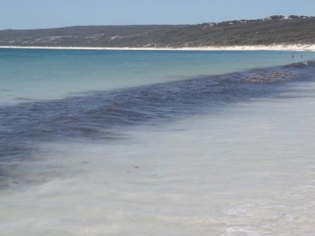
in diameter but it was knocked down in the gale of 1900. Turned down another
track to find Boranup Beach. A popular surf spot though the road down was very
rutted and narrow and steep. Then there was a narrow walk down to the beach and
that was a long way down too.


Found
some “old man’s beard” – Clematis.

He
must have got his car on the beach at Hamelin Bay and driven up here.


Looking
back at Hamelin Island.

Back
up the track and onto the Boranup Drive again then we turned off to a lookout.
Hazy view looking east and south over Blackwood River area down to Augusta.


Then
across to Hamelin Island and the Indian Ocean.


Along
the drive through all the beautiful karri trees.

Back
home for drinks at the van. Rang Erica and Terry for a long chat. Chatted with
a neighbour about our phone aerial but not much interaction with other campers.
A few families too.
No comments:
Post a Comment