Sprinkle
of rain early in the morning, 6am 14 degrees. Put on my jumper and worked on my
blog till breakfast time – Steve enjoyed a sleep in as it was overcast.
Lara
texted with a photo of 14mm of rain they had at Quinns making a little lake.
Chatted with Sid about going down to Moores Hut etc.
Headed
down the Windy Harbour road then turned onto the dirt Chesapeake Road which
goes all the way to Broke Inlet (a big lake area just west of Walpole that the
Shannon River flows into). Into D’Entrecasteaux National Park – hence the road
was rutted!! Through low wetlands with lots of kangaroo paw.
Stopped
at the bridge over the Gardner River which the Council closed off but the Bib
Track still walks over it. Couldn’t see any marron.
The
road then detours around to cross the river. Good bottom and not deep. Looking
up the river as we crossed over. Someone was parked up – probably checking his
marron pots. Another car pulled up behind us – chatted with him. He said the
2015 fire covered 300 odd kms and it had been 40 degrees days with strong
winds. Glad we haven’t got that now.
Better
road through tall trees and into Shannon National Park then right turn back
into D’Entrecasteaux NP again back onto the sandy bad road in the low scrub. Eventually
made it down to Moores Hut. It was built by the Brockmans (pioneer family) as a
summer cattlemen’s hut in about 1910. The bush poles hold up the roof. It
originally had oak flooring and pressed metal which were salvaged from
shipwreck nearby. Slim Kennedy and Charlie Burne were the last known cattlemen
to have worked and lived here when the coastal lease was Cecil Moore of Boyup
Brook. The flooring is now composite board when it was restored by Northcliffe
fishermen in the 1990s.
Nice
camp area sheltered by peppermint trees if you have a tent or camper trailer.
Steve
let some air out of the tyres as we headed 2 kms to the beach.
Down
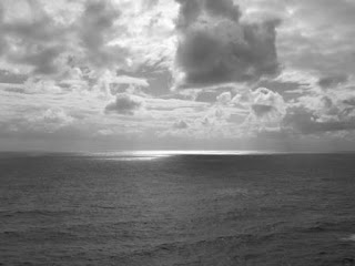
the narrow track onto Coodamurrup Beach and the Southern Ocean – windy and cold
so we just did a u-turn taking a few photos. West then east.
At
the top of a dune – looking back to the beach.
Back
to the hut for lunch. Luckily we didn’t meet anyone on the narrow track. Nice
warm leftovers and a cup of tea to warm us up. Jumper day today.
There
is another track from here to Fish Creek saying 17km so we headed off. Scared a
few roos then Mr Kooka sat on the road and wouldn’t move. Steve got out to move
him in case he was hurt but he flew away as he approached.
Spotted
white through the trees and it is a big sand dune.
We
were on the 4WD map on the Hema but we weren’t following the track on it then
we came to a fork in the road and someone had put a green mark on the tree so
we decided to follow that hoping it was going to Fish Creek. Found another hut.
Conveyor
belt has been laid in places to help with some of the softer sandy areas.
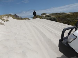
Needed
some more here as we couldn’t make it up the dune. Needed to let more air out
so Steve backed up and we walked down to the beach.
We
are on the eastern end of Coodamurrup Beach.
Looking
at West Cliff Point. Looks lovely and sunny but the wind was freezing.
We
are trying to Fish Creek but each map shows something different and the Hema
wasn’t any help.
We
backtracked to a y intersection passing the sand dunes again.
That
track just took us to the base of the dune. Steve headed up the dune – not too
far before we bogged down.
Found
another map on the Hema and it shows Fish Creek on the other side of the Point.
As we had headed west away from it we gave up. In the brochure it showed this
photo of crossing Fish Creek and the view from the eastern side (now we know)
of White Cliff Point.
Followed
another track up beside some old fencing then saw this sign. This land is still
owned by the Muir family (first settlers). On the map it is a little white
square in the middle of all the national park.
Back
through tall trees then into open scrub to the turn off.
Back
to Gardner River crossing but more people had arrived so there wasn’t any room
for us to park. Headed around to the bridge for a cuppa.
Back
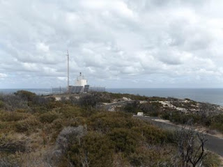
to the main road then we headed down to Windy Harbour again. Up to the
lighthouse. Zoomed in on Sandy Island.
In the back ground is Cow & Calf Island we saw out from Coodamurrup Beach.
Presumably named after whales – not cows!!
All
the shrubs still show the signs of the 2015 fire.
We
followed the track down to Natures Window on the point of Point
D’Entrecasteaux. The point was named after French Admiral Antoine de Bruni
D’Entrecasteaux (Bruny Island and the channel in Tassie named after him too).
He sighted this land on his way to Cape Leeuwin in 1792. His expedition was to
make surveys, scientific discoveries and search for missing explorer and naval
officer Jean-Francois de la Perouse.
A
low island off the point.
A
column has been left through the weathering. Another opening above it.
Steve
liked the pot plant holder.
Played
with the different settings on the camera. Fisheye, black & white, colour
effects. The last one is from the brochure – a coloured lens or was the sun
setting creating the colour.
Looking
back over Windy Harbour bay then Gardner beach then on to Coodamurrup Beach in
the distance. I can make out the sand dunes we were at earlier.
Continued
around the point to the next lookout.
No
point waiting for sunset tonight as the clouds are heavy but the sun is shining
through at the moment.
Further
around – looking back over the lighthouse then up the coast.
Mt
Chudalup in the distance.
Walked
closer to the edge for a photo of the rock formations.
Drove
around to Tookulup Lookout – looking over Salmon Beach then along the coast.
Can
just see the lighthouse from here.
Walked
back towards the truck then out to a picnic table with a fabulous view of the
cliffs.
Drove
down to the caravan park for a look – nice area set back from the beach behind
a sand dune. $16.90 per person per night – hence we are staying at Sid’s for $5
each.
A
bit of history info in the shelter shed.
Headed
back home – past Mt Chudalup again. Two people were standing on top.
The
rest of the Australian Salmon for dinner.
Light
shower of rain later in the evening.


No comments:
Post a Comment