7.30am
18 degrees, cloudy but the sun is peeking through.
Met
our neighbours, a couple from Townsville. Chatted for a while before we headed
off to explore Kalbarri National Park. Stopped at the Post Office to send off
the letter to Erica.

Lots
of these white flowers poking out of the plant.


Stopped
first at Binnu which was once a railway siding.


Big
grain bins across the road.

Turned
off the main highway then up to Warribanno Chimney.


The
flies were terrible so on with the fly nets – even Steve succumbed.

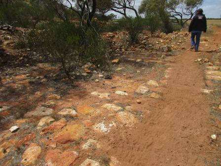
Followed
the trail up to the chimney.

Nearly
up to the chimney we spotted a fridge.


At
the chimney, looking down.


Then
up the chimney.

View
from the 4 sides of the chimney.


Followed
the trail down the other side then around through the remains of the furnaces.
We
walked up the flues.

To
the opening under the chimney.


Turned
around and headed back down. The flues separate to go down to different
furnaces.

It
has warmed up now as we head into Kalbarri National Park. Through the pay
station – we still have our yearly NP pass.


Pretty
flowers along the way.


First
stop at Ross Graham Lookout – died at such a young age. Lots of signs about the
temperature of the gorge which can be 10 degrees hotter than Kalbarri.

Headed
down the track – great views over the Murchison River.


Continued
down the track – pretty flowers.


Great
map of the Murchison River coming all the way from near Meekatharra. It is the
second longest river in WA, 820km long and has a catchment area of 82,000 sq km
(larger than Tassie).

Found
a nice spot to enjoy the river view.


Back
to the truck – another pretty bush.

Around
to Hawks Head. Great view from the carpark.


Nice
walk down to the lookout.


Looking
upstream with “Hawks Head” on the right.


I
wonder when this bit fell down into the river.

Below
us then downstream. Needs a good flush out.


Spotted
a duck or water hen doing duck dives into the weed.

Back
out to the main road – lots of pretty flowers and different areas have sort-of
pine trees or dead looking banksia trees.


Another
24 km to the turn off to the next attraction. The ranger waved us through as we
had our year pass. Down to a T-intersection – we went left to Nature’s Window
area. They are making a Skywalk nearby – the road to it is still closed. We had
heard on the news that there is some problem with the financial side so it
probably won’t be open this year as promised. Great view over the river and the
country beyond. Funny little flat-topped hill in the distance.


Found
a nice picnic table for lunch with a fabulous view. We sat in the shade but had
to move into the sun as the wind was so cold but the sun is burning – go
figure!! The road and picnic areas have all just been upgraded. Now it is
bitumen it would be great to come in after the wet and see the river in flood.


Interesting
information.


Don’t
think we will do the Loop Walk.

Walked
down the trail to Nature’s Window. Great view.


Looks
like a fracture in the rock.


A
bit of colour.

Further
around to a lookout platform. Looks like a piece broke off the point.


The
river does a big loop – not much between the two paths of the river. Looking on
the other side as the river continues downstream.


The
sandstone has so many colours and shapes.


The
clouds are disappearing which is great for the photos. Nearly at Natures
Window.

On
the flat area in front of the window looking down the narrow barrier between
the river but I think it will be a long time before it collapses and the river
joins up.


Waited
for all the internationals to take their ‘many’ photos of each other. I did a
selfie then a lady offered to take our photo.


We
walked down the path of the Loop Track for a bit. Looking back up to where the
Lookout platform is.


Continued
on to see if there is a gap behind the thin bit.

Love
all the shapes and colours.


Not
a cave.


Walked
back to the car-park then around to the West Loop Lookout. The river continues
its way north first then it turns south then west to the coast at Kalbarri.


Back
in the truck and back the 6km to the turnoff then 5km further on to Z-Bend
Lookout car-park. They are still doing up the road and car-park area here.


More
about the nasty looking scorpions. Not sure how these could be their tracks as
erosion would have worn them away by now!!


The
Murchison gets bendy here – we are upstream from Nature’s Window.


Lots
of bits broken off – I wonder when that happened. Great cliff face.


Walked
back off the Lookout platform to another platform in the joint between the rock
which highlights the joint further down the river. Amazing how the trees grow
anywhere.


Back
the 25km to the main road and into Kalbarri. There is a Station that has
homestays and caravan park called Murchison House Station which was established
in 1858. The road to the Lookout on Meanarra Hill is closed so we pulled over
to get a photo of the Murchison River as it nears the ocean.

Nice
entrance to town.

Down
to the river.


Around
to the mouth.


Followed
the road around to the mouth then up the hill.

Stopped
to check out the view over Back Beach and further south to Syphon Beach. Wild
weather and the wind is cold.


Walked
up to the Memorial for the ‘Zuytdorp’ which was wrecked near here in 1712.


Great
view over Chinaman Rock, the mouth then up the river and over Kalbarri. Big
rocks at the entrance so the boats have to head north first to go out to sea.


Zoomed
in on the limestone capped peak of
Meanarra Hill – it is 207m above sea level.

Steve
spotted some dolphins rounding up fish and jumping through the waves. Too hard
to get a photo though.
A
dredge is working to keep the mouth open.

Drove
down to Chinamans Beach for a cuppa out of the wind. Even the trees don’t cope
with the wind.

A
boat from the dredge is working back and forward obviously checking the depth.

Decided
to drive back down the coast back to camp – a few surfers are catching waves at
Jakes Point.

Turned
off into Wittecarra Creek. It is believed that two Dutch sailors were marooned
here in 1629 as punishment for their part in the Batavia mutiny.


The
creek doesn’t make it to the sea but has some water in it at the moment.

Continued
along the road – will do the coastal walks tomorrow. Past lots of sheep with
their lambs and more grain fields. Still
very windy.
Back
to our van in the ‘foreign country’. Got our drinks and put jumpers on as the
wind is cold. Joined Steve from Townsville and another couple from Perth for a
chat as the sun went down.
Back
to the van for a hot shower and dinner. No TV reception here – we only just get
phone reception.
No comments:
Post a Comment