I
woke at 1am and it was only 7.6 degrees – a bit nippy.
7am
it had reached 10.7 degrees so we can get out of bed – Erica’s theory – don’t
get up till it reaches double digits!! Lovely clear sky and lovely standing in
the sun.
Steve
brought up some more water from the well and heated up for me so I could wash
my hair – isn’t he a good lad.
Filled
up the fixed water tank and the washing machine bucket with water from the well
too.
We
are driving with the windows down (no air conditioning needed) but of course
the front of the truck gets a bit dusty so I try and give it a wipe down
whenever we have plenty of water.
We
headed off about 9am and it was 23 degrees so it has warmed up quickly.
Flat
sandy narrow track, some below ground level – no room for passing anyone. Not
that we have seen anyone else. Spotted a few abandoned fuel drums off in the
bush. If they brought them in you would think they could take them out and they
are lighter too!!


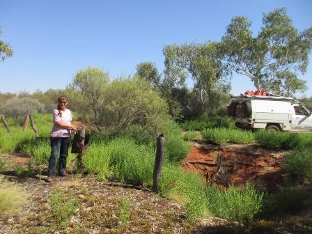
Stopped
to check out Murray’s trolley. Steve was impressed with its construction with
grub screws so he could change the weight distribution etc but probably needed
better wheels. Steve reckons he prefers his truck.
Murray Rankin’s Trolley
Murray Rankin and two friends left Wiluna in July 1974
to walk the CSR to Halls Creek. The trolley was not suited to sand and Rankin
abandoned the walk. In 1976 Rankin, together with Kathy Burman and Rex Shaw set
out from Billiluna to walk to Wiluna which they completed successfully.


He
parked it back in the trees where it will see out its days.


Continued
on over some sand ridges then over a rocky outcrop and through a washed out
creek area at the bottom.


Leaving
Birriliburu Country who cover Wells 5 to 15 and Wells 40 to 51 and charged $50
to traverse it.

Into
Martu Country who cover Wells 16 to 39 and charge $110 to traverse it.

On
to Well 16.
Well 16 (55 feet, 16.7m) was sunk beside an old lake bed and supplied poor
quality water.


Lots of water available for
all the little finches which we think are Zebra finches by the colouring on
their tails. Lots of bees and hornets too. Took a video as their zooming and
tweeting was fabulous.


Back on the road again
heading towards Durba Hills. Mostly travelling in 2nd gear high 4WD
doing 20-30km/hr.


Eight kilometres further
along is the turn off to Calvert Range and Sunday Well but Martu people don’t
allow access without a special permit now. Erica had sent me an article out of
a caravan magazine and they had been into the ranges and seen the aboriginal
paintings and engravings so I got to read about it at least.


Sunday Well
Tobin and Trotman were sent
ahead to find water as supplies were running low. They spent all night digging
in a spot recommended by a native guide and were rewarded on Sunday morning
with good clear water. Because of treacherous sand dunes to the north this well
was abandoned and a new route was located on the west side of Durba Hills.
We travelled along parallel
with one of the Durba Hills.


Stopped to take a photo of
this pretty flower – I think the others said it was a Sugar Blossom or
something and you can make a nice tea from it. Smelt sweet but we will give it
a miss.


As we came nearer to the
bluff on which Canning built a cairn we spotted another herd of camels and a
couple of emus.


Parked around the other side
then started the climb up to the cairn. My notes said ‘it was easily reached
climbing the eroded cliff face’ – really!!


Lots of river pebbles
imbedded in the big rocks.

I let Steve lead the way.


Made it – Steve added his
rock to the cairn but down the bottom so the wooden stake at the top can remain
seen.


Fabulous view of the country
around to the escarpment then zoomed in on the Durba Hills continuing on in the
distance . Took a video too.


Steve thought the tree would
make a good photo for me.

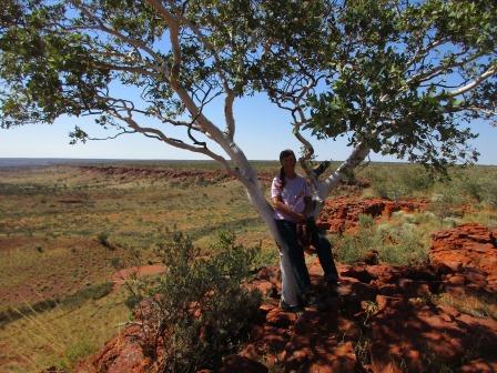


Thought we better have a
selfie too to mark this moment.

I decided to leave our mark
too. Couldn’t fit the ‘travelling’ bit and when I tried to put the year
underneath the rocks rolled off – should have found a bigger rock!!

A couple of crows were
calling out – that’s something we haven’t heard for a while as these are the
first ones we have seen since starting the CSR.
Now for the climb back down. Steve found a different route, past a few anthills and more pebbles.


Back down safely – wasn’t
really that bad.
Back on the track again for a
bit then turned off to crawl our way along a track to Biella Spring. This
spring was shown to Canning by his Aboriginal guide. No one else has been along
here for a long time. Crossed a couple of creeks till we reached a big tree in
the creek. Spotted a few Red Mulgas as their bark is easy to spot.


Spotted a couple of emus
meandering along the other side of the creek.

There is a little turn around
area here so we parked and had lunch in the shade of the tree. Grabbed some
water and the camera and headed up the creek. My notes said 1 hour walk up to a
major fork in the creek and take the left one to a pool. There is a second pool
which is harder to find.

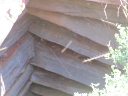
Kept an eye out under
overhanging rocks for any rock art.


Amazing how these trees
survive.

Found a few more bits –
wonder what they mean.


Not far up we found our first
water – not very nice mind you.

Continued along and found
some more paintings.


Another crazy tree trying to
survive.

Interesting rock formations
on top of the ridge.


The water must get a flow on
if the piles of debris is an indication.

This area would usually hold
water after the wet as you can see the water level.

Continued on to the next
water hole but not the one we are after.


Steve found an interesting
little fellow.

More climbing over the rocks
– easy enough walking.


Finally we found a major fork
and went up the left one.


Found Biella Pool – a bit
dry. It is named Springs but I think it is all a creek with pools left after
the rain.

Continued up as we could hear
lots of birds tweeting – a good indication of water.

Up high on a ledge I noticed
a couple of paintings.


Some big boulders make for a
narrow entrance around to the other pool.


Much nicer – would be lovely
after a good wash out. The water is clear but there is moss on the rocks. Looks
like there is another little pool above it and when flowing it would make a
nice waterfall over the rock ledge into this pool.


We think there could be
another pool above this as we can still hear more birds but the big boulders
made it impossible for Steve to get up and over to have a look.

Headed back through the
narrow gap on the right.

Steve found some more
paintings on the other side of the creek on the way back.


Some interesting rock here
and there that looks like lava.

This big slab looks like it
is held up by this little stone.


Steve found some ‘ochre’ rock
and left his initials on a rock in the creek.

Nearly back and we were
following the emu trail as there were lots of these droppings full of little
seeds. Must be good Vitamin C in the fruit going by the texture of the
droppings!!

That walk took about 1 ½ hour
return so that wasn’t bad.
Back out to the CSR again and
we travelled alongside another escarpment of the Durba Hills.


Around the end and another
escarpment appears.

Turned off and followed the
track to Well 17, passing lots of fallen rocks and valleys etc.


Out to the left were little
hills – this one is like the pyramid.

Unfortunately there is a gate
across the road into Well 17 so no access for us to this well.
Well 17 & Killigurra Springs
Canning built a small dam in Killigurra Gorge and
equipped it with troughing. Snell found the dam in ruins in 1929 so his team
sank a new well about 3 metres into solid rock at the entrance to the gorge.
However regular flooding filled the well with rubbish and because the gorge was
too narrow for easy entry by cattle, most drovers preferred Durba Springs. This
was the first water point given an Aboriginal name by Canning.
Killigurra is a registered sacred site and should be
respected by visitors. Traditional ceremonies are still held by Aborigines
living within this region.

Continued on the very sandy
track – more like a creek and around to Durba Springs. Again another one called
springs but it is a creek.


The creek runs down this
side.

We pulled up and Simon came
over to say hello. He had asked the Dekkers (who were here yesterday) if they
had seen us. Nice of him to care. There is another camp of 4 vehicles and 6
blokes from Charters Towers area. We made a cuppa then wandered over for a
chat. They had Toyotas so Steve nearly got himself in trouble saying his Nissan
was good – ha ha – standard rivalry. They had to detour after Well 34 into
Kunawarritji Community then west and around Telfer Mining Centre and down
through Rudall River NP and onto the Talawana Track back to the CSR where they
went around to Well 24 then started to head south again. We will have to do the
same going north. We were going into the national park anycase but it will be
shame to miss out on 10 wells. Better to be safe though as they said that it
cost the guy that got bogged $10,000 to get out.
Set up camp eventually after
lots of chatting. They say Steve is quiet – you should hear him when he gets
started about travelling, gold etc. One of the chaps has a station near
Ravenswood in Qld and he has made a campground and allows fossickers to come
and find gold on it. Will have to check that out one day.

Nice quiet evening by the
fire as the others went to bed early and we were both tired after all our
climbing and hiking today too.
The map of this section of our trip.

No comments:
Post a Comment