7.30am
7.2 degrees. Heard the mournful howl of a dingo across the other side of the
creek. The sun slowly coming up over the trees in the creek so it started to
warm up.
8.30am
13 degrees. Packed up and continued
along the track – well it is a road really.


Bit
bumpy and some corrugations but Steve is going 80kph so all good. Spotted three
kangaroos.
Track
better now we are back on sandy plains. Only an occasional tree.
Couple
of wedgies enjoying a feed. They are such magnificent looking birds.
Passed
groups of healthy looking cattle. I wonder what ratio of beast to kilometre of
land.
Spotted
a sign off to the right so went in on the track. It was advising not to drive
up the mesas. Why not have it by the road so people don’t drive in at all.


More
‘mesas’ to the left of the track too.


Back
into flat country again for a while. Met the track that heads north following
the Old Ghan Railway and the Overland Telegraph Track to Finke and on to Alice
Springs. We will do the top half on our way back to WA.
Into
a hilly section as we approached Angle Pole.

Put
the kettle on for a cuppa. The wind was blowing strongly so we had to stand
beside the truck in the sun to keep warm. The Pink Roadhouse sign needs to be
redone. Glad I have some other information off the Westprint maps to use.


I
tried to read what was on the sign – “Angle Pole Memorial. The 1872 Overland
Telegraph Line (OTL) was the country’s greatest technical feat allowing ‘more’
conversation between London and Sydney. Its little wire on pine posts changed
direction at this point moving north at an angle towards Blood Creek. ….?? The first section was built by 1891 and was
called the Port Augusta to Angle Pole Railway. This area was a support base …?? The rail line ran close to the OTL here and
this post must have been abandoned when the OTL crews swapped horses for
railcars for maintenance (ceramic insulators were popular targets for the
locals practicing their rock throwing skills). In 1874 explorer John Forrest
(future WA State Premier) blazed a tree which became a monument at the Angle
Pole waterhole. He followed the OTL south to Peake Telegraph Station …..??? The hills here have been dug out a lot over
the years for road base, rail repairs and possibly for pigment.” Such a shame
it is so hard to read.
Angle Pole is name is
given to the corner pole, north of Oodnadatta, where the Overland Telegraph
Line changed to a more northerly direction.
Into
Oodnadatta. A lot more buildings here than I imagined. Very tidy too. We
stopped at the Town Camp which has picnic shelter, toilets and firepit (dusty
spot but free). Dumped our rubbish in the bins provided. There is fuel
available at the Transcontinental Hotel for 184.9c/l.


Oodnadatta
John McDouall Stuart, exploring near what was later
the township of Oodnadatta, named many of the features during his first attempt
to cross Australia in 1859. He climbed Mt O’Halloran, north of town on 10th
June, 1859. The township was surveyed in 1890 in preparation as a railhead when
the Central Australia Railway was extended from Warrina. Good artesian water,
found at 432 metres supplied 1.2 million litres a day for the railway and town
which became the inland’s most northerly service centre. It was common to see
as many as 400 camels north west of the town in the area known as Afghan Town.
The repeater station for the Overland Telegraph Line was eventually moved from
Peake to Oodnadatta and the telegraph line gradually relocated beside the
railway track. Some health, welfare and spiritual needs of the community were
aided by the opening of an Australian Inland Mission hostel in 1911 by the Rev
John Flynn, who later established the Flying Doctor Service.
Oodnadatta’s importance as a service centre lessened
when the railway line was opened to Alice Springs in 1928, but the need for an
airfield, meteorological station, railway and telegraph line repair crews,
guaranteed its survival. The closing of the Ghan railway in 1980 appeared to
sound the death knell for Oodnadatta. However a new breed of 4WD ‘Ghan
traveller’ has helped the town change direction.
The Central
Australia Railway concept was to link Adelaide with Darwin. The line from
Adelaide to Oodnadatta was opened in 1890 and freight was carried north from
there by camel train for many years until 1929 when the line to Alice Springs
was completed. Diesel locomotives replaced steam engines in 1954 and many water
points fell into disrepair. The line was closed in 1982 and little now remains.
The present Ghan Railway Line follows the Stuart Highway further to the west. It
was not until 2003 that the line eventually connected all the way to Darwin.
The first freight train left Adelaide for Darwin on 15 Jan 2004 and the
inaugural passenger journey to Darwin, taking 477 hours to travel the 2,970km,
departed Adelaide on 1 February, 2004. Water was one of the main concerns when
building the early railway, as was the case with the telegraph, so it is not
surprising they took similar routes. Eventually the telegraph line was moved to
the railway line making repairs easier. Water also caused the ultimate closure
of the railway, as flash floods caused great damage and maintenance was
expensive. One some rivers low-level bridges proved to be superior to
high-level bridges as debris from floods tended to flow over low-level
causeways instead of building up against the bridge structure causing massive
damage. Both types of bridge were built on the Finke River but it was found to
be efficient to simply rebuild the line across the river bed each time it
washed away.
We continued up to the Pink
Roadhouse. Looks like some of the old signs have come back home.


Looks like there was a bit of
a problem in town with two fuel places.

Around to the front. Fuel
here is 183.9c/l, one cent cheaper than the other place. I wonder where they
use the canoes.


Found some information inside
about life here during WW2.

Picked up the Pink Mudmap and
one for the Painted Desert. Oodnadatta – basic conditions are the result of no
local councils in outback SA. Only Optus Mobile service available. The
Oodnadatta Track is graded by State Authority.


I laughed when I read the
note about Cairns.

Paid a deposit for the key to
the Museum. We walked back down the street checking out all the history
information on the way. The old school (1892) has great murals on the side.


There is always one place
that is the local dump.

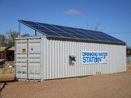
Another drinking water
station but it isn’t working at the moment.
Information about Sid Kidman.
I am glad I read some of the book about him before we came.


Next to that is an outdoor
cinema.

Pioneers and explorers
statue.


Steve was impressed with the
old Bren Gun carrier. Needs a bit of work.

An old telegraph pole.

Lots of information on
display across the road.


Walked over to the railway station where the museum is.


Unlocked the door and went
in. Lots of photos and things to read. There was a TV screen which played
interviews with locals etc. One was about the Algebuckina Bridge which is the
longest rail bridge near here – very interesting (I videoed it).


Anna Creek Station is one of
the biggest in Australia.

Peake Telegraph Station.

Two versions of the
Aboriginal story of Mt O’Halloran nearby.


Another room full of
information.


The two camp ovens – the cast
iron one and the Bedouri version. It was named after the station in Western
Queensland that first made it. When the cast iron ones fell of the pack horses
or dropped they often broke so they invented this light weight oven made of
pressed steel which would not break. It was mainly used on mustering camps
because it was easily carried on the pack horse.

Oodnadatta is also famous for
its horse races.


Another room had items from
the various children off the stations.

Back outside I looked for Mt
O’Halloran (174m). The cold wind is still blowing.


Over the railway line and
across the centre park area to the Transcontinental Hotel. Not much action
happening here.

Not sure about this
accommodation house – check the signs on the roof.


Back to the Pink Roadhouse
for lunch. Ordered an Oodnadatta Burger to share with chips. It looks so good I
had to take a photo of it. The chips were cooked perfectly too.


Drove around the other
streets for a look. A mixture of new and old homes. Brightly painted school
with lovely green grass on its oval. Interesting to note the name ‘Oodnadatta
Aboriginal School’ – I wonder if we can put ‘other Australians school for us’.
Steve spotted some old cars just waiting to be restored.

An old house needs restoring
too.

Headed out of town past the
racecourse (est 1890).

Decided to check out the
Painted Desert while we are here. Turned onto Kempe Road (goes to Cooper Pedy)
and found out where they use the canoes - at Hookey Waterhole in Neales Creek.


Over a hill into the red
gibber plains – nothing much grows on the plains but there are lovely big green
trees in the creek beds.


Rolled over some ridges with
flat open gibber plains - they just go on and on.


Turned west onto the track to
Arckaringa Hills and the Painted Desert. Hema map only shows Mt Arckaringa but
there is a long range (flat topped) we are heading towards first.
The track goes into Goorinkiana
Creek, literally, which of course is only sand.


Another hilly range appears.

There used to be free camping
here but that is no longer available. A campground is available at the
Homestead further down the track for $20 per night. Of course there is no
‘off-road’ driving in the hills.

Parked at the carpark of Mt Batterbee
Lookout. The wind was blowing strong and cold. Parked to get the stove out of
the wind and made a cuppa. 21 degrees in thermometer in the truck but if feels
more like 10 in the wind.


Fabulous view. Took at 360
degree video. It reminds us of Queenstown in Tassie.


The Arckaringa
Hills are an area of spectacularly coloured land formations. It is an
outstanding example of ‘break-away’ or ‘bad-lands’ topography featuring mesas,
buttes, tent hills and cliffs caused by erosion of an ancient land surface.
Colours come from pyritic sediments deposited in the soil millions of years
ago. Coal, opal and jasper are among the minerals to be found. The Arckaringa
Hills are also habitat for the Perentie, Australia’s largest lizard. The
Perentie grows to an average length of 2.1 metres with a body girth of 0.5
metres and is the second largest lizard in the world.
We didn’t meet any Perentie
unfortunately.
I walked further around.


Found an interesting rock.

Walked to the other side of
the lookout.


We continued down the track –
more shots of Mt Batterbee.


Map says Mt Arckaringa (243m)
– not sure which one it is exactly. Amazing shapes and colours in the hills.
Took another video – easier to get in the whole view.


We decided it was too cold to
wait for sunset for more photos so we headed back.
Back to the intersection just
south of Oodnadatta then back to Oodnadatta to top up with diesel. I chatted
with the lady behind the counter – she is from England and has been here for a
year and about to head back to England. The ‘work for 8 weeks’ to get another
year visa only works for backpackers working above the Tropic of Capricorn and
a few places south who have fruit picking. Back on the Oodnadatta Track heading
into Arabana Country.


Passed an old stone building
which was the fettlers’ home while they worked on the rail line as we neared
the turn off to Allandale Homestead.

We then crossed the old
railway line embankment and continued driving alongside it. Lots of little
bridges.


Great view of the wide open
land in front of us.

Turned off before North Creek
and followed the track into the creek and under the rail bridge to park up for
the night. There were two campers here.

As the wind was still blowing
we backed in beside some trees on the high bank above the creek and set up
camp.


Steve went off looking for
firewood while I climbed up the embankment to check out the bridge and sunset.
Wouldn’t want to have been driving the train here at this time of the day –
looking straight into the sun.


I just missed the sun colour
on the bridge. A young couple from Melbourne showed me their photos they just
took. He is heading to Alice Springs to work in the Hospital Emergency Dept –
should be interesting. She is finishing a degree in Politics focusing on health
so we had a ‘great’ chat. Very level headed young couple with sensible views.
Today’s journey.

We had our drinks by the fire
then dinner. At last the wind has stopped so the temperature doesn’t feel so
bad. Played cards by the fire. 9.30pm down to 14 degrees so time for bed.
No comments:
Post a Comment