The minimum temp on our gauge said 7.4 degrees but at 7am it was up to 14.8 which was ok.
A tow truck arrived to pick up the caravan that had broken its subframe - sadly they were only 3 weeks into a 8 week trip but they were heading west so have seen most of the sights. Who knows how long it will take to get it repaired in Derby or Broome.
We packed up and headed back to the Gibb River Road. Lovely escarpment view as we turn back onto the GRR and continued westward.

Across Bell Creek where a few corellas were having a drink.
.JPG)
.JPG)
Onto bitumen for the climb up a hill with a lovely view over the hills and trees. A few cars/vans and tour buses were already parked at the lookout so we didn’t stop.
Rough bit of corrugation before the next bitumen strip for Mt Bell Lookout.

Down the hill to March Fly Creek crossing. Tilted rock formations.
.JPG)
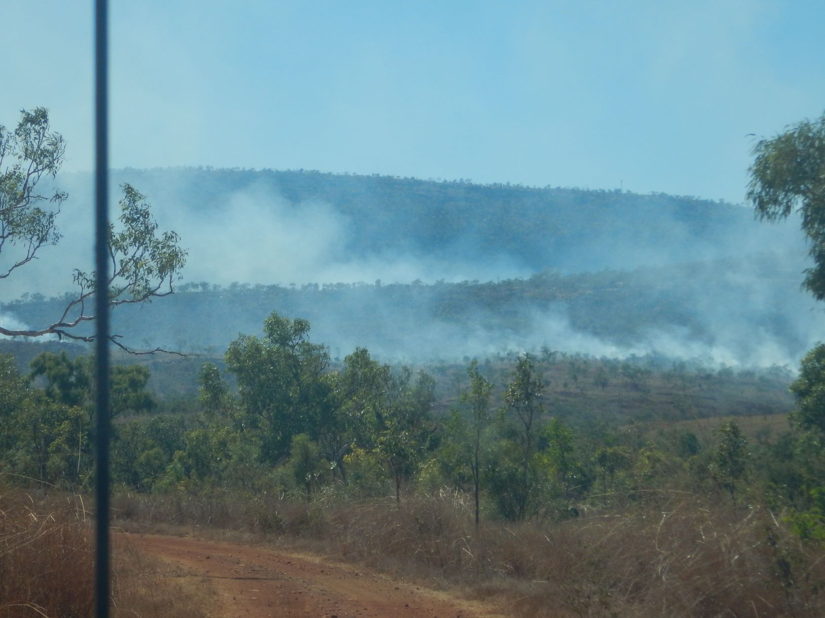
Found where the smoke was coming from yesterday behind Mt Bell. Still smouldering on one side of the road and grass burning well on the other.
Travelling along with high rock walls on our left and tree covered mountains on the right.
.JPG)
.JPG)
Around the end of the hill to more fires on the other side of it.
Continued on then turned off onto a track (8km) to Lennard Gorge. Black rocks on the hills in the grass, across a creek then a rocky climb up.
.JPG)
.JPG)
.JPG)
Into the car park we had an early cuppa before starting the 3km return walk.
.JPG)
.JPG)
It is very windy today which makes us wonder about the fire if it is a controlled burn or a camp fire that got away.
In the toilets I noticed a lot of grass behind the paper holder and found a little nest with 5 eggs.
.JPG)
.JPG)
Following the guy in the hat again. Down to the creek then along it, across then back again then up the hillside where the rocks make great steps.
.JPG)
.JPG)
.JPG)
.JPG)
.JPG)
.JPG)
.JPG)
.JPG)
.JPG)
Great view from half way up. Keeping an eye on the fire as it could come this way.
.JPG)
.JPG)
Continued up. At the top we can see a bluff in the distance.
.JPG)
.JPG)
Lots of wallaby poo everywhere but they are hiding now. Across the top then down the other side. Stopped for a photo of the bluff with the Lennard River below - zoomed in one a pool of water.
.JPG)
.JPG)
.JPG)
.JPG)
Continued down the hill to the lookout. The falls are hidden in the shadow so I zoomed in.
.JPG)
.JPG)
.JPG)
.JPG)
.JPG)
.JPG)
.JPG)
Moved further along and got a photo of another falls downstream.
.JPG)
.JPG)
.JPG)
.JPG)
.JPG)
.JPG)
.JPG)
A couple of flowers still on the Kapok tree.

Headed back up the hill.

As we were heading down we met a chap with his parents heading to the lookout and stopped for a chat about the fire and the walk. They continued on then when we reached the creek again we met the ranger who said he had closed the track in and we were to head out straight away as the fire was nearly. We said the other three were heading up the hill so he took off after them.
This would have been a good spot for a dip as it was nice and sandy but we kept going following the ranger’s advice.

Back to the truck by 11am. Headed out. Back across the creek. The smoke is still on the other side of the ridge.
Met two firefighter ladies who said it was a campfire that escaped, well they aren’t going to admit it was a controlled burn that got away with the wind!
Two drums blocked the track and there was a grader down the other road with the semi blocking the access off the main road. He moved so we could get out and we continued on the GRR. Across a few little creeks. More black rock areas on the hills.

Across Apex Creek and onto bitumen for 14kms of winding road. Climbed up to Inglis Gap and stopped at Pat Malcolm Lookout where the kids from some caravaners were signing their names to the guard rail.
.JPG)
.JPG)
.JPG)
Back onto the dirt to wind through the hills - rocky ones then grass covered ones as we enter Napier Downs Station.

The road is ok as it is the white dirt. Pulled into a cleared area by Donkey Creek which is dry for lunch. A couple other campers are parked up here.
Black rock and boulder hills and lots of boabs as we continue along.
.JPG)
.JPG)
On Wikicamps it showed the spot for ‘Cranky Face’ which we did agree looked cranky.

Open flat plains now with low scrub trees.
Rocky Napier Range comes into view as we reach the turn off into Napier Downs Homestead and ‘Queen Victoria’s Head’ looks down on Yamarra Gap as we cross Napier Creek.
.JPG)
.JPG)
.JPG)
.JPG)
Continued over more flat plains.
Arrived at Lennard River which is spelt with ‘nn’ on the maps and one only one ‘n’ on the river! Across the river then we headed in on a track to check out camp spots as we spotted a camper from the bridge.
.JPG)
.JPG)
.JPG)
No one was there but there was room for us before the gate and we have water views from the camper.

Someone has plucked the feathers from a few birds here as each tree has a pile under them.

There is no lock or sign on the gate and we saw another camp in there so we went for a walk. Plenty of space in here but no water views and there is another gate back to the road so I think the pastoralist must be ok with people camping here. Pretty flowers.

More campers arrived and headed into the fenced area. The family with the camper arrived but packed up and went across the river to try and get down on the sandy section. He went a little way then back out and disappeared. Another couple of cars pulled in but left again then a couple with their 5 kids pulled in - all in a troop-carrier. That brought back memories of our camps with the Milhinchs - what they could fit into their car was amazing.
Steve saw two wallabies come down to the river for a drink on the sandy area downstream.
Took our chairs down to the rocky area and had a cuppa enjoying the view.
.JPG)
.JPG)
The map of where we have travelled.

I worked on my blog for a bit then put a jumper on for drinks overlooking the river as the sun set.
Back to the camper for the night as the chill set in.
No comments:
Post a Comment