Wind
and rain all through the night making it a warm night. Woke up to a heavy sky.
Packed up. My chest is feeling a bit congested, hope I didn’t pick up anything
from that Doctor’s Surgery!! Gave the car and van a hose off before we left as
the sea spray had coated them in salt.
Headed
off towards to West Coast. The clouds then opened up and we drove through the
rain to Rocky Cape. Lots to explore along here but as it is raining we will do
them on the way back. Turned into the Tavern where there is free camping area
behind. It was still drizzly rain but I could see sun in the distance so we
decided to keep going to Smithton.
Past
Port Latta where the iron ore slurry is piped to from Savage River, then turned
into pellets and loaded onto the ships parked at the end of a very long jetty.
The
rain has stopped near Stanley. Lots of farmland, dairy cows etc. Mainly flat
land after we climbed a hill near Rocky Cape.
Into
Smithton. Everyone had told us to stay at Tall Timbers. On my camping sheet
from Burnie Council it said that Tall Timbers was on West Esplanade. I had a
Smithton map and off we went. Unfortunately we didn’t find any Tall Timbers
just a dump point. Saw some vans across the river but that was the boat ramp.
Some people heard us discussing it on the CB and said they were staying there
and would give us directions. Rick put it in his Navman and off we went. There
are two entrances to Smithton off the highway. Tall Timbers Hotel is actually
on the main road which bypasses the town. What a laugh. Found it eventually and
it is a lovely grassy spot with a little creek running through it. Set up and
had lunch. The Hotel also allows access to their laundry – big machines for $2
a load and the dryer $1 for 25 mins. Might do some washing on the way back!!
They have other facilities like tennis, pool, spa, sauna etc for $14 a day.

Drove
back into Smithton to get me some cold flu tablets as I am getting all chesty –
must have picked something up from that Doctor’s surgery.
Up the hill to check out the Tier Hill Scenic Lookout. Lovely view over Duck Bay with Perkins Island on the left. Robbins Island is in the distance. Trees stopped us looking over the town. Smithton was the first European settlement in the far NW region, established as “Duck River” in the early 1800s. It is well known as the base for a successful fishing, oyster and abalone industry.
Up the hill to check out the Tier Hill Scenic Lookout. Lovely view over Duck Bay with Perkins Island on the left. Robbins Island is in the distance. Trees stopped us looking over the town. Smithton was the first European settlement in the far NW region, established as “Duck River” in the early 1800s. It is well known as the base for a successful fishing, oyster and abalone industry.
.JPG)
Looking
back over the farmland.
.JPG)
Back
out again to drive back to Stanley. It is a historic fishing village with lots
of colonial buildings and lying at the end of a peninsula dominated by the
striking ancient rocky outcrop called The Nut. This lava plug rises 152m with
sheer cliffs on three sides and is connected to the mainland by a 7km isthmus. Zoomed
in on The Nut as we head along the highway.

On
the way in we stopped at the Lookout.

Of
course more info boards to photograph and read. At 152 metres the Nut is an
intriguing landform, the solidified lava lake of a long-extinct volcano.
.JPG)
.JPG)
.JPG)
.JPG)
.JPG)
.JPG)
.JPG)
Looking
over Sawyer Bay back towards Rocky Cape.
.JPG)
.JPG)
Another
shot as we got closer.

Drove
around to the wharf area first. Looking up The Nut.

Drove
up to the chairlift area. $15 return or $10 one way, so we went return!! Will
get our exercise walking around the top.

.JPG)
Steve
even agreed to the chairlift which is something. Maybe he checked out the angle
of the walk up to the top. Though
he was hanging on pretty tight!!
.JPG)
.JPG)
Swung
around to get a photo of Leanne and Rick coming up behind us.

Further
up – view over Sawyer Bay.
.JPG)
.JPG)

Nearly
up the top.

Leanne
& Rick arrive.

In
a little room was some more information on the area, flora and fauna.
Interesting one about the telephone line coming across Bass Strait from Apollo
Bay in Victoria to Stanley in 1935.

Absolute
fabulous views though the wind is fairly strong. Highfield Point.

Sawyer
Bay and Tatlows Beach.

On
the other side of the isthmus is West Inlet.

This
flows into Perkins Bay.

Through
the buttongrass following the track, hang onto your hat Rick.

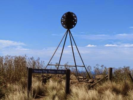
Stanley
Trig Point at 143 metres.
More
great views looking West to East.
.JPG)
.JPG)
Zoomed
in on the ship at the end of the Port Latta jetty loading up with Iron Ore.

Zoomed
in on Rocky Cape then Wynyard behind that.

Lots
of mutton bird holes everywhere.

Further
around I took some photos of the isthmus (the narrow neck) with West and East
Inlets feeding out into their bays.
.JPG)
.JPG)
.JPG)
Stopped
at Fisherman’s Wharf Lookout. We wondered why the signs are back away from the
lookouts but as we walked up the wind blew us backwards so maybe it is so the
signs stay up!!

Looking
down over the wharf, of course. The wind just hurtles up the face of the cliff.
I took a video to capture the sound of the wind and how it was shaking the poor
old fence.
.JPG)
.JPG)
Off
the buttongrass plateau for a walk through lush trees.

Next
was Tatlows Beach Lookout. First looking down to the old railway station and
wharf area then across to the beach and then over Stanley township.
.JPG)
.JPG)
.JPG)
The
wind was so strong here that Rick tried the Titanic look.

Last
lookout is called Highfield Lookout which of course was looking at the historic
homestead and Godfreys Beach.

Looking
down on the cars.
.JPG)
We
saw this rock from the carpark and hoped it wasn’t going to fall off. Looks
stable to me.
.JPG)
Back
down again.
.JPG)
.JPG)
Whee
.JPG)
Drove
down to Godfreys Beach for a cuppa overlooking Bass Strait. A couple in
wetsuits were enjoying a long swim along the beach. There was no wind on the
water, just the roll of the swell.
Zoomed
in on the Zig Zag track with the crazy people going up and down the track. So
glad we spent the money for the ride up. Maybe it would be have been ok coming
down.
.JPG)
.JPG)
After
a cuppa and reading the cairn about the different explorers and their ships we
drove up to check out Highfield. Top view from the top.
.JPG)
.JPG)
Remains
of convict barracks that were built in 1834 and used in 1836. There were 41
convicts assigned to the VDL Company (Van Diemen’s Land) to help establish
Highfield. A number which rose to 73 before convict transportation ceased to
1853.

Drove
around the corner to the entrance to Highfield Historical Homestead. It was
closed but we can still see heaps of it and the surrounding farm buildings. In
1825 the Van Diemen’s Land Company was granted land in the north-western Van
Diemen’s Land, including the Stanley area. Employees of the company from
England settled in the area in October 1826.
.JPG)
.JPG)
.JPG)
Great
view across the front of the house to The Nut.

Back
out the sea side of the estate. Another great shot of The Nut.

Glad
they left a gap in the trees. Would give them a great view of the ocean.
.JPG)
.JPG)
A
bit further around looking at another angle of the house.
.JPG)
Back
into Stanley to check out the old buildings. A port opened in 1827 and the
first school opened in 1841. The Post Office opened on 1 July 1845; it was
known as Circular Head until 1882. In 1880 the first coach service between
Stanley and Burnie was established.
This is the Stanley Hotel established 1847.
This is the Stanley Hotel established 1847.

Found
the self-guided info boards.
.JPG)
.JPG)
.JPG)
Lovely
little home.

This
is was the Harbour Masters cottage, circa 1880.

This
one was the Captains cottage, circa 1835.
.JPG)
.JPG)
This
is Lyons cottage, the home of Tasmania’s first Prime Minister. Steve was
impressed with the fact that the timber boards were made into planks with an
axe rather than a saw.
.JPG)
.JPG)
.JPG)
Next
is Poets cottage built in 1849.
.JPG)
.JPG)
At
the end of the street was The Big Rock Lobster (crayfish).
.JPG)
Leanne
checked out the cost of the crayfish as they were given one for free recently.
.JPG)
Looking
in on the tanks they are kept in.

The
VDL Company Store built in 1843.
.JPG)
.JPG)
Cute
little Minstrels.

Some
lovely stained glass windows in the shops here.
.JPG)
.JPG)
.JPG)
.JPG)
The
baker’s oven baked the bread for the entire village.

The
council here have released a new area down the road from the Caravan Park for
“Freedom” campers.

Back
to the van for dinner. Going to be a cooler night.
No comments:
Post a Comment