Freezing
night. It was 8.6 degrees at 7am so autumn has arrived quickly. Packed up and
headed into Smithton. We had 4 nights at the hotel and are supposes to only
have 3 so didn’t want to do the wrong thing since they are so nice in letting
people stay for free.
Filled
up with water and then parked with a few other vans at the RV camp area near
the boat ramp.
.JPG)
Looking
over Duck River out to Duck Bay.
.JPG)
Just
after we set two more vans arrived, more Queenslanders. First thing the guy did
was come and ask Steve about the intercooler!!!
Ducked
back into the shops for milk and a couple of things then made some lunch. Drove
back towards the west again to stop at the Tarkine Adventures at Dismal Swamp.
That bit of road has to be the bumpiest bitumen when we have been on so far.
There
are hundreds of butterflies fluttering around the flowers by the road.
Unfortunately a lot won’t live for long as they flew straight into the truck.
Tarkine
Forest Adventures, Dismal Swamp has a very unusual looking building – award
winning apparently. It is run by Forestry Tasmania.

In
1828 Surveyor John Wedge and his group area recorded as having a ‘dismal’
experience surveying the swamp. They were constantly wet, cold and slept on
fallen logs and in trees as an attempt to stay dry. The swamp area is a sink
hole. Due to the formation of the huge sinkhole (624 ha) and its being surrounded
by steep ridges, Dismal Swamp has evolved as a natural eden devoid of invasive
weeks and, for the greater part, feral pests. It is a blackwood ‘polje’
(pol-ya), a special type of sinkhole and the only one of its kind in the world.
The
110 metre slide from the reception area to the swamp floor adds a bit of thrill
to a conservation site. There is 1.5km of boardwalks around the floor of the
swamp with information boards and artist’s impressions here and there.

Not
the greatest look but off he went. I took a video of Steve heading down the
shute.
.JPG)
.JPG)
.JPG)
Next
my turn. It was fast and had quite a bump in one spot that I thought I might
turn over and then it was over. Looking back up the shute. You can do more
slides for $2 but you have to walk back up the 350m walk to the top.

Down
on the floor of the sinkhole we wandered around with our map following the
board walks. There was a bit of an arty side to it with people’s ‘feelings’ etc
but it was quite a nice walk. Of course we have read so much on all the timber
types and it was the same info provided by Forestry Tasmania.
.JPG)
.JPG)
This
is the Living Room by Simon Archer. He created a living room that is both
‘inside and outside’. Its curved ribs reach up like the bones of a prehistoric
animal – This is the arty side.

Interesting
fact about this sinkhole.

And
another blocked sinkhole, Lake Chisholm.

There
was a cut-out cow in one section to represent the fact that the area could have
been turned into pasture for cows. A District Forester, Wes Beckett, managed to
save the area. In 2001 Dismal Swamp was made a State Forest.
Scary
creature hiding in the grass.
.JPG)
.JPG)
Another
arty bit. Door made out of Blackwood that grows very well here.

Lots
of burrowing crayfish holes everywhere. We didn't see any crayfish though. They help turn over the floor and help
the blackwoods grow.
.JPG)
.JPG)
A
chair for contemplation about the environment!!

This
poor tree obviously had a break but mended itself and kept on growing.

Another
section had lots of crayfish and their holes made by an artist. Crayfish shed
their skins as they grow. They mate from July to December and carry their young
on their tails.
.JPG)
.JPG)
As
we head back out we are greeted by two huge Praying Mantis created by Greg
Duncan from the Walls in the Wilderness.
.JPG)
.JPG)
Nice
wide wheel chair friendly ramp to walk back up the 350m on.

A lookout
on the way up overlooking the slide.
.JPG)
.JPG)
Up
the top we walked out onto the cantilever platform to look out over the tree
tops and the sinkhole rim.


I
went to the toilet and this is the view – not bad.

A
fancy bit of glass work at the car park.

Headed
back out. I wanted to follow the Tarkine Forest Drive and noticed there was
road cutting across to join up with the Drive. It turned out to be a forestry
road but was in good condition except for the couple of road hogging ute drivers
and a couple of big dirt carrying trucks. Past a forestry site that had just
been logged.
.JPG)
.JPG)
Onto
the Tarkine Drive route and across the Kanunnah Bridge over the Arthur River.
Kanunnah is an aboriginal word for Tasmanian Tiger. The blackwoods in this area
are reputed to be the largest, tallest and straightest in the world
.JPG)
.JPG)
.JPG)
Up
the road is the Sumac Lookout (210m elevation). Information board about the
Tarkine Drive.
.JPG)
.JPG)
Made
a cuppa then wandered down to the lookout. It even had a picnic table with a
fabulous view of the Arthur River.
.JPG)
.JPG)
The
sign at the lookout was carved out of one piece of timber.

Big
forestry trucks use this road too. More beehives tucked into the forest making
the Leatherwood Honey. Old forestry spur roads leading off here and there. Old
signs nearly hidden in the scrub about when the area was last logged etc or
“Pulp and timber 1976, burnt 1977”.
Next
stop was Julius River Forest Reserve. Nice little creek and a forest walk.
Skipped the walk as it didn’t look well maintained.
.JPG)
.JPG)

As
we drive out I noticed the sign says Julius Rivulet. No wonder it was so small.
Turned
off to Lake Chisholm Forest Reserve. The lake is one of many sinkholes in the
area but only a few have filled with water. There are no creeks flowing in or
out of this deep pool of water.

As
we walked in there was a lovely archway made by a bent over tree fern. Nice
place for a selfie.

Then
Steve got a good photo of me. Even I like it.

Lovely
walk in then it started heading down hill.

Great
reflections on the Lake though the wind was rippling it a bit on the other
side.
.JPG)
.JPG)
.JPG)
Lots
of tall trees still growing around here.

Back
on the Drive we headed down another road to Dempster Plains Lookout. Scrap your
shoes before going up so not to spread germs.
.JPG)
Up
the stairs, along the path through the buttongrass to another platform.
.JPG)
.JPG)

Another
road off here leads to Wes Beckett Forest Reserve and Falls. I had been looking
for the falls as it was on the NW Waterfall list I had. We headed down the road
but the sign said it was an hour return walk that was steep and rocky and as it
wasn’t on the walk list for the Tarkine Drive we reckon it wouldn’t be
maintained. It is also 5.30pm so decided to give it a miss.
Very
dark tannin stained Rapid River.
.JPG)
Across
the Arthur River again.
.JPG)
.JPG)
Over
the Tayatea Bridge which was built by the Forestry Commission and opened in
1969.
.JPG)
Steve
found this big rock balancing on a post. It had lots of shiny silver stuff
probably Galena.

Out
of the forest to dairy farms which are surrounded with eucalypt plantations.

Through
Trowutta and down the range to Roger River. Back through more dairy farms and a
big Devondale dairy.


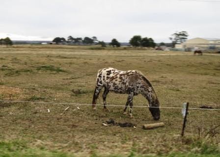
Unusual
spotted horse.
Back
to the van. Breeze getting cooler so into the van for dinner. Rang Dan and Jon
while Steve cooked the burger patties. Erica rang from Cootamundra where they
will start their Murray River trip from.
Beautiful
sunset colours through my kitchen window.
.JPG)
.JPG)
No comments:
Post a Comment