Started
off overcast and cool as we headed off with Gary & Margaret to explore
Innes National Park which is just down the road from Marion Bay. Jumpers and
jeans today.
Stopped
at the Park Centre so Gary could get a new yearly National Park Pass. We all
think it is terrible that we pay our taxes to make these National Parks and
then we have to pay again to go into them as well as pay to camp!! The lady on
the counter though agreed with us, especially the new computer way of doing
registrations. She said they laid off 3 people to put in the computer booking
system then had to put 4 people back on to do all the work and fix the
problems!! The Park covers 9415 hectares and it was used to graze sheep from
1847 near Cape Spencer then some small scale cropping.
The
park gets its name from William Innes who discovered commercial quantities of
gypsum in the area in the early 1900s. In 1913 he set up the mining township of
Inneston where gypsum was produced until 1930. During the boom phase the
township boasted a population of around 200 people. Although isolated, Inneston
was completely self-sufficient, having its own school, post office, bakery,
general store and tennis court. The Stenhouse Bay jetty was built to enable
ships to berth and load the bagged gypsum. The Inneston Chalk Factory used the
gypsum to make the chalk we all used at school.


A
huge White-bellied Sea Eagle was on display. It is Australia’s second largest
bird of prey with a wingspan over 2 metres. They mate for life and their nests
are made of sticks and can be up to 4 metres deep and 2.5 metres wide.

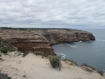
We
drove down to Stenhouse Bay lookout. The walkways were made from the gypsum.

Looking
back to the other side of Rhino Head.

A
big anchor but no info about it.

The
‘Hougomont’ was scuttled near the jetty to make a breakwater after it had been
stripped so it won’t be her anchor.

The
jetty, built in 1913, was used to load the gypsum onto the ships after it was
sent down over the sandhill on a shute.


A
few vans in the campground as we headed along the road around the bottom of the
National Park which is the southern-most point of Yorke Peninsula. Gary and
Margaret’s favourite view appears as we crest the hill. We agree, though would
be spectacular with a clear blue sky.


Turned
off to Cape Spencer car park. Great view across to Wedge Island.


Walked
down towards the lighthouse.

A
couple of wallabies sat still for some photos. Not sure if they are a Western
Grey kangaroo or the Tammar Wallaby which were once extinct from the lower
Yorke Peninsula but were reintroduced to Innes in 2004.


Southern
point of Kangaroo Island in the distance.

Fabulous
cliff faces and ledges. Haystack and Seal Island.


Another
wrecked ship which struck a reef of Althorpe Island. The Althorpe lighthouse
was built in 1879 and was kept working by lighthouse keepers for 112 years till
1991 when it was converted to operate on automated solar power. It was made out
of limestone and hard sandstone quarried from the island. It stands 15 metres
tall and 91 metres above sea level.


Not
a traditional looking lighthouse on Cape Spencer. In 1950 an automated beacon
was here then this concrete lighthouse was built in the 1970. It stands 78
metres above sea level. Cape Spencer is the dividing line between the Gulf of
St Vincent and Spencer Gulf.

Lovely
beaches if you could get down to them.

Zoomed
in on ‘the Titties’ and Wedge and North Islands in the distance.


Looking
back along the coast line.

As
we walked back Margaret was chatting with a young couple, both school teachers
from NSW who are doing a year ‘lap of the map’.
Further
along we stopped at Inneston historical township which William Innes started
for his gypsum mining. Don’t have time to do the walk so will save that for
another visit in the future.


Past
one of the many salt lakes – this one is called Deep Lake.

Out
to Ethel Beach where there are two wrecks, the ‘Ethel’ and the ‘Ferret’.
Interesting story as the ‘Ferret’ was the first to report the ‘Ethel’s’
problems and then 16 years later the ‘Ferret’ is wrecked here too. The
‘Ethel’s’ hull is below the cliffs.


The
remains of the ‘Ferret’s’ boiler can be seen on the beach and a bit in the
shallows.


Looking
south to Althorpe Island.

A
few surfers were enjoying the waves.

Back
into the car to West Cape. Looking south to Althorpe again.


At
the lookout there were curved walls with photos and information. Fantastic
photo of a surfer and dolphin catching a wave together.

Looking
across Pondalowie Bay with its collection of islands. A popular crayfishing
village.


West
Cape lighthouse was built in 1980 of stainless steel and is called Simplex Munditiis, which means elegant
simplicity in Latin. It is 8.5 metres high and stands 67 metres above sea level.


From
this lookout the lights of 5 lighthouses can be seen at night – Wedge Island,
West Cape, Cape Spencer, Pondalowie Bay and Althorpe Island. The Wedge Island
lighthouse is on 5 metres tall, the light is the highest above sea level in
Australia, standing at an impressive 206 metres. It began operating in 1911.
Farmers settled on Wedge Island in the mid-1800s. For more than 100 years the
different owners ran sheep, cattle, horses and for a brief time, grew barley. The
Royal Australia Air Force installed a radar station there during WW2. Up to 50
men lived there, watching for enemy ships.
Warming
up enough to take off the jumpers now though the wind is still quite cold. We
continued on to Pondalowie fishing village. Lots of dead sea grass on the beach
but a nice protected bay for the boats.


Around
to the northern section of the National Park to Dolphin Beach but there were no
dolphins frolicking today.


Still
a couple of beach shacks here but as the owners pass away their ‘lifetime’
lease ends and they are being removed from the National Park.

The
lichen on the rocks reminds us of the Bay of Fires in Tassie.

Next
was Shell Beach but I did a quick detour to the campground’s toilet block.
There was a notice about feral bees and not to have water about as it attracts
them. That applies to the toilet tank and bucket – so will wash my hands
elsewhere!!


Caught
up with the others at the stairs down onto the beach. No shells on the beach –
not doing too well with their names.


Looking
across the water to ‘Dust Hole’, a big exposed sand dune near Corny Point.

Looks
like a great cave.


We
walked along the beach to the rocks at the other end to check out rock pools.

Climbed
over the rocks checking out the rock pools.


Gary
used to come here as a kid leaping off the rocks into this rock pool.

Spotted
a crab in the shallows.

Found
some nice shells to add to my collection.

The
water is so clear.


Funny
little plants surviving the salty conditions.

Great
friends, Gary and Margaret. I met Margaret on Hayman Island when I was 16.
Feels just like yesterday when we were sipping cocktails by the pool!!

Margaret
had showed me a pile of shell ‘plugs’ she had collected. I found one and then
we found the shell with its slug and the ‘plug’ so I could see how it worked.
If it is threatened the slug just pulls the round shell ‘plug’ in and closes
off the entrance to the shell.

As
we drove out we passed the Shepherd’s Hut that can be booked to stay in.

Last
one was Browns Beach. Rick and Kaylene rang as they were bored at home – should
be on the road with us!!

Back
the way we came though Gary said they are going to open up the road to Gym
Beach to make it a round trip to get back to Marion Bay as they realised that
with fires in the area there is only one road in and out.
Back
to the house for a late lunch. Gary pulled out the last dead tree before taking
the tractor back to the shed just out of the village.


I
had said to him earlier that I didn’t get the full tour treatment as we hadn’t
seen any emus in the National Park. When we turned into the property where his
shed is there were four emus running along. So he covered it all – good fishing
and great sightseeing.


But
wait there is more. We headed north for a look at the other side of the foot
and along the toes!! Stopped at Formby Bay for a look.


Passed
a pile of salt by a small lake.

The
sky has cleared over Spencer Gulf making for a great photo.

Daly
Head is a National Surfing Reserve. Surfers have been coming here since 1962.


The
aborigines have been coming here for many years too.

The
‘Dust Hole’ sand dune.


You
would get your exercise up and down these stairs.

Fabulous
coastline. Look at that sky - who would have believed it after such a gloomy start to the day.


Stopped
at Dunn Point to check out the great display showcasing the history of the
area.


Out
to Corny Point lighthouse, first lit in 1882. Made from limestone quarried from
a nearby farm. Entries from the lighthouse keeper’s logs describe how it
survived earthquakes and other natural phenomenon such as seeing meteors flying
past.


Looking
back to Dunn Point.

Lovely
area at Berry Bay.


Back
to Marion Bay but on the other side of the jetty.


Map
of our scenic tours today. Great day out and by the afternoon it turned into a
beautiful day.

Rebecca
rang for a chat.
Smoked
tuna and baked flathead for dinner tonight – we are being spoilt. I tried the
tuna which was nice but I don’t like smoked things too much. Picked our way
through the flathead bones – the flesh was delicious.
A
few more games with a few glasses of lovely wines.
Warmer
night as the wind has dropped off.
No comments:
Post a Comment