15
degrees in the van at 7.15am, windy outside. Our last South Australian sunrise.

Sent
Leanne Mitchell a text for her birthday today.
Had
our last banana with our cereal and made up our lunches using all the rest of
the fresh food. Decided to drive back to 25k peg rest area and drive down to
the coastline where it slopes down. Found the Pegs at last that the rest areas
are named after.

Unhooked
the van. Overlooking the water is a memorial to a trucker and his dog who died
in 2010. They released his ashes here in 2011 so not sure if he died here or it
was just a favourite spot of his.


Now
to just work out which track is best to get down to the water.

Headed
down – me hanging on tight and Steve in control. Just a bit rocky to start!! Down
we go.


Crossed
over the ‘creek’ area at the bottom. Looking back up.


Stopped
on an outcrop overlooking a large flat rock platform with the waves washing
over it. Can’t get down to the water but this is good enough. We are about 10m
from the water.


Looking
east.


Watching
the waves roll in as we had a cuppa.

There
is a sandy beach area a bit further to the west but I think it will still be a
cliff climb to get down to it.

Looking
back at the track, we go down into the creek then back up that rocky track.
That was a bit fun coming down as it had loose rocks – not looking forward to
going back up it.


Then
around the hill and continue up the hillside to the top.

Others
have camped here as there is rope, crab and other shells remains and ‘a
toilet’!!

I
saw something dark in a wave and it turned out to be a few dolphins. Was tricky
getting a photo of them.


Zoomed
in further west along the coastline. The high cliffs in the distance as Wilsons
Bluff which is on the border of SA/WA.

Back
up the track, got stuck on that rocky bit so he had to back up and have another
go. I did keep my eyes open but I held my breath, mind you, I trust him totally
but still!! Hooked up the van and headed west to Border Village. Looks nice and
sunny in West Australia!!

Pulled
in beside Big Rooey II for a photo and to play another hole of golf.

They
haven’t got Cairns on the sign. We are nearly halfway between Adelaide and
Perth. Standing this side it should say SA/WA border!!


Got
out our clubs and balls. Each one has a story to tell. Border Village burnt
down in 2000.

Should
be easy as it is a straight line to the green. Only problem is it was narrow. I
zigzagged my way down and had to pick up my ball from behind bushes and trees 4
times so I ended up 12+4. Steve did much better and got it in in 7 (stuffed up
getting it in the hole).


Wandered
into the Roadhouse. Some great photos – all in flood. Motorbikes everywhere.


This
section of WA has its own special time which is only ¾ hour behind SA.

A
semi carrying semis.


Walked
over to the Quarantine Station and then checked out the border info area. Needs
a big makeover – it is missing the state info boards. Steve has a leg in each
State.


The
GPS checkpoint.


My
turn.


Info
boards. The Red kangaroo – the red ones are male and the females are blue/grey.
The Western Grey kangaroo – brownish grey with black tips to the paws, ears,
feet and tail.


My
phone changed straight to Perth time (1 1/2hr behind) so we just changed to
that. Sat down and had our lunch at 11.50am and a midday I changed my watch.
Now it was only 10.30am – going to be a long day.


Into
the Quarantine Checkpoint. Nice lady did a quick look in the truck and fridge
and then I showed her where I had kept the onions and potatoes – all clean.
Fridge was clear too. We were all good to go then she saw Steve’s firewood bag
at the back. Took one that didn’t have any wood in it as she said it could have
been a seed bag – bit of the top when you think where it has been. She let us
keep the other one full of timber.


All
good so off we headed, straight around the corner to the Border for a photo
with the truck and van.

WA
road is a bit wider as they have a bicycle lane. 110km/hr for cars but trucks
and towing vehicles can only do 100km/hr.

Ten
kilometres to Eucla. Eucla had a population of over 100 in the early 1900s and
was the busiest telegraph station in Australia beyond the capital cities. Through
the few streets passed the van park and fuel station (148.9c/l) – will top up
here. Out to the Lookout. A memorial to Eyre and his men and another to two
fisherman who lost their lives.


Great
view over the plains and around to the highway as it heads west.


Zoomed
in on the white Delisser Sand Hills.


I
walked down the road a bit while Steve brought the truck and van around. Found
a blowhole, but it wasn’t blowing.


Down
the escarpment to check out the Eucla Telegraph Station.

Tony
and Yvonne were just walking out. Chatted for a bit, they are staying in the
van park. Over the dune to the Telegraph Station has been buried under the sand
dunes but it is exposed at the moment. The Station opened in 1877 and helped
link WA with the rest of Australia and the world, sending 11,000 messages
annually (just 33 years after Samuel Morse invented the telegraph). The first
message sent to Perth on 8th Dec, 1877 stated “Eucla line opened,
Hurrah”.


All
silted up inside, Steve could see over the wall standing near the top of the
window.

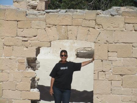
Climbed
up on the wall for a good look over the building.


Looking
back up to Eucla.

Behind
the Station were huge eucalyptus trees. Steve thought there might have been a
bore here for them to be growing so well compared with the others.

Continued
down the track towards the beach – another building.


Out
onto the flat salt pans. We found two bottle dumps that Steve thinks could have
been thrown into a couple of tanks which have since rusted away.

Out
to the beach where the remains of the old jetty still stand. When the telegraph
station was in operation all the goods etc had to come to them via ships, then
carted to the station using camels.


Lots
of seagrass here too. Looking east to the Delisser Sand hills then around to
Wilsons Bluff.


We
made it down to the water’s edge of the Southern Ocean.


Walked
up to the jetty. Looking further west along the beach.


Back
up over the dunes following the remains of the other parts of the jetty
platform.

No
shells on the beach but Steve found me an urchin. Got our exercise today with
that walk.

Back
to the van, it is now midday!! Where’s my lunch – oh yeah we had that!! Drove
back but instead of going back up to the lookout we went around to the west and
came up the Eucla Pass where you climb up from the plain back up to the high
plateau.


On
the Hema it showed another roadhouse which is where I thought the golf tee was
but there was no roadhouse and the golf course was further 5km north along a
dirt road, passed the rubbish dump. Eventually we found it. The pistol and clay
shooting club was there too.


Interesting
story of the Nullarbor Nymph.

We
should do ok here as it is nice and wide and straight down to the green.


Found
the old golf tee. I made it in 7 and Steve did very well with 4 to the green
but then missed the hole a few times and ended up on 9.

Back
into Eucla for a cuppa with a cracker and cheese to keep us going till dinner. Good
internet reception here so I uploaded 4 days to the blog and updated Facebook. Ian
sent a text saying he was watching the V8s with Brian. We will have to watch
the highlights online later. Topped up the fuel. Walked across to check out the
distance sign.

The
Leeuwin Way Whale. It is approximately 10 metres long, 3 metres wide and 3
metres high, weighing approximately 4 tonne. It is constructed of Ferro
Concrete, after the fashion of concrete yachts. The construction, transport and
erection of the whale was undertaken as a community effort by the people of
Albany, with the project being co-ordinated by the Albany Promotion Committee.
Albany, founded in 1826, is the oldest town in WA and was the only shore-based
whaling station in the Southern Hemisphere – it is now a museum.

Met
Tony & Yvonne again as we headed to the Museum. It is a small room with
lots to read and check out.


Sad
story of two trucks colliding on the Eucla Pass.

The
first settlers at Eucla – the Muirs.

A
story about travelling across the Nullarbor in 1953. In it he mentions Koonalda
Station which was owned by the Gurneys. They ran 1200 sheep and 100 head of
cattle on 1124 square miles as they only had water from two wells. The water is
called ‘Two ounce’ as it contains 2oz of salt to the gallon. He went into the
limestone Koonalda Caves and saw an amphitheatre underground the size of the
Colosseum at Rome.

There
was the Gurney’s family history book with lots of info about the station and
Eucla and the Telegraph Station.


Headed
off again down the Eucla Pass onto the Roe Plains.

New
animal sign – emus replace the wombats. I wonder why they don’t cross the
border!!

Another
RFDS Airstrip on the road.


We
are now travelling alongside the Hampton Ranges/Tableland and still continuing
with the open plains.


Passed
our first roadkill, a Western Grey kangaroo. Next rest stop, 30km west, is
called Najada Rockhole but when we pulled in there was no rockhole. Chatted
with a couple with a Qld numberplate and they were from Yorkeys Knob. We kept
driving. I changed the GPS to the Hema 4WD maps and noticed that Najada
Rockhole was actually on top of the range so the rest area was just named after
it. Very good road so far considering all the trucks that use it. Next roadkill
had a Wedge Tailed Eagle and crows on it but I wasn’t quick enough to get a
photo.
Continued
on to Mundrabilla for another hole of golf. It is behind the van park and the
roadhouse so a few people came out to watch thinking we knew what we were
doing. Steve got a 9 and I got a 10.


A
couple of Novas are here too.

Dark
clouds have come over and the wind has gotten quite cool. Nasty burrs around
here.


I
went into the roadhouse to find out about the meteorite that was discovered
nearby. It weighed over 10 tonnes and was Australia’s largest. The lady said
that it was about 200km north on the Mundrabilla Station. Parts were chipped
off and sent to museums. I took this photo of the big rock out front. You would
think they would have a ‘Big’ rock for the tourists.

Got
a blurry shot of the next eagle.

Next
rest stop was at Kathala Pass (which was up on the range again). A roofed area
over two water tanks provides water for travellers. A bit rusty now though so
we gave it a miss.

Stopped
at Jilah Rockhole Rest Stop for the night. The Rockhole is up there somewhere.


Malcolm
and Kerry rang for a chat after seeing my Facebook update of heading into WA.
They had heard there was a caravan crash so wanted to check we were ok. Such
great friends.
The
Map.

No comments:
Post a Comment