Another
perfect morning though still cool, 15 degrees but it warms up quickly. Out of
Victoria, over the Murray River and back into NSW – I have fun keeping track of
that bit. Headed into Albury to sightsee. First was the Memorial Hill where a
magnificent monument reaches into the sky. Looks fabulous against the clear
blue sky today. This area was originally called Western Hill.
On
23rd March, 1925 on a ‘dark, clear night’ the War Memorial was
revealed. It cost 3200 pounds and that was raised by public subscription. It is
30.48 metres (100 feet) to the top of the beacon and is constructed of reinforced
concrete. An old brewery near the union bridge was being demolished at the
time. The bricks from there were used to make the curved buttresses.
Around
the garden were more plaques remembering those fallen from other wars.
Around
the edge of the pathway were plaques of the serviceman and women.
Walked
around to the actual front with a magnificent view straight down into Albury.
On
top is a light.
The
trees have now grown up now, after the years of grazing here has stopped. Now
there is only a limited view across to Wodonga.
Down
Memorial Drive to the World War 2 Memorial Bowl. A curved grassed area encased
in a rock wall.
Stopped
at Hovell Tree Park beside the Murray River. Once a month on a Sunday they bake
pizzas and scones here for all to share. Even has the recipe for scones on the
artwork bench.
Over
at the tree, lots of information to read. If only we were 30 years younger we
might head off on this walk - It’s only 440 km long!!! It is from Cooma Cottage
to the Hovell Tree here.
Nice
and shady but not so good for photos. Not long till it will be celebrating its
200th birthday in 2024 since Hume and Hovell started out from Appin
(near Sydney). Amazing how they did it in such a short time – 16 weeks for
1900km.
Interesting
reading how they turned a cart into a boat to cross the Murrumbidgee River.
Another
plaque read “The Hovell tree is Albury’s oldest landmark. Captain Hume &
Hamilton Hovell, their men – Henry Angel, William Bollard, James Fitzpatrick,
Thomas Boyd, Thomas Smith, Claude Bossawa – the first white men to explore this
area arrived here 16th November, 1824. Hume discovered the Murray (Hume)
River that day. He had named the river, The Hume, after his father but there is
no info saying why it got changed to the Murray. The Hovell tree date is the
following day.
Above
it was another plaque about the trees the descendants of Hume and Hovell
families.
Info
board.
You
can barely see where he carved the date etc.
Walked over to the river – looking back at the Hovell tree.
The
Murray River rushing by – interesting note, the border between NSW and Victoria
is the top of the bank of the southern side of the river, which means that none
of the river itself is actually in Victoria – so hence we are looking into
Victoria on the other bank.
As
we drove through Albury I snapped off some photos of the lovely old buildings.
Former Dalgety Farmers & Graziers Woolstore. It was once Australia’s
largest inland woodstore. Prior to being redesigned by Louis Harrison (who also
did the War Memorial) in 1933, it had a 104 metre frontage along Smollett
Street. By 1962, its total floor space was a whooping 2.75 hectares, and it
could warehouse 12,000 bales of wool. The Farmers & Graziers Woolstore is a
powerful and poignant remember of the importance of the wool trade in the
development of our nation.
Albury’s
original Catholic Church was erected in 1858. On 21 August, 1870, the Reverend
Dr Michael McAlroy laid the foundation stone for a new Saint Patrick’s church,
subsequently opened on 24 November, 1872. The decorative window and door
dressings, unchanged since the 1870s, were quarried at nearby Table Top, and
the stained-glass windows were the work of Australia’s premier stained-glass
artist, John Falconer.
Down
to the Railway Station to check out the Info Centre. It was the last stop on
the Great Southern Railways line and was once one of Australia’s most important
rail terminals. It acted as the transfer point for the change in rail gauge
between NSW and Victoria, as standard gauge between Sydney and Melbourne was
only introduced in 1962. Symmetrically designed in the grand Italianate manner,
the Station was first used for public service on 26th February,
1882. At over 450 metres, the Station’s platform has been credited as one of
Australia’s longest.
Outside
the Info Centre was an artwork of Wombeyan and Chillagoe marble.
The
Info Centre is in the former Albury Station Master’s residence. It was designed
by Henry Deane and built over 1881 and 1882 - the original residence featured a
sitting and dining room, scullery, pantry, kitchen, front verandah and five
bedrooms upstairs. The plans for the house showed the every room had its own
fireplace and, although unusual for the times, water was piped directly into
the home. The Residence was restored in 2010.
The
lady was very helpful about the fruit fly laws here and further up the Murray.
They have cumquats growing outside the centre and she said that hopefully they
won’t have too big of a problem this year with the fruit fly after have a
severe black frost this winter – hopefully that will have killed off the
larvae. Got some directions on good lookouts etc.
First
one was Easter Hill Reserve (270m elevation) – where some of the phone and TV
towers are. Looking over a new estate near the airport.
Then
across where the Murray River is winding its way to Albury.
Further
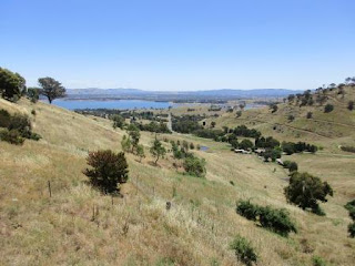
up the hill we could look across to Lake Hume in the distance.
Zoomed
in on the Dam Wall and the lake.
Down
the hill and around to the Hume Weir – one minute they say Weir next it is Dam
and then they call it Lake Hume. Steve reckons it can’t be a lake if it isn’t
natural therefore it should be a dam!! I said they call it Lake Tinaroo at
home.
Such
a beautiful day and the colour of the grass, water and sky make it look
spectacular.
They
are starting to create an outdoor museum – no info yet though.
Walked
down to the dam wall (210m elevation). The usual Engineering plaques.
On
this one it is called reservoir.
Great
view. Left goes back to the Bethunga Bridge and further up where the Murray
River enters. To the right and down to Tallangatta where the Mitta Mitta River
flows in.
Looking
across the wall.
Big
gates are pulled up and down on chains.
Looking
down on the power station and the substation.
The
water flows out and down on the right continuing along as the Murray River
again. It thing the other side goes around that island.
Lots
of gates.
Across
to the other side – looking back.
On
the dam side.
We
travelled over those mountains coming back from the source of the Murray.
Spotted
a heap of turtles and a carp floating around.
Looking
along the spillway side of the wall.
Zoomed
back to the lookout we were at before.
Walked
back across then down the stairs to the power station.
Great view back from the lookout platform near the substation.
Not
sure what this is about on the side of the river.
Had
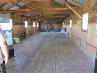
lunch in the shelter shed then walked up the road to read the boards. This is
where some of the many workers lived for many years while the dam was being
built, it took 17 years to build using steam engines and horse-drawn carts.
When it was built it was the largest dam in the southern hemisphere.
Back
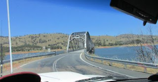
up along the lake to Bethanga Bridge and over into Victoria. Looking upstream
this time where the Murray River is flowing in a lot way up the lake.
Steve
has the bridge to himself. The same type as Sydney Harbour with rivots etc.
Through
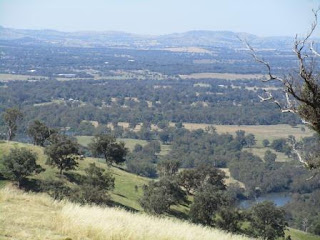
Bellbridge and up a narrow windy road through Kurrajong Gap to a fabulous
lookout (400m) – Towong Tourism certainly are doing a good job.
Info
on the gold mining town of Bethanga further along this windy road.
Then
the Bethanga Bridge.
Great
view – zoomed in closer on the dam wall and lake.
Then
zoomed in on Albury.
A
distance plaque – Brisbane is only 1115km away, Townsville 1864km, Adelaide
737km and Perth is 2884 km.
Back
across the bridge into NSW then we turned off before the dam wall. GPS map.
Headed
across the Murray River again over the Heywood Bridge into Victoria. Looking
back up to the dam wall. You can see that it was an island in the middle.
Further
along we went into a small area of a huge Army camp that then became the
Immigration Reception place for over 330,000 European immigrants who arrived in
Australia after World War 2 (1947 to 1971). Bonegilla Army Camp was built in 1940
and was used for training throughout WW2. The army shared the camp with the
migrant centre from 1965 to 1971 then they moved to Latchford Barracks in 1982.
The army dismantled a lot of buildings over the years.
The
lady gave us an overview history then we headed off to walk around the site.
Block 19 Bonegilla is the last remaining block of more than 24 blocks that made
up the Bonegilla Migrant Reception and Training Centre, which received and
trained migrants to Australia following World War 2. The centre was big and at
its busiest housed up to 8000 people, occasionally in tents but usually in
large accommodation huts. Women and children were housed separately from men,
until huts were partitioned into cubicles for families. When the centre first
opened, each week saw hundreds of people arriving from Melbourne docks (where
the Spirit of Tasmania departs from now). The trains, known as ‘red rattlers’,
offloaded passengers at the Bonegilla siding. Luggage was collected and then
people were ready for the short trip across to the migrant reception centre,
where staff prided themselves on serving a hot meal within an hour of arrival.
Later migrants, particularly the Dutch, arrived by plane through Australia’s
only international airport in Sydney. Initially, only displaced persons from
refugee camps in Europe were selected. As demand for labour increased and
Australian immigration officials realised they could not meet the government’s
migration quote, the opportunity to migrate was opened up to the assisted migrants.
Every person over 16 years, whether assisted migrant or displaced person,
signed a contract stating their willingness to work for two years in any job,
in any part of Australia. Qualifications, work experience and education were
not considered. When your job allocation ran out, you were expected to return
to Bonegilla to wait for your next opportunity. There were usually 200 to 300
employees at any one time working as employment officers, health workers,
cooks, patrol men, welfare officers and children attendants. Many migrants won
their first Australian job at the centre. In 2007 the site was recognised and
is now included in the National Heritage List.
Migrants
arrived in Melbourne and onto the ‘red rattlers’ then into the countryside to
Bonegilla siding.
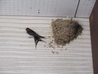
A
cute little sparrow made his home in the Beginning Place.
Here
we listened to people telling their stories of why they wanted to come to
Australia.
Looking
across to the Recreation Hut, Kitchen and messes and accommodation huts.
The
Recreation Hut – info about activities and Wanda’s memories as she was born
here.
Into
the Kitchen and Mess Hall – when you walk in they have recordings that start up
of what it would have sounded like with all the different nationalities talking
at once. Steve checked out the appliances while I read the recipes.
Don’t
think I will follow their menu plan.
Tudor
Hall had many displays in the various rooms.
The
accommodation huts. Each person received an allocation of linen and grey
woollen blankets and other items they would need during their stay. If they
lost anything they would have to pay for a replacement.
Communal
Huts – here they had another soundtrack – a baby crying and a mother trying to
calm it – would have been very hard for mothers and children.
Newly installed sculpture - ‘Passage’
by Ken Raff, 2015.
The
‘Arc’ by Ken and Vicki Luke, 2015 has plaques of some of the families that started their
Australian life here.
Steve
checking out the Ladies showers – he was impressed as they had overhead shower
roses. They had a walk from the accommodation huts but at least there were
flush toilets in Block 19 whereas other Blocks still had deep pit latrines.
What’s
left of the Men’s showers and toilets.
Thanked
the ladies and headed off again past the Latchford Barracks down the road. It
was a good spot for a Migrant Centre being so close to the Dam too.
Crossed
over Kiewa River which also feeds into the Murray. Turned off beside another
big army camp area (Gazza Ridge Barracks) and climbed up Huon Hill to 450m
elevation. Steve missed the cow this time!! He was a jumpy little calf.
Top
views. Looking back over Wodonga one side.
Then
over Albury – zoomed in on the War Memorial.
They
have made lots of walks through the Huon Hill Parklands.
The
Army Base below us. There is also a big Army Museum Bandiana nearby.
Did
the pan around – from the south and up and over Wodonga, Victoria. Then I took
a video of the 360 degree view.
Then
the other side over Albury and around over the Hume Dam to the south again.
Zoomed
in on the dam wall and lake.
Back
down again on the main road and we passed another Army placed – Wadsworth
Barracks. Onto Anzac Parade were it is lined with flowering shrubs.
Onto
the Hume Highway and back across the Murray into NSW and Albury.
Back
into the CBD to find Coles. Did a blocky trying to find a park so I got some
photos of the buildings. Mate’s Limited building was originally occupied by
Albury’s first National School, built in 1850. The building is one of the
city’s most iconic and much-loved edificies. The site was purchased by TH Mate
in 1860 for 700 pounds. The original Mate’s building was destroyed by fire and
replaced by the current structure in 1915, with a full second storey added in
1929. For several decades, Mate’s was the focal point of Albury retail and underwent
major redevelopment in 1987.
They
have a good pedestrian crossing system here – all vehicles stop and then
everyone crosses in whatever direction even diagonally. I saw this in Auckland
in 1980 – should be done everywhere, much safer for everyone as the turning
people don’t have to worry about pedestrians on the other road.
The
origins of the Albury Post Office building date back to 1861, when its main
function was as the Telegraph Office. In 1877, a revamped Post Office was
designed in the Victorian Free Classical style by James Barnet and built by
Alexander Frew. The building included private accommodation for the postmaster,
stables and a buggy house. The first floor comprised of six rooms and
incorporated the clock tower, the bells of which first rang out in November of
1879. In 2011, the Albury Post Office was placed on the Commonwealth Heritage
List.
The
Globe Hotel was built for John Roper, a member of Ludwig Leichhardt’s 1844
expedition from Brisbane to Port Essington, and Albury’s first Clerk of Petty
Sessions from 1847. In 1859, when the NSW government decided the Sydney Road
would encompass Albury’s Kiewa and Dean Streets, the enterprising Roper
recognised a business opportunity. He commissioned the design and construction
of a two-storey, eighteen-room hotel with stables. The Globe opened to
travellers and locals alike in October of 1860.
The
Court House was constructed in 1860, and is classified by the National Trust.
Designed by colonial architect Alexander Dawson in the Classic Revival style,
and built by Thomas Allen, a local grey granite was used for the
Palladian-style façade and portico. Inside the Court House, features of a
bygone era include the two holding cells at the rear, an iron-railed dock, an
original painted coat of arms, and a press gallery where, traditionally,
journalists have carved their names.
Now
the Art Gallery, the Town Hall was opened on 17 July, 1908. It served as a
recruitment office and Red Cross depot during both World Wars. The design was
intended to show the ‘energy, enterprise and grit’ of a district recovering
from harsh times.
The
Australian Mutual Provident (AMP) Building was built in 1940 to replace
dilapidated commercial and retail shop fronts. Its three storeys showcase a
symmetrical façade, with subdued spandrels between the second and third storeys
to emphasise a vertical appearance. The building is topped by fine statuettes,
with a Latin inscription that reads ‘Amicus Certus in re incerta’ or ‘A sure
friend in an unsure world’.
This
imposing two-storey building, built in the Classic Revival style, is the former
Telegraph Office. It has graced the eastern end of Albury’s civic block since
1886. From 1888 until 1904, it also incorporated the telephone exchange. In the
early 1900s, the building served as a trade school and a museum, before
becoming home to the Riverina Music Centre in 1981. The NSW Heritage Council
placed a permanent conservation order on the building in 1981.
The
Australian Building was originally the site of Thomas Delaney’s Bedding Factory,
which operated for 20 years until Betro Abikhair (patriarch of a prominent
family of local retailers) built the present store in 1911. Then known as the
Australian Building it soon became popularly known as ‘The Big Store’. Designed
in the Commercial Federation style, key features include the detailed parapet
and the Australian coat of arms on the corner façade. Now over a century old,
‘The Big Store’ remains one of Albury’s important architectural characters.
Images
first flickered onto the silver screen of The Regent Cinema in 1927. Inside,
elaborate decorative plaster mouldings exude the grandeur and elegance of the
Roaring Twenties. The original theatre seated 1,286 movie-goers and, from the
late 1940s, circle patrons were able to stroll out to a rooftop garden, where a
waterfall disguised the cooling tower. The Regent Theatre is listed as part of
the Heritage Trust of Australia.
Got
our groceries at Coles then headed off to find a Coles Express. Away from the
main two streets I spotted another lovely building built in 1912, The Model
Store – General Merchants.
Back
to Howlong. Its origins can be traced back to 1836, when Major Mitchell set up
camp on the southern bank of the Murray River – near where we are camped!! He
crossed the river and noticed gig wheel tracks where white settlers had
ventured beforehand. The town was surveyed in 1856 with 10 streets from east to
west and 10 streets from north to south. In July 1857 Thomas Allan operated a
punt crossing the river, later followed by Ferdinand Rutzo. In 1876 the local
member for Parliament, George Day, advocated a bridge to ‘add another link to
the chain of Federation’. In early 1885 the NSW and Victoria governments agreed
to share the coast. The bridge was officially opened on 21 Oct, 1887. The new
bridge system was opened on 5 Oct, 2001 and named the ‘Leahy Bridge’ after
Richard Leahy who settled in Howlong at ‘Leahyvale Estate’ in the 1800s.
The
town was famous for long distance races and those arriving to compete would
ask, ‘how long’ is the race today – hence the town was called Howlong. Well it
sounds a good story but I was assured that it is true. Otherwise it is from the
aboriginal word ‘Oolong’, meaning a gathering of native companions (brolgas).
Read in another brochure that the name came from a corrupted version of Hoolong
cattle run established by Isaac Rudd in the 1840s. The racetrack was where the
golf course is now. The first races in Howlong were staged on 28 & 29 Feb,
1860. The 100 mile race in 1873 took place around the old Roman Catholic
Church. Court proceedings followed with charges of cruelty to animals. The
Howlong Constable proved to be the best witness for the defence, by declaring
that he saw no act of cruelty. In fact at the end of ‘Vikings’ 92 mile
marathon, his 15 stone owner mounted, jumped over a fence and headed home to
‘Tarrawingee’ – 30 miles away.
We
stopped at the Pioneer Park with the most magnificent sandstone wall,
celebrating the first cattle drive, Howlong to Adelaide in 1838. The route Joseph
Hawdon took is carved into the wall too. He left Howlong Station on 13th
January with 340 cattle and arrived in Adelaide on 3rd April to then
dine with the Governor on the 4th.
In
the shelter shed were plaques of all the people of Howlong and what they did –
very interesting.
A
wooden water trough by Howlong Trough Makers – 1838 plus 170 years.
Even
somewhere to tie up your horse.
Back
across the river in NSW and to our van. Still lovely and sunny and it is
7.30pm. A drink by the river while I rang Mum to see how Val was going. Got a
text back from Lorraine too saying that she had had another turn last night but
was ‘giving orders’ so all good so far.
Had
dinner outside then rang Pinks to catch up on their news. Chatted with Jacinta
first about her latest riding competitions – fit chick!!
Had
a great laugh watching Paul Hogan’s ‘One Night Only’.














No comments:
Post a Comment