7am
8 degrees in the van, probably 4 degrees outside but I’m not checking. Put the
heater on and enjoyed eating our breakfast in the warmth (16 degrees). The sky has cleared.
Watched
Sunrise and saw all the terrible flooding in Tassie and the beach destruction
in Sydney. Amazing video of the water hurtling down Cataract Gorge in
Launceston.
Into
our big coats as the wind is biting outside. Said farewell to Lyn as she was
heading back to the east coast to see her children while Jeff carries on
detecting.

We
fuelled up – trying to get the cheapest fuel at the 24hr truck stop but it
wouldn’t accept my credit cards so pressed the Help Button and the lady said that
machine was only accepting BP cards at present – a sign would be good!!
Grabbed
a few more groceries – prices are too dear but it adds up when you do a 2-3
week grocery shop!! Packed up and then Steve started chatting with a WA couple.
He had a lovely gold specimen rock as a pendant. Said bye to Jeff as he was
sorting out a couple of things and will meet up with us tomorrow arvo at Lake
Mason.
Stopped
at Skycroozer’s food van (the chap that had the drone at Tunnel Hill) and got
two delicious burgers. Chatted with a couple from south coast NSW and they said
their neighbour had measured 4 inches of rain. They are doing a 2 year trip of
Aust, mainly concentrating on WA.
Headed
back to the Meeka-Sandstone Road. As it is dirt the advisory sign said it was open
to cars and 4WDs with caution but closed to trucks due to the recent rain. It
was pretty good, just a bit wet on some low gully areas.
Passed
where we had camped then past Gabanintha Mine that we explored last time too. Onto
road we haven’t been on and saw a turn off to Mt Yagahong so went in to check
it out. There was a Miners Path info board so learnt all about the mine, the
township and the mountain. The aborigines said the mountain represented an emu
on its side with its side torn away by a dingo attack.


Lots
of cattle on the road today.

Next
stop was Barlangi Rock which was a meteorite 1000 years ago.


Now
entering the Sandstone Shire – will have to find where the London Bridge is.

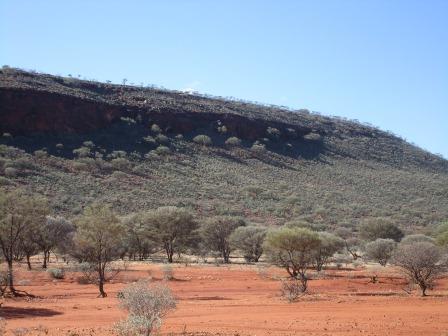
Passed
a few old shafts right beside the road (Sugarstone Mine on the Hema Map) then
noticed some rocky outcrops called ‘breakaways’ and a couple of vans parked
nearby. Pulled into the track and around to one van. Lovely couple from WA who
are caretaking this property ‘Cogla Downs’. They also detect but have only
found a few little bits.
Wandered
around the ‘breakaways’ checking out the caves. Looks like it is the animal
graveyard as there were bones in each one or maybe it was where the dingoes
came to eat their catch.


Lots
of old broken bottles around.

Said
bye and headed off. Put the heater on in the truck as it is getting quite cold
now at 4pm. Crossed the No. 1 Vermin Proof Fence. Saw another Miners Path sign
but no information. Further along we stopped another pullover area to check out
another Miners Path sign. It was about Lake Mason and the flora and fauna that
live there.


Turned
onto the Sandstone-Wiluna Road and headed east till the turnoff to Lake Mason
Homestead. It is now under DEC (like National Parks) and there used to be
bookings and fees but that has stopped now. Jeff’s friend used to caretake
here.
The
sun has set so we pulled in near the shearer’s quarters and kitchen area and
jumped out of the truck and put the heater on in the van and moved in for the
night. It was 13.7 degrees but quickly warmed up to 20 degrees. Steve put the
thermometer outside and it was 8.6 degrees.
Made
some toasted sandwiches for dinner as we were still full from the big burger at
lunch.
Will
photograph our camp spot tomorrow.
No comments:
Post a Comment