Overcast
and windy. Checked BOM site and it showed it would be worst tomorrow and the
next few days so we headed off to Walpole then sightsee our way back.

Past a few giant bugs near the turn off to Mt Barker.


Stopped
at Walpole Post Office to pick up my replacement metal detector batteries that
were replaced under warranty (expensive ones).
Up
the road to Mt Clare (190m), stopped at the John Rate Lookout. He was the first
District Forestry Officer in Walpole. The trees are nearly blocking the view!!
Zoomed in on Deep River as it winds its way into Nornalup Inlet with Newdegate
Island just off shore. All this area across to Bow Bridge is in the
Walpole-Nornalup National Park which covers 18,000 hectares.


Back
down the road a bit then turned south down Rest Point Road and turned off to
Sandy Beach. The area from here is where the Karri and Tingle forests lap the
water’s edge.


Up
the track then down to Rest Point. The Swarbrick family came here in 1923 and
set up a timber mill. They built the guest house in 1926 and starting building
boats here. Only a saw pit remains of the mill. They had another mill in
Walpole which Bunnings bought but it burnt down in the recent bushfires. The
family left the area in the 1960s and moved to Perth where they carried on
their yacht building. They built the prototype of the America’s Cup yacht. Now
Rest Point is a caravan park with the original guest house open for use. There
is traditional van parking or you can park in the bushland under the tingle
trees. Of course in peak time it is $52 per night, now it is off peak (school
goes back Wednesday) it is down to $36 per night (powered) – too dear for us.

The
original jetty still stands with its shelter shed (built 1926). The point is on
the edge of the Channels, the narrow waterway (to the right) between the
Walpole Inlet and Nornalup Inlet. The Walpole River flows into the Walpole
Inlet and the Frankland River flows into the Nornalup Inlet.


The
sky is clearing which is nice. Into Walpole to the Info Centre in a replica
pioneer cottage. Walpole was settled by pioneers who drove their cattle south
in search of summer grazing country. The Bellanger family settled on the banks
of the Frankland River in 1909 at the present site of Nornalup, followed by the
Thompson family in 1910, at Tinglewood on the Deep River. Following a
ministerial visit that year, 30,000 acres were progressively set aside as
National Park reserve and the area became an attraction to summer visitors.
Following the completion of the railway from Denmark to Nornalup, a main camp
was set up in 1930, on the site of the present Pioneer Park, for the Walpole
Land Settlement, with 50 families establishing farms to the north. Walpole was
gazetted as a township in 1933 and for many years timber milling was the main
industry.


Around
to the other side of Walpole Inlet to Coalmine Beach on the edge of Nornalup
Inlet. Walked down the trail a bit to one of the signs.


The
beach is lovely. Lots of shallow water, great for kids.


Continued
around the one way road through the karri and tingle trees.

Stopped
at the Channels picnic area and walked down to the water. Looking left to
Nornalup Inlet then around past Rest Point to where it enters Walpole Inlet.


Continued
east then up the one way forestry Hilltop Road to a lookout over the Frankland
River with the Nornalup Inlet on the right and the Southern Ocean on the front
and left.


Stopped
at the Giant Tingle Tree picnic area. Interesting info about the Tingle Trees.
The other big tree in the Valley of the Giants that people parked their cars in
has fallen down in 1990.


Followed
the track through all the trees – found our first tree, Hollowbutt.


The
trees look twisted.


Some
good specimens.

Giant
red tingle is impressive. All that burnt out and it still lives. It is the
largest living girthed eucalypt known in the world.


Inside.


Through
the tree, looking back.


Nearby
is another big Tingle with lots of lumps and bumps.


A
nice straight Karri.


Back
to the highway then along to Nornalup, another Group Settlement area, on the
edge of the Frankland River. All the houses on the river side have boat
landings.


The
chap at the Info Centre recommended a bakery just past Nornalup, Tingles
Bakehouse - they make lovely pies and pastries. Bit strange driving into
farmland but they have made a nice coffee shop area off to the side of the
house and grow their own herbs etc. Grabbed some pies then headed down to
Conspicuous Beach for lunch.

Stopped
for a photo of these trees – they look redder in real life.


Down
to the carpark – of course a walk to the beach. Some info on the area and the
name of the pretty flowers – Red Flowering Gum. They only grow in this area and
bloom now in a variety of colours – scarlet, crimson, orange and pink.


Half
way was a seat overlooking the beach so that did us for lunch. Nice in the sun
as the breeze is cool but the sky is clear and blue.

Walked
up the track to the lookout. Looking back to the road and the Bib Track
meandering over the dunes.


Fabulous
view of Conspicuous Cliff and Beach.


Walked
further around towards the cliff to another lookout.


I
forgot to mention all the steps we climbed up to get to the lookout!! Down we
go. Then more to get down to the beach.

Fresh
water flowing out of the hills. Right past the bottom of the steps. Luckily
someone had made a little bridge off to the left so we could get onto the beach
without wetting our boots.


Down
at the water’s edge looking back up.


As
we walked back Steve noticed this big worm eaten log. It can only have got here
via the sea – must have been a big blow to get it up here.


Back
up the dirt road then east to Peaceful Bay. Lovely spot with a van park (dear
too).


Up
to the highway then back to the turnoff to the Valley of the Giants. We aren’t
going to do the Treetop Walk as we have done a similar one in Innisfail and
after climbing the Bicentennial Tree which was totally above the treetops I
have no need to pay $20 each to walk along a 600m boardwalk 40 metres up. There
is a free area called the Ancient Empire so we headed to that.


Easy walk with lots of information boards along the way.

We
thought Quokkas were only on Rottnest Island. The chap said these ones are
still nocturnal and are a lot healthier than the Rottnest ones.


The
Yellow Tingle.


Slipper orchid.


The
Red Tingle.


Grandma
Tingle. She is hollowed out too.


Karri
She-oak.


A
hollowbutt.

Another
big walk-through tingle.


Amazing
to think this is still living.


The
other half has fallen off and is leaning on another tree.


Burls.


Three
different trees.


They take up a lot of room on the ground.


Another
wren to keep an eye out for.

Count
the rings to see how old it is.

Back
into the centre to read all the info.


The
old tree that everyone parked in fell down in 1990. They have a mock up car
which kids can get in (like this boy).


A
video showed the story of the tree-top walk’s creation in 1996.


Steve
checked his height.

Followed
The Giants Road around through clear pastures on the hillsides and down to
village of Bow Bridge – named because of a bridge of the Bow River.
Snapped a shot of the big Blue Marron at Kent River.

Passed
the turnoff to Parry Beach – too many low trees for our van. Turned off to
Williams Bay which has a lovely spot called Greens Pool. Made a cuppa and
enjoyed the view – another big walk down to the beach from the carpark.


Popular
spot going by the photos on the info board.


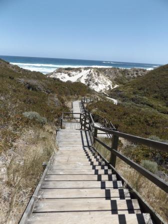
Walked
down the stairs to the beach.


The
rocks protect the pool from the rough Southern Ocean and the wind though one
lady said the water is still freezing.

Drove
to the next carpark for Elephant Rocks and followed the track around. The rocks
do look like a herd of elephants all huddled in the little bay.


Climbed
up onto one of the huge boulders to look down onto Elephant Cove.


Interesting
rock formation on the other side.

Up
the hillside there were more boulders standing tall.


Steep
steps down to the beach which we decided we didn’t need to go to.

Drove
further around to the other side to Waterfall Beach. A text came through that
Jon rang so we rang him back. He and Jess were heading off to Footsal. Lovely
chatting with them. View from the carpark towards Lights Beach on the other
side and Point Walton where the Wind Farm is – well two wind turbines!!


Walked
down onto Waterfall Beach.


I
thought the waterfalls were the water cascading off the rocks on the point but
Steve walked along to where the freshwater was flowing and he found a real
waterfall. Must be from a spring on the hillside as there is a lot of water
coming over for this time of the year.


Back
around the point to Madfish Bay which has a low rocky area creating a little
island offshore and a sandspit out to it.


Walked
down to the beach then up the big boulder back to our truck.


Back
up to the highway then we turned north up into the hills and open pastures and
onto Mount Shadford Road. Nice drive with the road line with big Karri trees.


Down
Mohr Road to the lookout. Big hazy in the late afternoon but still a great view
over Wilson Inlet (below Denmark) and the Southern Ocean.


Mt
Shadforth (315m above sea level).

Down
a very steep dirt Sunrise Road to the highway and then down Lights Road. Passed
the turn off to Lights Beach and Monkey Rock – another big rock which I got a
glimpse of and did look like a monkey. There is a walking track to it and Mt
Hallowell but we skipped that. Onto Ocean Beach Road and down to where a spit
used to block off Wilson Inlet from the Southern Ocean but now it is open
again. A nice timber sculpture at the lookout.

Looking
up the inlet with Denmark in the distance, down then out to Ratcliffe Bay and
the ocean. The Bib Track crosses here though I think there must be an
alternative ferry crossing now across to Nullaki Peninsula.


Zoomed
in on Anvil Beach and the rugged coastline of Nullaki Peninsula.


Drove
back to Denmark – it was established on the Denmark River by Europeans in 1895
as a timber mill town. The local Nyoongar name for the river is ‘Kwoorabup’.
Mokare, an Aboriginal renowned as being a man of peace, led Lt Thomas Braidwood
Wilson RN throughout the district, and it was Wilson who renamed the river in
1829 in honour of a colleague, Dr Alexander Denmark RN. As timber resources
dwindled, fishing, fruit and vegetable growing, and beef and dairy farming
became the economic mainstay. Tourism and wine-making are currently Denmark’s
growth industries.

Drove
down by the river for 1km to where the old rail bridge crossed over.


Looking
down to the mouth of the Denmark River as it flows into Wilson Inlet.


Getting
late so we headed for home. Turned out to be a lovely day. Back at 7pm so put
the other pizzas in the oven to get rid of them – McCains – weren’t very nice!!
No comments:
Post a Comment