Cloudy
morning but weather forecast for Mt Barker was sunshine so we headed off. Took
a dirt road shortcut north west to Porongurup National Park. Through Blue Gum
plantations and open pastures. Past a Silica sandmining operation (they get the
sand from near where we are camping). Across the small brook of Kalgan River,
that grows and flows into Oyster Harbour near Albany.
Into
the National Park and turned off into the Granite Skywalk carpark below Castle
Rock. Read the info then made a cuppa before we headed up. The Skywalk opened
in 2011.


Started
out ok then it was a continuously climb upwards through the trees.

Stopped
to check out how old this tree was.


Next
stop was a big boulder with a view to the Stirling Ranges.


Lots
of rocks and roots to look out for so we spent most of the time looking at our
feet rather than the trees. At last, 40 minutes later, we headed into the boulders
near the top.

Steve
gave the Balancing Rock a shove back up.


Continued
through the boulders to the intersection of the two viewing platforms.


Headed
out to the Karri Lookout first – to catch our breath. Fabulous view even with
all the cloud. We could see the coast though it was very hazy.


Looking
back to the Stirling Ranges then scanned around to the coast.


Chatted
with a couple from Hillary Boat Harbour for a while. Others were going up to
the Skywalk above us. Another amazing stainless steel installation.

We
headed around – first the clamber over the boulders. Luckily they have
installed these handles now.


Not
so squeezy through the next bit to the 7m ladder.


Great
view of Castle Rock (570m) face from the big boulder below the ladder.


I
went up the ladder first – it didn’t wobble like the ones up the Bicentennial
Tree. Steve was all good coming up.

Long
platform going around to the south side of Castle Rock.


Looking
across to Collier Peak (634m) then down to the Karri Lookout on the other side.


Another
scan around from the Stirling Range to the coast – lots of tree plantations.


At
the very end of the platform I looked back over the flat edged rock face to
view back to the other half of the Stirling Ranges.


Long
way down.


Steve
checked out the fastenings and is happy with the structure!!


Bluff
Knoll (1073m) in the Stirling Range.

Headed
back down the ladder and over the boulders again then back on the track
downhill – amazingly only 5 minutes quicker going down!!
Drove
around to the next picnic area for lunch. Lots of birds flittering around –
tried to get a photo of the parrots but they are too quick.

Walked
up the track to the Tree In the Rock. It got its tap root down through a crack
in the rock and is still growing.


Lots
of long walks from here to more mountain peaks but we have done the best one. There
was one 600m long called Bolganup Heritage Trail so we headed off on that one –
I thought it had history plaques but the one plaque there was unreadable. It
was just a walk through the karri trees down to where Bolganup Creek was – not
that we noticed it. Got our legs going again after our big climb.
Headed
down the Scenic Drive past Angwin Peak and Gibraltar Rock (640m).


Stopped
above a winery with a fabulous view of the Stirling Range.


Zoomed
in the Sleeping Lady – Mt Magog (856m) is her breast and Talyuberlup Peak
(783m) is her head.


Toolrunup
Peak (1052m).


Bluff
Knoll (1095m) and Ellen Peak (1012m).

Out
onto the bitumen road again and then across to Mt Barker. It was settled by
Europeans in the 1830s. Vineyards were first established in the late1960s and
now the area is a major wine-producing area. Stopped at the Info Centre in the
old train station – cute toilets – to get some water. I went in and picked up
some more maps – a chap in Denmark has made them and they are great.


Information
boards outside with history, maps and lots of suggestions for day and half-day
tours. Will head out to the lookout and the historic church.


Another
wind farm – only three turbines.

It
is also the home of the Mt Barker Free Range Chickens – we see the advert on TV
where the chooks wander everywhere – to school, shops and even into the pub!!
Haven’t seen any yet.

The
tower is impressive – bit of an Eifel Tower look. It is the tallest free-standing
tower in the Southern Hemisphere.

Up
to the new lookout on Mt Barker (404m above sea level). I found a bi-centenary
plaque hidden in the bush nearby.

Nice
view across to the Windfarm, over Mt Barker township with the Stirling Range in
the background then across to the Porongurup mountains then down to the coast
near Albany which we can only just make out.


The
184m tower is for broadcasting.


Back
down to Mt Barker Road where we continued along onto the dirt St Werburgh’s
Road. Spotted another plaque by the old bridge over the Hay River – it flows
down into Wilson Inlet near Denmark.


Interesting
that they only have a concrete causeway now – though I did notice a lot of
debris high on the bank so it must flood still.


Through
the nice fence to the church which is on private property but open to the
public.


So
pretty – the walls are made of clay pug. The roof was shingles, probably
sheoak. A carpenter, Mr Blechynden, from Albany did the woodwork, using local
sheoak and jarrah, the floors were timber too. The ironwork was made in the
family forge and the font had been the family mortar which had probably been
used to make coarse ground flour. It has been restored and there was a donation
box outside but vandals have broken into it so now they have the bank account
number of the Restoration Fund if anyone wants to donate. They still hold Holy
Communion (Anglican Church) here each month and weddings and baptisms are still
carried out. All by candle light as there is no electricity to the church.


Inside
the bell tower room was some information and visitors’ book. Only a little rope
for the bell. Interesting tiles on the floor.


George
Edward Egerton-Warburton arrived in Albany, a young lieutenant of the 51st
Regiment. A little later he sold his commission and returned to Albany, where
he married and soon afterwards settled at Saint Werburgh’s. In 1872 he received
550 pounds from his eldest brother, the squire of Arley, Cheshire, for the
building of a Chapel here. With the help of artisans the building was completed
in 1873 and Bishop Hale consecrated the Chapel on 21 June 1874.

Saint
Werburgh was born about 659AD and died about 699 AD. She was the daughter of
Wulfere, King of Mercia and of the third Abbess of Ely, descendant of the Saxon
queens (sounds like someone from the Game of Thrones). The legend is – Saint
Werburgh is attributed the miracle of restoring the life of a goose. A flock of
wild geese, had been penned for the night, for devouring the corn and fruits of
Weedon. The goose had been stolen by one of her servants, but, by virtue of
Werburgh’s benediction the bird was restored and flew away ‘fullsome’. There
are 32 religious buildings dedicated to St Werburgh; 29 are located in England,
one in Zimbabwe, one in Ireland and this one.

Inside
was simple and serene.


A
small cemetery was beside it. George is buried there with some of his family.


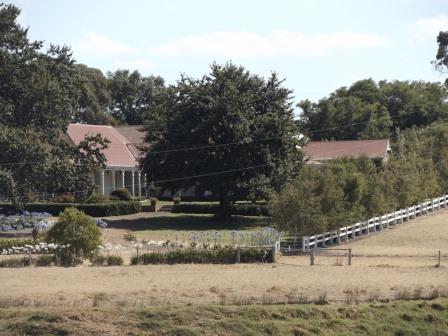
Around
the back we looked across to what we imagine is the main house. Below were lots
of sheep.


Back
to the truck looking across to the big tower on Mt Barker.


Drove
back into town for a cuppa in the park. The sky has cleared – maybe we should
go back up to Castle Rock for better pictures. Steve didn’t agree.
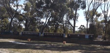
Passed
a ‘train’ beside the footpath as we headed out of town.
Next
stop was the old Police Station Museum but it is closed for renovations in
February. The Plantagenet Historical Society opened the Cottage as a museum in
1968, furnishing it with artefacts donated by residents of the Shire. In 1971
the Pioneer Room was built to display more artefacts and in 1985 and 1987 the
cottage and stables were restored. We parked and had a quick look around. The
Police Station was built by convicts in 1868 and was used till 1908 when a new
station was built next door. The Court House office was added in 1919. It was
also the Telegraph Station in 1871 then the Post Office in 1887. The stables
had a portion divided off for the lock-up in the 1880s. Lots of lovely scented
roses too.


Continued
on then turned off towards the Stirling Ranges which spans 65 km from east to
west. Bluff Knoll is the highest peak in south-western Australia. It is WA’s
only site of intermittent snow falls in winter.
First
we stopped in Kendenup.

Spotted
a big bulldozer in a shed so stopped for a look. Ex US Army one.


Kendenup
was originally a sheep station run by Captain Hassell from 1840.


There
was a gold mine on Kendenup Estate in 1875. Though it was the second gold mining
company listed it was the first to start work though it didn’t last one and
closed the following year.

Sadly
a lot of the info is faded and hard to read. Obviously apple orchards played a big role in the growth of this area.


As
we headed across the railway line I saw a sign for the Mt Barker Free Range
Chickens – so they aren’t actually in Mt Barker!!
Onto
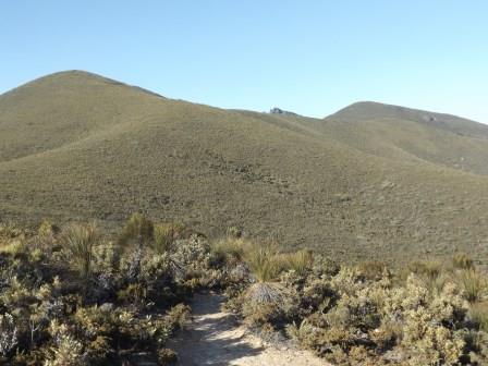
Red Gum Pass Road into Stirling Range National Park.

Looking
at the map I think this is Mondurup Peak (817m) then Ross Peak (637m).


Stopped
at the first lookout on the edge of Baby Barnett Hill with Mondurup Peak on our
right.


Through
the trees looking east.

Mt
Magog (856m – 3 to 4 hour hike) on the left and Talyuberlup Peak (783m – 2 to 3
hour hike) on the right.


Next
lookout – we only went part way as it is 5pm and getting very windy.


Looking
back to Porongurup.

Then
back down the track.

Not
much to see other than the hills and greenery. The walks are all very long ones
up to the peaks which we aren’t interested in – funnily enough.
Toolbrunup
Peak (1052m – 3 to 4 hour hike) though is impressive.


As
we head around we come the other side of Talyuberlup Peak where you can see the
trail heading straight up.

The
sun was too low for a photo of Mt Hassell as we passed behind it (848m – 2 to 3
hour hike). Turned onto Chester Pass Road and headed for home. Bluff Knoll etc
are further east and as we weren’t going to climb any we decided to skip them –
got lots of photos of it anycase. Bluff Knoll is 3 to 4 hour return and the
info said 20,000 people commence the climb every year, with more than half
making it to the summit – not the best recommendation. There is a waterfall
about a quarter of the way up that might have tempted me but knowing my luck
there wouldn’t be any water coming over!! Further on there is an 8 hour hike up
to Ellen Peak and others that take 2-3 days!!
Lots
of little birds beside the road as we headed back. The road south is very soft
and tarry as the big grain trucks head down to Albany. Turned off onto a dirt
road to shortcut back to South Coast Highway. Across the Kalgan River again.
Back
to camp where the wind is whipping up the little bay. Glad we are parked back
over and not on the front tonight!!

Windy
night and the moon is glowing brightly.
No comments:
Post a Comment