Windy
and overcast, 16 degrees. A sprinkle of rain while we had breakfast. Weather
forecast for 22 maximum today. On the radio they said that the whitest beach
award Lucky Bay had was assessed by the whiteness of sand down 10cm – a beach
in the Whitsundays came second but I didn’t get its name.
Headed
west along the highway with more scuds of rain passing over us and a strong
wind that we were heading into unfortunately!!
Passed
Quagi Beach turnoff then crossed over Lort and Young Rivers that flow into
Stokes Inlet. Turned south onto a dirt road with a sign ‘water over road’. And
they are correct. Enough room on the right to only have to go into the water a
little way.

Stopped
at the NP pay station to check out the info. Looks like the campsites are well
back from the inlet.


Continued
down the road past the turnoff to the ranger’s house which is before the
causeway that looks like it was under a lot of water.
Stopped
at the camp host van to pay our camp fee. Chatted with Syliva about being camp
host – they are from Brisbane and love doing the hosting. This one is big with
4 camp kitchens and lots of toilets to maintain but she enjoys it and meeting
people. She said they were flooded in for a week during the floods but were
well looked after. The inlet is open to the sea for the first time in 6 years.
She gave me a brochure about the Moir Homestead – built in late 1800s. We have
to go back to the Quagi Beach Road and come into the National Park that way.
Shame they didn’t have any info at Quagi so we didn’t have to do the backtrack.
Paid our fee for the night and parked up.

The
couple in the van in the next site are from the Glass House Mountains – Qld
invasion!! After a cuppa we drove around to the day use area beside the inlet.
Lots of information and great photos in the nice shelter sheds.


The
last time the inlet was open to the sea.

Walked
down to the water, it’s a big inlet. The wind is still strong though we are
sheltered on this side.


Walked
along the edge of the inlet – tidal now because it is open to the sea,
unfortunately we must be at high tide. Walked in and out of the trees till we
got to a sandy point. The full force of the wind hit here.


Still
a long way around to the mouth.


Went
further to the next point for a clear view of the mouth.


Turned
around and headed back through the trees.

Found
another BBQ shelter with some different info boards. Shows the inlet open in
2007.


Learnt
an interesting fact about the WA Salmon and the herring.

Climbed
up some stairs – well ran up them for some exercise!! Great view across the
inlet.


Ran
back down them too!! Back to camp for lunch and put dinner on in the Ecopot.
Then we headed back out to the highway and back east to Quagi Beach turnoff.
Down the road – seems rougher than when we were last here. It even spat with
rain!! Turned off where we saw the beehives last time, into the Nature Reserve
and followed the sandy track along the edge of pastures.

Followed
the track for quite a while then turned off to Moir Homestead. It is amazing to
imagine what their lives were like. Now the land is covered in banksia trees
but was it like that back then, otherwise what possessed them to think it was a
good place to graze sheep etc.


Walked
in on a pathway of conveyor belts.

First
we passed the shearing shed – nearly falling down but there has been some work
to stabilise the building.


We
then turned north to the old well and tank. Steve spotted a little dead snake
on the belt – must have been too hot for him.


The
poor old windmill is no more.

Plenty
of water still in the well though the tank has seen better days (all rusted at
the bottom).


The
frogs think the well is good.

Back
to the intersection and further on past the shearing shed to the shepherd’s
hut. It still has its roof though it looks like the beams have been burnt at
one stage.


Continued
along the path heading south to the grave of John Moir (one of the brothers who
first took up the land). There is nothing in the info about his death but
guessing by the note on the plaque that he was killed by two men.


These
are the Jonquils they found later which helped them identify where the grave
was after a fire had burnt the timber surround.

Back
along the track to the intersection then we turned west to the homestead. A
huge Moreton Bay Fig towers over the ruins.

Kangaroos
have made it their home.


I
had been told to watch out for the big bees hive high in the branches. It was
hanging from a branch is the bees were very busy.


The
homestead has been taken over by plants.


Steve
went around to the front door and knocked to see if anyone was home.


I
checked out the house well – all dry.

Wandered
into the homestead. Steve found someone or should I say lots of someones in the
kitchen. Two big bee hives in the oven and up the chimney.


I
thought the chimney one was small but when I got closer and peered up the
chimney it was all full of bees. There was some honeycomb on the top of the
stove too.


Wandered
through the rooms – I think our pioneers were amazing.


Outside
there was even paving around the building.

Looking
back over the fig, homestead and house well.


Further
along was a huge Mulberry Tree.

There
are a couple of male date palms here that are allowed to stay for historical
reasons from the days of the camels being used as transport.


Haven’t
seen this plant anywhere so we are wondering if it was another plant brought in
by the pioneers.


On
the other side of the fig tree are the remains of the blacksmith’s workshop.
Even had an old car and axle, obviously from the 1950s owners, the White
family.


Lots
of gum trees, I think they are the Salmon Gums, and banksia.


I
thought these trees were dying but it was the sea pods and there are millions
of little black seeds with a red edge around them.


Drove
back out then down to the Fanny Cove – named after Fanny Dempster who was the
first female traveller to arrive by ship here. The cove became one of
Esperance’s first ports and wool producting areas. It was also the port where
all the gold prospectors first arrived on their way up to the Dundas Goldfields
in the early 1890s.


Parked
at the Day Use Area – nicely presented considering the remote area. There is a
few campsite here and Roy is the camp host. No camp fee but he made sure we had
our parks pass when we met him on the beach trying to catch some dinner.

A
lot of sea grass along the beach. The seagulls are hoping to get a feed on the
small fish coming in for the worms etc that live in the dying sea grass.


Went
for a walk around the rocky point.

I
found a pearly shell.


Following
the black brick road!!

Across
the point where lots of plovers are resting near the rocks.


View
to the east (to Quagi Beach) then around to a big rock.


Up
and over the rock – interesting rock colour on top and lots of little pools.


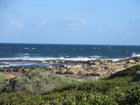
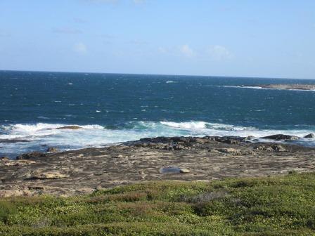
Because
of the rocks just off shore the water was being churned every which way
creating some great splashes.


Further
south west is Shoal Cape.


Back
to the truck for a cuppa under the shade shelter then we followed the sandy
track to Shoal Cape. Fabulous view from the top of one dune over the cape then
we had to drop sharply down into a valley and climb up the next dune to the
bush camp sites.


Shady
sites, even has a toilet!!


As
we are high on a dune there are few steps to get down to the beach.


Nice
view first from the little landing of Shoal Cape then over the lagoon created
by the rocky bar – looks like there are two bars.


Got
some more exercise skipping down the steps to the bottom. The wind isn’t as
fierce down here so the march flies can catch up to us.


Continued
further west along the beach to another lagoon in the beach.

Walked
out onto the rocks. Looking back on the dune and steps.


Ran
back up the steps – well half way before I needed a breather!! Steve found some
firewood which we can use at our next camp spot – only place we have found in
the south as it is all under fire ban from Oct to April.
More
shells to add to my collection.

Someone
had made a wind chime of crab claws.


Headed
back towards Fanny Cove then turned onto another bush track and found another
area between Shoal Cape and Fanny Cove.


The
waves were breaking over the flat rocks making waterfalls.


Back
along the track again and out to Farrells Road. Lots of kangaroos grazing in
the pasture on the other side of the fence. Stopped to turn the hubs out again.
Lots of bee hives here and a nice view east over more green pasture.


Up
to the highway then back to our camp. A few more vans have moved into the other
sites.
The
strong winds have settled down. Bit chillier tonight as the sky is clear now.
No comments:
Post a Comment