7am
24 degrees, clear sky.
The
door on the bed side has become too hard to close now so Steve decided we should
change it this morning.
It
is a fiddly job but we managed with the help of two big sticks to help hold the
door up while I held it against the truck. Steve had to pull off the rubber
hinge then cut off the old pop rivets. Next job was to screw/pop rivet on the
new metal hinges which were two lengths so had to get them perfect. My arms got
a work out holding the door up. Once the strip was done on the door part then
we had to do the same to where it attaches to the truck. In the end it worked
perfectly and the door closes well. Luckily we were on the shady side and there
weren’t too many flies about – I had put on my fly net just in case.


All
finished by 10am so made a cuppa and finished packing up. Thermometer said it
was 40 degrees in the shade of the truck!!
We
continued a new wide gravel road which loosely follows the Overland Telegraph
Line to Finke. The old Ghan Railway is further west which we will pick up again
in Finke. I photographed the map.

Through
red sand section. Water on the track from the recent storms. Further along two
camels were having a drink from one of the pools on the road.


Quite
a lot of water lying about. Some spots we had to go right to the edge of the
road to get around the water.

A
couple more camels who didn’t want to get their photos taken.


Through
a gate – my job to open and close it of course. A new road turns west before reaching
New Crown Station or the Finke River.
New Crown
When Charlotte Waters Repeater Station was declared
obsolete by the Post and Telegraph Dept, it was sold to the owners of the New
Crown Station who salvaged the building materials to build the homestead.
Left
the red sand and now have gravel as we rise onto a ridge with some hills around
us.

Down
the other side – lovely view with two flat topped hills in the distance.

Open
plains with hills to our left. Through the next gate – hot strong north-west
wind.
Across
the Goyder River which is wide and dry.


Bitumen
runway for the airport as we approach Finke. Solar and diesel power station on
the left.
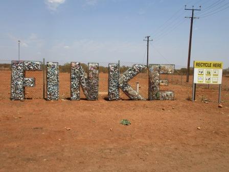
Onto
bitumen as we head into town. Neat and tidy so far.


Good
recycling idea.
Checked
out the info board – needing to be redone.


Finke
Finke was established in 1929 during the extension of
the railway line from Oodnadatta to Alice Springs. Finke is run by the Aputula
Community, after the closure of the railway in 1982, with its own council,
culture and restrictions. (No alcohol may be brought into or consumed with the
town boundaries unless bought at the Liquor Store. No photographs either.)
The Finke River (700km in length) was named by John
McDouall Stuart in 1860, “After William Finke Esq., of Adelaide, my sincere and
tried friend, and one of the liberal supporters of the different explorations I
have had the honour to lead”. The river now only flows once or twice a year and
then not always for its full length. The largest recorded flow was in 1974 when
it ran for 9 months and Lake Eyre reached its highest recorded level. It is
claimed to be the world’s oldest rivers, simply because it has been running in
its present course for longer than any other river.
The
old railway water tank and more info on the little rail trolley. This sign
definitely need redoing.


Across
the road is the old Police Station precinct. The corrugated shed at the back
had 1940 carved into a bit on the roof.


All
quiet in town – being Sunday everyone must be indoors keeping out of the heat
and sandy wind. There is a shop, art centre and mechanic but they are all
closed. There is a liquor shop but I noticed a sign as we came in about
bringing in alcohol. A bit of art brightens up the place. Not sure if the
building across the other side was part of the old railway precinct. Looks like
some of the old fettlers cottages. This area of course was done much later than
the stone buildings from Oodnadatta down to Marree.

Lots
of horses wandering around.

The
weather forecaster – no stone so there must have been a cyclone.

Next
minute we were running back to the truck as a wind storm brought a wave of dust
across the open paddock towards us. The poor horses had to just stand there.

Drove down the street to the
old railway
precinct, crane and goods shed.


Found
the Finish Day 1 sign for the Alice to Finke Desert Race that was held in June
just before we got here when we came down from Halls Creek. Lots of white tyres
marking the track.


On
the other side of the sign it says Start - Day 2, as the competitors then head
back to Alice.


A big
sports stadium is beside the red dirt footy oval etc.


Lovely
mural on the toilet block.

Waved
to a lady and daughter outside their home as we did a blocky. There are signs
on the street entrances – no photography. Not sure if that is cultural or that
they don’t want people to see how they keep their homes. Sadly they don’t keep
them well and most have dead cars in the yards and junk everywhere. Oh well
they have to live there.
The
school, established in 1958, looks nice and tidy and the small hospital is one
of the Anglican Church’s Inland Mission Hospitals.
Continued
north following the old Ghan Railway Trail driving on the actual rail
embankment with the Desert Race track beside us. Took a video.


Passed
more horses as we went through some hills. Found two bores and tank on the
other side of the hills that were used by the railway.


There
are tracks going every which way. We took one and ended up at the Finke River
where we found some old bits of the railway crossing washed down stream but not
the actual crossing.


Went
back and found the right track. There are two lots of foundations here as they
built a few bridges for the railway but they all got washed away in the floods.
First one then a photo looking along the bridge back to the bore frame.


Found
the next foundation.

Walked
further over the very hot sand – I only had my thongs on and there is a very
hot dry wind. Found a different type of foundation from another attempt to put
a rail bridge over the Finke River.

I
was checking my notes and realised we should have turned off on the road to
Kulgera so we could check out Lambert’s Centre. The geographical centre of
Australia. Headed back to Finke then headed 20km west. A dead kangaroo was at
the turn off – first one, dead or alive, that we have seen since Qld. Wound our
way up 13km of narrow corrugated red sand track. There was a choice of one
track going straight, obviously the original, and the other newer one which
wound around the trees trying to get away from the corrugations but it was just
as bad.
Arrived
at a clearing where there is plenty of room to camp on the red sand flat beside
the acacia bushes but as the wind is howling I don’t think we will stay. I
thought there was information etc here like at the roadhouse on the Sturt
Highway but there was only the marker and an old toilet block.
Got
our photos in the centre of Australia – we have been to the most southerly
point and the most northerly point – still have east and west to do. It looks
like the same as the flag pole on the top of Parliament House in Canberra. The
wind is making the Australian flag fly well.


Dark clouds are building around us. Lots of locks and people have left their name on all kinds of bits and pieces on the chain. Good spot for a selfie.


My turn to be in the centre.


Signed
the visitors book – this book was started in July this year and it is nearly full
so a lot of people make the trip to stand at the centre.
We
parked beside the ‘not too good’ loo to use it to block the wind so we could
make lunch. It is 42 degrees in the shade of the truck at 1.30pm. Someone has a
sense of humour.


Back
to Finke – flags flying well. As we drove in the wind brought up all the sand
again – glad we are in our air conditioned truck.


Went
down the race track this time. Spotted this interesting sign and wondered if
this is the sacred site where they have dumped an old car.


Crossed
the Finke River on the race track. The railway bridge would have been further
to our right.


Took
a video of ‘Pat’ zooming along the race track then the road splits. Across a
bit and we get back onto the railway embankment.


Long
straight ‘track’ with the race track to our left and sand dunes on each side.

Travelling
beside the line to an old shed, stock yard and loading platform of the railway
called Rumbalara Siding. No info here though. Lots of old sleepers, railway
line and clamps. A water tank and buggy maintenance spot.


Continued
on the actual railway line again. Mesas appearing around us.


The
track changed and we ended up on the race track. Lots of lumpy bits. Took a video
of us rolling over the humps – boy I wouldn’t want to do this at speed.

Long
straight railway again – sandy and corrugated. Crested a rise and there was a
vehicle in the middle of the track. Drove down and a man and two ladies were
very happy to see us. Mansell and his wife, Jubilee had been into Alice to pick
up supplies and to collect Joanne from the airport. She had just been home to
Cairns, lives in Woree, and is returning to Finke where she works in the
Kindergarten with Jubilee. I think Mansell worked with the church – they have
been in Finke 5 years. They had a trailer full of gear and it is very hot today
and they just couldn’t make it up the sandy slope. Steve got to work with
Mansell with the snatch-em strap to get them out of the soft sandy while we
stood in the shade of a tree and chatted. Joanne said there were about 180
people in Finke and most of that are children. It isn’t a dry community and
they have lots of problems as the nearest police station is at Kulgera. Joanne
said that Cairns was having rain when she left and there had been hail on the
Tablelands.


Steve
got them unstuck then they hooked on the trailer and then we snatched them up
the rest of the way to the top of the rise. Said our farewells – hope they make
it the rest of the way without any problems. Jubilee got us all together for a
selfie. Steve said he found some old railway spikes when he was digging in the
sand around the tyres.


A
big container and sign, Mt Squire, which is a fuel point for the race track.
There was a rail siding nearby too but no sign of it.


On
to the next siding which was Engoordina. Good information here and about the
previous one, Rumbalara.


There
are some nasty prickles around here.

Continued
along the straight track into desert oaks and acacia bushes and sand ridges.

Through
a narrow cutting on the railway track.

Very
rutted sandy section then a ‘Roads to Recovery’ sign and hey presto the road
improved.
Next
siding is Bundooma and there was information about the accident on the bridge
over Alice Creek which is further on.


Better
map on this one and it shows all the ones in South Australia. We saw the ones
down to Marree on the way over to Cairns.


The
big water tank still stands and the foundations of the buildings are still
here.


I
walked up to the sand dune and looked back over the foundations of the buildings.


Steve
found some old railway spikes.

All
kinds of treasures have been found and left here from different eras of time.


Still
very windy so we kept driving. No point pulling up to camp as the wind is hot
and blowing up all the sand. Across Alice Creek – railway bridge foundation
just down a bit from us.


Back
onto the trail line again. The race track is still running alongside this
track. Over a rise - who says it’s not green in the desert.

Jubilee
said to take the fence line track to Titjikala Community through Maryvale
Station then head down to Chambers Pillar, instead of going all the way up to
Rodinga. We did though it was not a smooth track and there is a bit of water
about making it boggy. Some cattle on the track then two donkeys stopped for a
photo.

A
bit further along two more and a baby stood for their photos – very obliging
animals. They have interesting markings.


The
sun disappeared behind a cloud making a nice photo.

Found
the rubbish dump full of wrecked cars and lots of other interesting bits and
pieces. Around the hill and we arrived at the entrance to Titjikala Community.
Gave some locals a wave as we passed by. Turned and crossed the dry creek and
then turned onto the Chambers Pillar Road. 42km to go and it was 6.15pm but
still light so we kept going as the wind is still strong. Hope it settles soon.
Across
a very boggy/sandy section then we run down along the Hugh River.
Lots
of dust in the sky creating a lovely sunset as we headed south.


Continued
along the track trying to snap photos of the sun setting as we go. The sun set
at 6.36pm.


Corrugated,
curvy track then as darkness comes on us we climb up the Jump Up. Note says
this is the first glimpse of Chambers Pillar – we can just see it. Very steep
descent then down the track to a gate which I had to open and close. Up and
down some sand dunes then through another gate to enter the Historical Reserve.
Continued along the track – there was a turn off to the Bush Campground but we
continued to the Chambers Pillar Campground. This is a first – a campground
with a view of the ‘feature’. We can just make out the pillar and on the other
side of us is another huge rock formation called Castle Hill???
There
are two other campers here so we found a spot with a view of the pillar and set
up. As the water in the back tanks was hot from the heat of the day we had our
showers first. Lovely after the sand blasting day we have had.
Easy
tea of soup and tinned stewed meal and a cold drink. A light cool breeze
starting about 8pm – still 32 degrees.
The
stars are out and I even spotted a satellite. I can see the Big Dipper and my A
set of stars which I haven’t seen in ages.
Quite
evening reading – Steve has never read books so much in his life!!
10pm
29 degrees as we get into bed – no need for blankets etc tonight – won’t even
need a sheet.
There
is a gentle breeze which is making a lovely soft swirling sound through the
desert oaks.
No comments:
Post a Comment