6am
- sun rising over the NSW sand dune. Nice cool breeze – 15 degrees.

Kayleigh’s
birthday today but no phone reception so will have to send her a belated
birthday message when we get reception again.
Got
packed up early to get in front of the OBT group.
Across
the grid and back into South Australia heading west at 7.30am – not bothering
to change to SA time which would be 7am as we will be back in Queensland in a
day or two.

Over
a grid and into Bollards Lagoon Station.
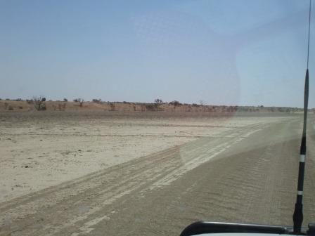
Onto
the 118km red roller coaster as we head to the Strzelecki Track. One person
said there are 215 sand dunes!! Easy driving as the road is formed so no fun
for Steve ‘yet’.


Past Bollard Lagoon Station homestead. There is a track heading north along the border that Sidney Kidman put in when he was droving his cattle down this way – it is called the Bore Track and my notes say you have to get permission from this station to traverse it.

Another
shot of the roller coaster ride. Good fun.

Spotted
some cattle at last.

No
spinifex here so the red sand is more exposed.


‘Nick
of Time’ Bore came up on the Hema – wonder how it got that name. Steve said
they found water with the last bit of bore pipe or was it that they found the
water before they perished!!
A
dingo ran across the road ahead of us. Turned onto the top of a dune and then
continued parallel with the sand ridges.


Onto
Merty Merty Station. Spotted the homestead on a ridge further over.
Turned
onto the Old Strzelecki Track which is east of the new one. The chap at the
Corner Store said it was in better condition as it doesn’t get the traffic the
new one gets from all the oil and gas mines around this area.
Information
off the Westprint Maps we are using:
Strzelecki
Track
John Conrick pioneered this
track in 1867 when he successfully drove 200 horses from Mobel Creek
Station, north of Quilpie in Qld, to Kapunda, north of Adelaide.
The Strzelecki Track developed as a stock route, even
more hazardous than the Birdsville Track because it relied on waterholes, dams
and wells. The only bore to be drilled on this stock route was Monte Collina in
the Cobbler Desert. During periods of drought the Strzelecki Track was closed
for years at a time. Many cattle from Innamincka Station were taken west to
Mirra Mitta Bore and down the Birdsville Track rather than face the uncertainty
of the Strzelecki Stock Route.
Although the Track was now been realigned to provide
access to Moomba, and is a well-maintained road, parts of the old track can be
negotiated between Innamincka and Merty Merty Station. Some of the old
waterholes and wells are still visible. The Track closed as a mail route in
1935.
The Strzelecki Desert is similar to the Simpson Desert
with many similar plants, soils and trees. The most notable exception is that
the sand dunes run at a different angle. It is interesting to note that the
longitudinal direction of sand dunes in Northern South Australia appear to
radiate out from the top of the Flinders Ranges much like the spokes of a
wheel.
Will
do the rest of the Strzelecki Track when we do South Australia in more detail
one day.
Interesting
‘bone’ sculpture just up the track.


Left
the red sand ridges behind and onto grey dirt.

Past
Santo pump thing then an oil pump thing which is called a Beam. There are 6
more around it that we can see.

Further
along more beams. Got a photo of it going up and down.


Roads
go off to more fields - Ulandi and Jena Fields then more pipes along the ground
for the high pressure oil. Better not run over them.

An
adult emu was strolling along. Then another one rang across the track in front
of us.
No
kangaroos this morning.
A
storage tank had a flood height marked on it from the flood of 2010.

Winding
back and forth over the grey dirt flats then sand ridges appear on each side of
us but well in the distance.

Turned
right on the new Strzelecki Track and pulled off into the bush beside the fence
to have a cuppa. Hot dry wind greeted us – glad we have the air conditioner
going.
Further along this track is the Hot
Rocks Power Station.
Innamincka, with a permanent population of 12, is set
to be the proving ground for hot fractured rock (HFR) geothermal energy
production when it swaps diesel fuel power for geothermal power. Innamincka
sits atop the Cooper Basin which contains multiple granite fractures and water
under pressures of up to 12,000 pounds per square inch (psi).
Across
the grid then back onto the old track again and headed into the Innamincka
Regional Reserve. Narrower track here as the oil/gas lot don’t use this one.
Dead
cow by the road which was all blown up ready to burst – yuk.
More
live cattle as we continue along. Another company – Beach Energy – has pipes
running across the track from their wells.


A
flock of corellas flew along beside us.
As
we neared Innamincka we spotted some very healthy horses grazing by the road.
Two were getting a bit frisky!


Turned
onto the 15 Mile Track which runs parallel with Cooper Creek then goes south to
Moomba on the Strzelecki Track or turns north west through Walkers Crossing on
the Cooper and up to join the Outside Track of the Birdsville Track. Lots of
signs and this is the map.


We
pulled into the first camping area by the creek called Policemans. Toilet up on
the high side then we dropped down closer to the creek.

Nice
spot with big trees, lots of corellas and turtles poking their heads out of the
light brown coloured water.


I checked
out the information board.


More
info off the Westprint Maps:
Cooper Creek
Charles Sturt named Cooper Creek as he moved
northwards during 1845 in search of an inland sea. His diary entry reads, “I
gave the name of Cooper’s Creek to the fine watercourse we had so anxiously
traced, as a proof of my great respect for Mr Cooper, the Judge of South
Australia. I would gladly have laid this creek down as a river, but as it had
no current I did not feel myself justified in doing so.” (The apostrophes on
many place names, eg Cooper’s Creek, were later removed under regulations set
down by a National Mapping code.)
Back
out then along and down to Ski Beach.
2010
flood level is marked on the toilet wall up on the higher bank – boy that would
have been amazing amount of water going through here.


Bit
different to Ski Beach on the Murray – no nice sand here. It is a smaller camp
area with lots of trees.

Next
turn off was to King’s Marker. More info as we follow the track towards the
creek.


Steve
would have been swimming during 2010 flood.

This would have all been under water in the flood. So
Wills died downstream and Burke upstream so King must have walked back along
the creek to be found here. Interesting note at the bottom about King
celebrating his birthday thereafter on the day he was rescued as he believed
that was went his life was returned to him.


Info
about the blaze which was made in 1947 to mark this site.

More information boards here.


We continued down the track to the water’s edge. There is a wide sandy area where the creek narrows and the creek is wider up and down stream.


Back
to the truck where Steve noticed a cairn off to the side. It said this was
where King was found so not sure if it was here or down by the water!!

New
campground area further along with a nice new dunny. I think I was the first
person to use it.

Next
one along is Minkie Waterhole. Lovely big gums – not good to camp under though
has they have a bad habit of dropping their limbs.


Another
flood marker and we are well up from the water. There hasn’t been any other
floods marked.


Information
about Sidney Kidman’s Coongie Station. The lakes are further north west from
here.


We
drove down to get closer to the water.


Lots
of corellas, galahs and some very pretty green parrots flying about. Not happy
about the corella above us who didn’t look below before he pooped.


Had
lunch with the flies under a lovely big tree. We will have to look up about
flies and see what their purpose in life is and what eats them, as it doesn’t
seem that any birds do.

Even
a pelican slowly worked his way along the creek. We feel like we are on the
Mighty Murray again as the colour of the water, trees and wildlife are just the
same, yet we are a long way north.


Some
of the other campers had a swim across the creek. Lots of turtles popping their
heads up – reckon they would get your bait before any fish did.
We
continued along the track then turned up a track. Passed some old sheep yards.

Over
a flat clay pan with red sand dunes on each side.

At
the carpark there was another cairn – Wills died in creek 1861.

Further
along we found the information board.


The
stone cairn is near the downstream end of Tilcha Waterhole.


Headed
back along the track we spotted an emu.

Back
to where we turned off. Further along is the Town Common where you can camp for
$5 per night along a long narrow waterhole called Queerbidie. We have a Deserts
Parks Pass which we got to cover all these SA National and Regional Parks so we
don’t have to pay to camp. Had to pay enough for that so will chose a camp that
is under that pass.


Plenty
of room to camp here. The trees have had the soil washed away from their roots
over time and looks like they are trying to put some dirt back around them.


Across
a dry Strzelecki Creek which was named by Charles Sturt in 1845 after Sir Paul
Edmond de Strzelecki, a Polish-born explorer and scientist.
The Cooper-Strzelecki Junction
This was an important landmark for Sturt, Gregory and
Burke & Wills who travelled along both creeks. When Cooper Creek reaches a
depth of approximately 5 metres, water flows into Strzelecki Creek and runs
southward to Lake Blanche.

Up
the side of a gibber stone covered hill.

Into
the township of Innamincka.


Innamincka
The explorer, Charles Sturt, visited this region in
1845 during his attempt to reach the centre of the continent. He named Cooper
and Strzelecki Creeks. Sturt Stony Desert was later named in his honour.
Augustus Gregory followed the Cooper and Strzelecki Creeks in 1858 while
looking for traces of Leichhardt and Burke & Wills entered the Cooper region
in 1860. These explorers were the first men to venture into this arid land.
Cattlemen followed with their herds, to face the hardships of a land where the
annual rainfall averages a mere 250mm.
Three police troopers set up a tent near Innamincka
for use as a police station in 1882. A store was built nearby in 1884 and a
hotel built at the intersection of the Strzelecki Track with the Cordillo and
Nappa Merrie roads. By January 1892 the Town of Innamincka was proclaimed.
North of Innamincka is No. 1 Bore. Geologist Dr Reg
Sprigg first recognised the land formation now known as the Innamincka Dome as
a possible exploration site for oil. This was the first exploratory bore in the
Cooper Basin and was drilled in 1959. The traces of hydrocarbons found gave an indication
of the presence of oil or gas in the area.
I
found another friend.

We
wandered over to the information boards first.


Next
door was the National Parks building with a big cairn in the garden. Plaques
about Sturt and Burke & Wills.


The
building was originally a nursing home but now National Parks office is here.


On
the direction finder it had Cooktown but no Cairns – that’s a first.

We
went inside and noticed information boards along one of the verandahs.


Inside
one room was all the info about the building and the work of the Mission. Wow
what an experience for those nurses.


On
another wall was about the Aboriginals of the area.


Some
bits and pieces on display.

On
the other side there were more photos of plants etc and these great ones of the
Strzelecki Creek during the 2010 flood.

Shame
they don’t have a better sign out front as I reckon a lot of people miss
reading all this thinking it is just the NP office.
Over
to the pub. Great plaque about Burke and Wills out the front. Still trying to
figure out why Wills died one side of Innamincka and Burke the other and they
found King in the middle. Will have to read some more.


Into
the pub for a look around. Lots of great photos, newspaper clippings and the
back wall is covered in signed money. The OBT crowd are having a ball inside
chatting.


Look
at that – its cuppa time in Qld.

We
went next door to the Trading Post.


Checked
out the old Beaufighter engine. Steve was impressed with the gears on the
front. Another photo to send to David.


Steve
got the truck to top up the tanks, $1.80c/l (it was $2 at Cameron Corner).
Steve
commented there was a lot of air coming out so we stopped in case we weren’t
actually getting the right amount of diesel. When I mentioned it to the chap in
the store he apologised and said he was running the tanks down as he has bought
his own bowsers and will be installing them shortly so he can buy his fuel from
whoever he wants. Steve asked about his pick up in the tank, worried we might
have got some rubbish but he assured us that there was still 2,000 litres in
the tank so it will be ok. He didn’t charge us for that first bit so we backed
up to another bowser and finished filling the tanks. Very nice of him. We
chatted about things and he said there was 60% chance of getting 2ml of rain
tomorrow. I said should we be worried and he laughed. He said it will disappear
before it hits the ground.
We
bought an ice cream each then wandered over to read the information about
Sidney Kidman and the Cooper Catchment.


Certainly
hotter today and the wind is very hot too. Drove up the hill then down the
gibber stone track to the rubbish tip as there were no bins in ‘town’. Looking
back over the main area then the two houses further up the rise.


Drove back through ‘town’,
there are a few streets and stopped to check out the site of the old Police
Station.


Across the road is the bottle
dump from the hotel.

Across the Cooper Creek
causeway – upstream then downstream.


Along the other side of
Queerbidie Waterhole where there are more camping sites available.
Back across the causeway then
up another street to where accommodation was available in old train carriages
and a few blocks for industrial area. There are bench house sites for sale with
a couple of hills further up the ridge.


Out of town where the ground
is all gibber stone. Turned off to head down to Burke’s Memorial beside another
section of Cooper Creek. Through open gibber plains and mesas and a range to
the other side.


Back into flood plain grey
soil again as we reached the Cooper. Love all these big trees.


Walked along the waterhole
and read the information boards along the way. Lucky they all kept such good
journals in the old days so we have this history to refer back to.


Interesting information. I am
confused though about the spelling of coolabah or here it spelt with an ‘i’.


Burke’s grave under the
coolabah tree and more information. Still haven’t read why he was here and King
was back towards Wills.


There is another camp area
back from the car park for the memorial but it didn’t have nice views of the
creek.
Headed back out then we
continued on to Cullyamurra Waterhole which is further upstream.

Cullyamurra Waterhole
This is one of the most magnificent waterholes in
Central Australia. It was formed by mammoth floods in the Cooper being
restricted at a very narrow gap, the Innamincka Choke. The turbulence created
by this flow has gouged the riverbed out to a depth of 28 metres. The waterhole
has never been known to be dry. The SA Lands Dept built the flood recorder on
the north side of the waterhole in 1966. At the same time they recorded the
depth of the waterhole with hand line and lead.
We
drove along the high bank checking out various spots. Didn’t spot the flood
recorder though it probably washed away with the flood.
Found
a spot with a nice clean toilet nearby which is handy. Set up camp. Steve went
looking for firewood and spotted a dingo in the floodplain nearby. There is a
sign in the toilet about them. Had our
drinks overlooking the creek. 5.30pm it was still 34 degrees. Lots of birds
singing which is lovely and the whistling kites are a lovely sound in the bush.


Our
route for today.

After
a while we noticed the ground was being invaded by black ants. They didn’t seem
to bite but they are everywhere. The temperature hasn’t dropped and now the
bugs have moved in big time. We pulled the table well away from our light and
played Dice for a while after dinner with our feet up.
9.30pm
29 degrees but there is light breeze now. When the breeze changes direction all
the bugs disappear but soon return when the wind blows back the other way
again.
As
we got ready for bed we saw lightning flashes in the south. That’s why it has
been so hot today.
No comments:
Post a Comment