6am
17 degrees, sunrise through a bit of cloud.


A
crow flew over with a squawk then I heard one little bird tweet – otherwise it
is all quiet.
7am
18 degrees, light SE breeze, clouded over completely with that high thin cloud
so the sun is still getting through.
Steve
dug a hole to rebury the other camper’s rubbish which has been dug up – they
didn’t bury it deep enough or they should have just taken it with them!! Track
has been pretty clean considering the traffic it sees. A few bottle and cans
along the track though at the bottom of one dune there was a pile of cans left
behind. The worst has been the toilet paper flying around and caught in bushes.
The
wobbly ride continues.

I
had turned off our phone but it still goes off if I have an item on my calendar.
It buzzed to let me know it was Charles and Wendy A’s birthdays today. Sending
them birthday wishes from us hoping they both have a lovely day.
Heard
chatter on the UHF and three vehicles were heading our way. We passed the
Colson Track turn off.
They
called and said they had pulled over and will wait for us to come through. We
stopped and chatted for a while. They are from Melbourne and looking forward to
a drink at the Birdsville Hotel. I videoed them as they wobbled their way up
the next dune.

Choice
of two tracks – we took left one – 10 metre climb according to ‘Fred’. I
videoed it.

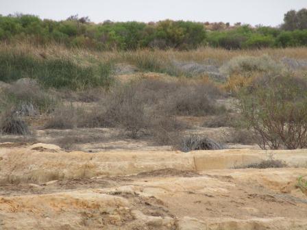
Lots
of spinifex on the flats now, nearly replacing the grass.

Big
dunes now – some dunes are double headers.
A
few smaller ones in a row between the bigger ones.
Stopped
for a cuppa. Steve asked if I would like to drive in case I felt I was missing
out. No thanks, I had my one sand dune driving experience and that is enough
for me. I could do it in an emergency but why worry when I have a capable
driver doing the job.
Long
wobble down then 3 dune step up climb from 84m elevation to 108m – a 24m climb
onto a plateau.


At
the top we spotted the remains of a trailer. Well, the axle and wheels.

A
wedgie is doing circles in the thermals above us looking for something to eat.

Slowly
creeping up in elevation – now 113m, though on the flats it is around 100m.
Another
vehicle called up they were coming towards us. We are still a distance from
them but will keep calling to make sure we don’t meet at the top of a dune.
At
26 13 10.6S 136 25 46.8E we stopped to read a sign about the seismic shot points.
We have seen these random poles sticking out of the ground beside the track.
Very interesting reading the plaque. Fancy 45 men working out here for 3 months
– imagine carrying enough food and water for them all.


The
other car called up that they had stopped on a crest because their flag had
fallen off. We continued and finally found them.

We
pulled off the track and they drove down to meet us and have a chat. A couple
with some kids in the back – not a trip I would want to do with kids.
We
continued up and down smaller, more frequent, dunes.
Through
Wonga Junction which is the meeting point of Rig Road and the French Line. 12km
south to the abandoned Mokari Oil Well and air strip but we will skip that. The
Rig Road has a clay surface to enable the drilling rigs to be moved by road
trains when they were drilling out here.

Looks
like they continued with the surfacing along the French Line as in the flat
sections we can see the old base which is now getting corrugated.
The
dunes are a lot smaller so we are just rolling over them. Still at 95 to 100m
elevation.
Stopped
for lunch. Steve went back into high range now as there seem to be no bigger
dunes to go over and it isn’t as wobbly on the flats.
We
laughed when we saw the 40kph sign – Steve will need to speed up!!

We
now enter the Witjira National Park and as such have finished the Simpson
Desert. Signs reminding us about no fires allowed and no firewood collecting in
this National Park.
Continued
along over smaller dunes till we reached a Slow Point sign.

Purni
Bore was over the dune which I think is the end of the French Line.
Wandered
over to the information boards.


Looks
like a dead baby camel bones and some lazy beer drinker’s cans.

Walked
down to the bore, there are depressions where the original water would have
created more lakes when it was allowed to flow freely. Now a pipe takes the
water down to the lake.

The
ground is like a sandstone/limestone base with ridges etc. Steve picked up a
piece and it was very light.


A
small pool with reeds has been created along the pipe as water spits out and
steam hisses occasionally making it sound like there is some strange creature
in there. The water is 85 degrees.


Some
little birds that weren’t on the info board.

I
followed the pipe down to where it enters the lake – well to the Hot Water sign
at least.


Continued
along the dry ground following the reeds to where I could see flattened grass.
Looks like this is where all the animals and ‘feral’ animals come for a drink.


The
water is so clear but the stuff underneath doesn’t look very nice. A bubble
comes up in the middle every now and then but I think it is just because the
water comes along under the ‘sludge’ and breaks through there.
I
tested the water – pretty hot.

Looking
along the reeds and then across to the red sand dunes nearby.


Lots
of dung everywhere – spotted emu and camel ones.


Steve
met up with me as I was walking back. He had just seen a dingo go across the
flat and up into the dunes nearby with what looked like a big lizard in its
mouth. I just got him going up into the sand dunes.
I
said about the flattened grass area so we headed back there. The dingo came
down off the dune and headed for the water too so we waited until he had a
drink. It would be like having a hot cup of tea. He kept an eye on us.


As
we walked closer he walked around the other side of the pool. Must have tough
feet.


He
wandered off around the weeds so we headed back. Lots of swallows and zebra
finches flittering about.

Another
couple pulled in so we wandered over for a chat. Heading east. He said it was
much nicer at Dalhousie Springs and there is a beautiful warm pool to swim in,
though the mozzies are a bit fierce at night.
The
high cloud cover is still there making it quite hot today. More flies here than
we have seen in the last few days.
Made
a cuppa before we headed off. The dingo came back and wandered across the
track.


Lots
of nasty burrs here.

As
we drove out he wandered over to say good bye – certainly wasn’t worried about
our presence. Mightn’t have gotten and camel photos but I got a lot of this
dingo.

Continued
rolling over little dunes. Met another couple, foreign sounding, who are
heading east but via the WAA Line rather than the French Line. It is much the
same my map says but doesn’t get as much traffic so maybe it won’t be as
chopped up for them going up the dunes.
More
rocks are appearing on the track as part of the base put down on the track.
Steve deciding whether to put some air in his tyres then we go over some more
sandy bits.
Over
some more low dunes with wider gibber stone flats in between.

Past
an airstrip – we wondered what the thing was in the middle – it must have been
the pole for the wind sock. Then we saw the sign and the flat air strip.


Bigger
wider flats between the dunes now. Over a final dune and we enter the Spring
Creek Delta. It can flood easily here.


A
sign advises us that Aborigines live out here. I wonder how many exactly.


Rockier
corrugated track now over a few little sand rises then wide flat plains.
Slowed down for a soft sandy section. Steve is happy he didn’t pump his tyres up.

Zooming along 50-60kph in 2WD now. A few flat topped hills appearing in the distance.


Alternating
between rocky and sandy sections as we run alongside the hills.
Wide
flat clay pan opens up in front of us stretching for miles westward with a
gibber stone range to our left and rolling hills on our right.


Lots
of black cattle dung on the track which is strange as this is a National Park
but maybe they allow the Aborigines to run cattle on it.
Stopped
to photograph a dingo by the track – it was happy to pose for some photos.


The
road across the clay pan is closed which would go straight to Dalhousie. We go
north for a while then across and back down to the original track after a while.
Still
going through corrugated sandy and rocky sections with lots of different tracks
to choose from. I can see blue sky ahead – the thin cloud cover is
disappearing.

Dropped
down off a plateau (115m) onto the next plateau (102m) then down through Spring
Creek (96m). Looks like salt and some water there.


Spotted
four cattle grazing.
Back
to the old track – 26km return trip to the lookout. Won’t be much different
view to what we have seen so will skip that. Turned right and through the fence
line - 6km on to Dalhousie Mound Springs.
Turned
off first to dump our bit of rubbish – a few cans. We burn the rest. Now this
is a smart frame for their rubbish – no rubbish flying over the landscape here.

Walked
over to check out the view – lovely pinnacle in the middle of a flood plain
area.


The
ground has a crusted surface.

Past
some mound springs – easy to see by the big trees and green reeds.


Large
flat topped hill as we turn into the main area.

Past
the ranger station and some sheds on the other side. We drove into the visitor
day use area and checked out the information box – no information here.

Big
notice on the top about ‘drones’. Looks like they have been issuing some fines.
I remember when cameras first came out on mobile phones and all the talk that
went on about people taking them into toilets or at pools etc but that has been
forgotten as mobile phones have taken over. As drones seem to be the next step
for people travelling – we have seen a lot of people with them and they take
fabulous photos of the view from up in the sky – it will be an issue for a
while then people will forget about them.

Walked
down the path to the pool. Information boards here and a visitors’ book. The
water is very warm so will be nice later on. There are noodles etc to use too.


Dalhousie Springs
When Stuart explored this area in 1859, Aborigines
managed to keep this wonderful valley of springs a secret but 12 years later an
Overland Telegraph Line construction party came across this great fracture
zone. Christopher Giles wrote “We beheld a singular spectacle. The ground we
had been traversing abruptly disappeared and we found ourselves on the brink of
limestone cliffs 50 to 70 feet high”. The party saw, “waving green reeds, with
large pools of water at intervals, and dotted with island cones topped with
reeds or acacia bushes”.
These springs were named Edith Springs after the wife
of Sir James Fergusson, Governor of SA at that time. Lady Edith requested that
the name be changed to honour her father the Marquis of Dalhousie.
While sheep were the initial mainstay of pastoralism,
by the turn of the century the focus had shifted to cattle, and although many
bores were sunk on Mount Dare station, the springs remained vital for the
survival of stock. At one time it was hoped that the springs might supply water
for irrigated crops and an area of cultivation was set up near the main spring.
Farm machinery at the site is all that remains of the unsuccessful experiment.
A
bit of machinery left as a display.

Went
back and set up camp. Put up the fly mesh under each awning to help stop the
mozzies and the flies. The toilet and shower block is nearby though I went to
use the toilet and the mozzies nearly carried me away so will use the new
handicap one beside as it is open and light so they aren’t in there. The
rubbish bins are all full and it appears there aren’t any rangers here or camp
hosts so I presume someone will come and empty them sometime.


Rang
Mum on the Sat Phone to say we were safely across the Simpson Desert. All good
back in Cairns. Our route for today.

An
aerial view of the pool which I got off an information board near Lake Eyre.

Put
on our togs and went down for a dip. There are heaps of ‘noodles’ available
which is very handy. I got to go in first. It was so warm and felt quite hot at
first but it didn’t take long to feel refreshed.


Another
couple from Melbourne came down so we had a nice long soak while we chatted. I
looked up the pool to where the source is and spotted a green shed. Laughed as
I said to Steve, ‘I found the hot water systems’. When we were at Mataranka 26
years ago Steve went up stream trying to find the hot water systems as he
couldn’t believe that hot water came out of the ground like that. Steve could reach the bottom just out from
the steps. Other people said it gets warmer as you go up the pool towards the
source and cooler down the other end. We tried both and didn’t feel any
difference. Lots of swallows swooping over the water and the corellas are
making a racket in the trees at one end of the pool.
Stayed
in too long as we were a bit light headed when we got out but that didn’t stay
for long. Back to camp for late drinks while we read our books. 6.30pm 29
degrees, no sunset as there is a thick cloud band in the west.
I
cooked dinner. I had planned to go back for another swim but it got dark
quickly and then a dingo howled very close to our camp so I think we will just
stay in and read. We are both enjoying the books Erica gave us by David
Baldacci.
A
few mozzies have gotten in but they are bush ones and easy to kill and they
don’t seem to buzz in your ear like normal ones do. Mr Dingo came closer and
howled again and then another one howled from the other side of the pool. We
aren’t worrying about using the showers or toilets here as the mozzies have
taken them over. There is a new disabled persons’ toilet which is separate and
so far the mozzies haven’t moved in. Also it appears the showers are only cold
water. After our nice warm swim we don’t need one. The water is very nice and
doesn’t leave you itchy or anything.
All
quiet in the camp now as we put the other mozzie net over the bed. The stars
are out though some cloud is still on the horizon.
No comments:
Post a Comment