I
woke to the sound of scurrying feet. I heard it yesterday morning and thought
it was birds or something running across the generator box outside but it was a
little mouse inside running along our headboard!! He must have snuck in when we
had the main screen door open as we have the magnet screen to keep the flies
out and there is a gap at the bottom. Not quite the animal I want creeping
around the van at night. He is very fast and the next time I spotted him he was
up on the spice rack so I sprayed him with insect spray but he darted down the
back of the stove. I went back to bed hoping the spray will make him sick.
I
managed to get back to sleep. Steve kept sleeping on!
7.30am
17.4 degrees, clear sky and light breeze. When I opened the utensil drawer the
mouse darted out. I slammed it on his tail but got such a fright I forgot to
keep it closed to hold onto him so he managed to escape again. I won’t be
getting much sleep until we catch him.
We
packed up and went around to top up with diesel. $2 per litre. I asked if they
had any mouse traps as we scored one of their locals!
Drove
to the main road and headed west past Mt Augustus.
Stopped
for a cuppa at Cobra Downs which used to be Bangemall Inn in the early days
then became a Station Stay place with Dept of Parks and Wildlife.


Read
the information – The Inn at the end of the Mail Run. Part of Kingsford Smith Mail
Run trail. Very shiny on the metal sign which makes it hard to photograph. “In
1895 prospector Jack Horrigan made a remarkable overland trek from Tennant
Creek, NT and was rewarded when he discovered gold in this area. His find lead
to a ‘rush’ and soon the hills and creeks around here rang to the sounds of
picks and shovels. A year later there were enough miners on these fields to
prompt the establishment of a hotel.


Steve
spotted a man so we walked in for a chat. Neville has been living here for 17 years
and has most of the leases around here. He has found all the gold with a
detector and now has to do hard rock mining to find any more. He said the
station has been handed back to the aborigines now but nothing is happening
here. He suggested we try around
Mangaroon further west to detect as someone called in with some little nuggets
from there. His directions were a bit loose which doesn’t help.

We
continued on past the old shearing shed and stone cottages.


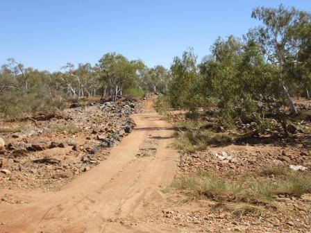
Left
the hills behind and onto open plains – red dirt and low trees and shrubs.
Laughed
at the traffic sign – Traffic Hazard, next 220km, drive to conditions – well
that covers it all!
Continued
on a good road so not sure what ‘hazard’ lies ahead.
Across
the new crossing over the Lyons River.

Fletcher’s
Crossing was downstream – should have been called Fred’s crossing as it was two
men named Fred that built it in 1963 by hand.


There
is a pool of water upstream.

Further
along we crossed the dry Alma River which has an island according to our Hema.

We
found a track along the edge and pulled up by the big gums to have some lunch.

Continued
along the road then pulled up to check on two guys changing their tyre. They
were ok but said it was their second puncture – Steve noted they only had road
tyres and these gravel roads certainly eat the tread off the tyres quickly.
We
must be in Nissan country as all the vehicles we have seen have been Nissans.
Lots of patches of bright yellow wildflowers appearing.
Back
into low rolling hills as we near Mt Sandiman. We have been slowly dropping in
elevation – now 230m.

Pulled
off to read the info and chatted with a guy and his two little sons having fun
in the dirt. Another metal sign that is very hard to read. “Early explorer,
Francis Gregory wrote – a few miles along the river brought us to gorge at the
eastern edge of the sandstones, to the east of which it opened out into
expansive plains in some parts well grassed, and in others much washed by the
river. Several trap and granite hills were visible at some distance to the
northward and eastward. Our bivouac was in latitude 24 degrees 31 minutes 0.5
seconds, about three miles south of a bold trap-range, the summit of which was
named Mount Sandiman.”
‘Mounts
like Mt Sandiman before you may appear inconspicuous enough to modern car
travellers. However, to early explorers such mounts were highly important
landmarks. These hardy men would scramble to the top of these landforms to
assess the land around them, take coordinates, measure the height, name them and
plan their future routes.’
‘While
Aboriginal people had used such landmarks for millennia, European explorers
only ventured into these parts in the mid-1800s. Among them were the Gregory
brothers, Augustus and Francis. They explored land in the Swan River District
in 1846 and then went north to the Murchison and Irwin Rivers. Later, in 1858,
Francis again set out, this time further north to the Gascoyne. It was on this
trip that he explored the area in which you are now travelling. It is likely he
named Mt Sandiman after Governor Sandeman, MLA. Sandeman was a NSW
parliamentarian in 1856. He was also a business associate of HC Gregory,
Francis’ brother. Due largely to the reports of people like Gregory,
pastoralists began settling the country. Mt Sandiman became a station in the
late 1800s and the homestead became a popular point for social gatherings for
local pastoral families. Tennis games, dances and sing-alongs around the piano
were common events at Mt Sandiman in the early 1900s. In 1973 the station was
absorbed into the neighbouring Minnie Creek Station, and has since been run as
an outcamp.’
A
few crests later we can see Kennedy Range in the distance – low with a flat
top.


Past the Lyons River homestead then turned off for the 12km drive to the Kennedy Range National Park. Looking south then along the escarpment as we drove in. The range is 75km long and 25km wide. We are at 170m above sea level now.
A goanna was digging a hole on the edge of the road so Steve stopped and turned around so I could get a photo but he was camera shy and ran away.

Nice
views of the escarpment and Temple Gorge as we head around to the campground.


The
camping bays have been outlined with rocks. Met the camp hosts, paid our fee
(they gave us seniors’ rate) and then showed us two spots for our van. We
picked one so keep the sun off the fridge which has been struggling. Steve will
have a look at it in case something is blocking the gas jet.

He
gave us a booklet about the geology to read and return so I photographed it. The
National Park is only a very small section of the range.


Nadine
is camped here too so we will catch up with her later for a drink. Found some
more information boards to read. My knees are feeling better so hopefully we
can do some of the walks tomorrow.


The
campground is just below the escarpment so we have a lovely view.


Nice
colours on the walls as the sun sets into Temple Gorge.


Joined
Nadine for a drink. Steve found another Nissan owner, Andy and had a good time
chatting with him. The wind picked up again so we left our awning rolled in.
Lovely
evening outside chatting – so many stars above us it is beautiful. Very quiet
now as everyone has gone to bed.
We
will leave the main screen door open and put some food on the step hoping to
entice the mouse out of the van tonight.
No comments:
Post a Comment