6am
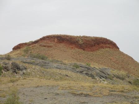
32 degrees, very sticky night. Cloudy and a light breeze now. A flock of little
birds are having a toe-tapping time on the roof of the van. Photo of our
campsite as it was too dark when we pulled up last night.

Sent
Jakob a happy birthday text. Another 7 months and he will be a married man.
Continued
heading east across West Australia. Flat country with anthills, grass and boab
trees and another tree that has bright green maple-like leaves.


Lots
of cattle roaming near the road.
The
flood plains of Fitzroy River are called Willare Floodplains.
Cockatoo
Creek – big pool on left and dry on the right.


We
are on the National Highway and it has a one lane bridge over Minnie Creek
which has a little bit of water in it.


Next
one is Ski Creek – water on the left and dry on the right.

Long
single lane bridge called the Wallare Bridge over the Fitzroy River – lots of
water on both sides.


Line
of flowering boabs outside the Willare Roadhouse.

A
nice bottle shaped one.

I
looked up some information about the difference between Boabs and the Qld
Bottle Trees. I learnt that the ‘bottle trees in Qld are a species called Brachychion. That species also includes
the Illawarra Flame Tree and the Kurrajong like we saw at Yardie Creek. Brachychiton rupestris, the Queensland
Bottle Tree grows mainly in central and southern Queensland. It got its common
name because of the water stored in its trunk and that it looks like a bottle.
The
Boab comes from the genus Adansonia
(Baobab) and there are only six species of which one is found in Australia,
called Adansonia gregorii which only
grows in tropical Western Australia and Northern Territory. The most famous is the
Prison Boab near Broome which is reputedly 1500 years old.
Turned
right at the interestion to continue to Fitzroy Crossing. The other way goes up
to Derby. Will be back to explore here and do the trip to the Horizontal Falls.
Stopped to check out a big boab and found a nut with the pod inside.


Continued
on rolling up and down ridges. Cloud cover blocking the morning sun which is
great since we are heading towards it.
A
little sprinkle of rain from a dark cloud over us.
This
area is coming back from a recent burnt off. One green patch was covered in
corellas.
Stopped
for an early cuppa at a rest area beside a very big boab. Found a little nut.


Opened
up a broken pod to check out the white fibrous stuff inside. The shell is like
a coconut hence they are able to carve them. I should have bought that
beautiful one last year at the markets at Sapphire.


One
of the bright green leaf trees.


Passed
under the cloud band and heading for blue sky now. Interesting to see all the
different shapes of the boabs.
Hills
appear which are part of the Erskine Range – flat topped. Back into spinifex
again. Erskine Hill 133m elevation. Erskine Terminal has some sheds and oil
tanks nearby – wonder what they are for.

Back
to the flat grass country dotted with boabs and little grey ant hills.
Pulled
over to offer assistance to the driver of a road train. He is parked partly on
the road. He had drilling equipment and had just come from an oil field area
south of here (now we know what the oil tanks we saw are about) when the engine
just stopped – no warning lights etc so he had no chance to get off the road.
Luckily had managed to get phone signal and got a message through to the
company for help. Steve jokingly said he could try and pull him off the road –
the driver said the first trailer weighed 40 tonnes plus there are two more! He
said trucks haul out road trains full of oil from the oil field a few times a
day.
We
left him to wait for help and continued on our way. Spotted some red-tailed
black cockatoos near Mt Wynne Creek.
Back
to the scrubby trees and big red ant hills as we go up and over a ridge.
Floodplains
of grass and grey little ant hills again with boabs here and there.
Another
abandoned car with smashed windows and windscreen!
Passed
the turn off to Tunnel Creek National Park – more great places to explore.
Big
open grassy area as we approach Fitzroy Crossing township. Access to
Geike Gorge National Park from here.
Another
single lane bridge on the National Highway over a dry Brooking Channel.


The
next single lane bridge is over the Fitzroy River which is mostly dry though
there is lagoon downstream. Luckily there isn’t a lot of traffic so we haven’t
had to give way to anyone on the bridges yet. Missed a cairn as we headed
across.


Another
single lane bridge over 2 Mile Creek. Continued on and crossed yet another
single lane bridge over Blue Bush Creek.
Ridges
appearing on the left with grass, spinifex and scrubby trees.


Nugumban
Cliff escarpment as we pass the turn off to Mimbi Cave Campground.

We
climbed 150m in elevation (to 300m) between the limestone and red rock hills.
Climbed
onto the escarpment to the Nugumban Cliff Rest Area. Nice view.

Time
for lunch, 40 degrees in the van and no breeze so it was a quick lunch. We are
nice and cool in the truck at 25 degrees though ‘Pat’ has a meltdown
occasionally and shuts down the air con for a bit if we are climbing hills or
pushing into a head wind.
Continued
on – someone cleanout their cupboards by putting t-shirts on the ant hills.
Probably a backpacker thing.
Flat
and open grassy plains again.
Rolling
up and down small rises with lots of gullies covered in spinifex. Grey sky
again.
Across
the dry Mary River.

Climbed
up a ridge (320m) for a view across the flat ground to the green trees by the
Margaret River (no wineries here). McAlly Hills on the other side.
View
of the two ends of the escarpments then we rolled down into flat plains with
hills/escarpments around us.


Back
to hills covered in granite rocks. Water lying around from recent showers. Slowly
climbing (340m elevation).
Checked
what time sunset will be as to how far to travel tonight. Lost an hour as we
travel east, now 6pm where it was 7pm on the coast.
Continued
climbing slowly – ‘Pat’ not too keen about the slow climbs.
Through
an area of huge granite boulders – they look like they have been piled up by a
giant.


Passed
the turned off into Mt Dockerel where we detected June last year. We explored
Halls Creek and the Bungle Bungles then which we enjoyed.
Open
grasslands (417m elevation). Up to 450m elevation as we pass the Tanami Road
turn off.
Into
Halls Creek for a cuppa near the pool. Lots of kids about and lots of rubbish
too. No respect – so sad, they have so much and just have no appreciation. So
much for ‘Looking after Country’. We were having our cuppa inside and a group
of little kids came by asking for money then food – they have just come back
from the shop! I said no as I know how it goes, they start small then just keep
asking for more. As they walked away one threw a rock at the door of the van.
Rang
Mum for update – she is looking forward to us coming back.
Topped
up with fuel. The part aboriginal lass behind the counter was trying to write a
sign about no admittance to kids if they don’t have a parent in between
customers. A policelady was in front of me and she offered to bring her some
more signs. The lass said stealing has been terrible since the kids aren’t at
school. An older male aborigine was trying to buy cigarettes and was talking to
her in native language – she said “don’t talk silly to me” speak English. She
called him ‘Greasy Man’ as he left. I asked why and she said he is creepy. I
commented on the rubbish everywhere and about looking after country and she
said ‘as if’. This is what the politicians don’t see or want to know about.
Headed
north out of town heading to Kununarra. Dark clouds around us. A faint half
rainbow has appeared in front of us – is that where the gold is!
A
few drops of rain and wandering cattle near Little Paton Creek. The road was
wet further along so we just missed that shower of rain. A little roo was
getting a drink from a puddle on the edge of the road.
Passed
the big boabs we stopped and took photos of last year.
Passed
the meeting point of three cattle stations, Mabel Downs, Alice Downs and
Springvale. Nice big name signs made of metal shaped into letters. They grow
good ant hills here too.
Up
and down through the hills.
Heading
away from the dark clouds now. Still dry in the Ord River as we crossed the new
bridge. The sun is setting behind the dark clouds.

Onto
new road and overtaking lane that has just been finished. Spring Creek is dry.
We
had thought we could stop at Spring Creek Rest Area where we stopped last year
before heading into the Bungle Bungles but the road crew have taken it over.
Passed
the turn off into the Bungle Bungles. Now we are on road we haven’t ever
travelled before.
Another
one lane bridge over Tickalara Creek. I wonder if they will make it two lane
when they do this section of road up.
Nickel
Mine in the hills – on the Hema it is marked as Sally Malay Mine.
Slowed
to check out a stopped car near the turn off into the Frog Hollow’s Aboriginal
Community. They gave us a wave – just having a drink!
Another
one lane bridge over Frog Hollow Creek – what a lovely name.
This
section of road definitely needs an upgrade – narrow and bumpy.
Continued
through very hilly country. We had been slowly descending in elevation – down
to 380m then a steep drove down to 300m. Slowly going down to 230m by Rocky
Creek which has another one lane bridge.
Not
only roos and cattle to watch out for on the road but horses too.
Another
one lane bridge over Mabel Spring Creek – it will cost a fortune to make all
these two lane.
Through
Turkey Creek which is now called Warmun. Nice looking place with airstrip, lots
of house, community centre, police, medical centre and big diesel power plant.
Further along is a roadhouse and van park. New signs about fruit fly problems
in the Kimberleys and to dispose of fruit and vegies before entering between
April and December.
Down
to 206 metres elevation at Mistake Creek which has a one lane bridge too.
Pulled
into a rest area near Bow River after the sun had set. It used to be a truck
stop or where the road camp was when they build the bridge. Now they have a
couple of picnic shelters and bins and a ‘no truck’ sign. As we haven’t seen
much traffic I think it will be peaceful here tonight.
It
is still hot but there is a nice breeze blowing.
8.30pm
the wind picked up which was great to go to sleep with.
No comments:
Post a Comment