7am
17.6 degrees – a lot colder this morning with that cold howling wind. I had
said to Jeff yesterday that I don’t put the jumpers away as the weather changes
quickly. Should have known not to change the sheets too!!
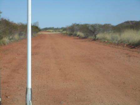
Packed
up in the wind. Farewell photo with
Jeff.

We
all headed back to the Trig Well to see if it is full. The poor windmill would
have been going crazy with this wind. It is full up. Glad the boys fixed the
pipe back on or all that water would have been wasted.

Needs
some maintenance though as there is a leak in the tank.

The
cattle have lots of water now.

Waved
bye to Jeff as he headed south.

We
turned north again and headed back to Marble Bar. Spotted two kingfishers in a
tree as we headed into town – such beautiful colours. Stopped at the park to
top up with water and dump the toilet. Had a cuppa on the green grass of the park
watching a bird (looks like a butcher bird) go through the rubbish bin.
Back
down the track passed the 4 Mile Mine Detecting area and turned off onto the
track leading to the Salgash Mine 1 where we had found the gold on the
hillside. Parked behind a little hill that has a couple of mine shafts in it.

Went
up for a look.


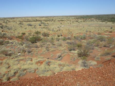
We
are not too far off the road – you can see the dust of a car going past.

Looking
back to our van and then across to the hills we crawl up and down and through
creek beds to get to the detecting spot.


The
wind has dropped a bit but we decided to go sightseeing and go detecting
tomorrow. Drove further south then turned off to the Secret WW2 Airbase on
Corunna Downs Station. The sign back at the Marble Bar road said 35km but there
has been no other signs since then but we followed the track on the Hema and
got to the right spot. At least there is a good sign here.


Followed
the road in till we found the taxiway.


Further
up the road you can see the crossing of the main airstrip.
Stopped
for a photo – looking east down the strip. Then west over the truck.


Drove
to the western end where the workshop used to be.

The
taxiway meets the airstrip here.

A
disc on the side of the strip said ‘gun pit 20 metres’. Wandered through the
spinifex till we found it.


Looking
back down the airstrip – a mirage in the distance, looks like water.

Headed
down the strip to the other end (2 km) where the wind sock used to be.

The
other airstrip is shorter (1.4km) and it goes north to south, crossing the east
west one.

The taxiway runs off the end of it. Steve got the truck wound up and we tried to take off but ran out of strip before we had to turn left into the taxiway, got to 120km/h – should have tried it on the longer one!! Took a video.


Followed
another track through the Army Camp area – nothing left here, except more gun
pits.


Back
down the main strip again – looking to west.

Stopped
to check out a sign – the site of the Wireless Shed and another Gun Pit.

Back
onto the track that ran across the air strip and headed towards the hill where
the airforce personnel were housed.
Using
the other map we figured out this was the hospital – Steve found a loo.


Up
on the hill was a Bofor Gun site (wherever that was).

Continued
past more concrete slabs of the Air Crew Quarters and Ablutions Blocks till we
found the Workshop and Kitchen Mess area. Lots of junk strewn everywhere.


Followed
the track up onto the hill, past a small slab for a water tank and onto a
flattened area on the other side of the hill. Looking back over the airstrip
area and then around to the east over the Small Bore Rifle Range etc. There is
a creek running along the end of the airbase area which according to the Hema
Map has a pool.


Zoomed
in on the rifle range.

Turned
around and took photos over the creek then around to the mess and workshop
area.


Steve
parked in the kitchen. He found an old stove, washing machine and fridges.


We
think this might have been a bomb holder.

I
walked further along and found the Workshop area.

Back
along the track then took the turn around the bottom of the hill passed the
Nurses Quarters, Canteen etc – a few slabs and lots of spinifex. Around to the
other side of the hill to the Picture Garden area. The serviceman, Ernest Cook,
who started it sadly died when he fell from a truck here.


Inside
the capsule was his service records etc.


Back
to the main road where we passed the Aircraft Bays where the planes were
sheltered. Dirt was pushed up in a half circle to protect the aircraft.

Headed
back to the turnoff then followed a track to find Owen’s Gully as per Doug
Stone’s gold book. He has the worst maps and directions in his book!! Drove up
and down hills and through creek beds but didn’t find anything that looked like
scrapes etc to detect. Fabulous ridges though.


Following
a creek along we found a tyre then the tyre carrier – I wonder if the chap
realised he had lost it.


Mr
Roo wasn’t too worried about us using his creek.


Nice
quartz outcrops here.


Just
got back to camp when Ray & Carol rang to see how we are going.
Got
the fire going to heat our shower water. Leftovers for dinner which was easy.
7pm 28.7 degrees in the van with a light breeze.
Had
to close the windows as the night went on because the breeze was a bit cool!!
Should have left the flanny sheets on!!
No comments:
Post a Comment