Sun
in and out of the clouds. Still windy but the bay is calm. No croc sightings.
Malcolm
cooked bacon and eggs for everyone – Sunday treat.
Packed
up and headed back along the track then up to Cable Beach and Punsand Bay which
was originally called Cable Bay as a new underground cable for the telegraph
was laid from here to Thursday Island in April 1894 after the original cable
from Paterson Telegraph Office was abandoned due to repeated failures. The
telegraph office was dismantled and moved to Peak Point nearby and then called
the Cape York telegraph office.
We
wandered into the resort. Found some
nice orchards.


They
have ‘glamping’ tents with views of the beach.

Huge
tree on the beach – I wonder where that came from. And a helicopter!! He does
tours over the Tip and around other areas.


A
Quarantine map showing the two names for each of the islands.

Looking
across to Peak Point.

Kerry
thought the name of the bar was very good.


Checked
out the tourist information.


Good
map – Thursday Island is so small compared with the others.

Back
down the track to the Croc Tent then we headed to The Tip. Pretty drive through
the Lockerbie Rainforest. Still a narrow track.


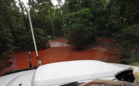
A
creek crossing, we went straight through but the others took the bypass to the
right.


Into
more open scrub as we near the top.

Passed
the remains of Pajinka Resort which was originally the Cape York Wilderness
Lodge run by Ansett. It was bought back by the government to be run by the
local aborigines etc but there was a dispute about wages just before we arrived
in 1986 and it was abandoned. When we arrived then everything was just left
open for anyone to help themselves. The machinery shed and machinery had been
torched. What a shame. Nothing appears to have been done to it since then. Will
check it out on our way out.
Arrived
at the car park for the walk to the Tip and it was crowded – they were parked
in like sardines. We managed to get parks along the side of the road but many
more followed us in and drove right in then had to turn around and drive back
out. Obviously no one is interested in providing better parking etc or making
something of this area. At least it is still free to come up to!!

Had
a cuppa then went down to Frangipani Beach.


Zoomed
in on some vehicles further around the beach.

Bob
decided to walk around the beach way as the tide was out. Kerry and Malcolm had
already headed up over the rocks so we headed up after them.

Some
of the many visitors’ cars to the Tip.


Great
view from up on the rocks over the bay to York Island.


Steve
found a rock cairn to add to.


Very
windy up here – even the grass is laying over.

The
east coast.

Further
along we can see the east side of Eborac Island with its lighthouse.


Looking
back down along the east coast.

Below
us on the west side we spotted the ruins of something.

Stopped
at a peak to check out the direction cairn. Cairns that way.


Continued
along the path then York and Eborac Island came into view.


Where
the two seas meet – the Coral and Arafura.

Looks
like we will have to queue up for our photo with the Tip sign.

Didn’t
take long and we had made it to The Tip and have the photo to prove it.


Steve
was always after a Topless photo at the Top and when we were here with our boys
– they were all topless so that should be enough. I played the game and when it
was our turn for the two of us I said ‘one, two, three’ and lifted our shirts –
of course I only showed my belly, no bra on – I would have scared all the
tourists!!


The
next lot waiting for their photos.

Rock
tree. Rang Mum and Dad and sent the boys a text to say we have made it to the
Top. Took a video over the islands and the Top of Cape York.

Walked
back via the other track on the western side. No wind this side. Lovely view
over the bay – took a video too.


Took
off my shoes to walk in the water.


Sting
rays have been here.


The
mangroves along the beach.

Back
to our vehicles then back to Pajinka Resort for a look. Such a waste. The tree
roots have grown into the pool.


The
cane toads are loving it here though and didn’t worry about us looking on while
they mated!!


Someone
did a good spider painting in the office.

Spied
a pretty flower high up in the tree but don’t know if it belongs to the tree or
is part of a vine.


Back
to the main track then through more rainforest as we head to the east coast and
Somerset ruins.

We
drove down to the camp ground first as we knew another big group might be
coming this way. A sign says $20 per night fee to the caretaker. Doesn’t look
like anyone has cared for this area in a while.

Found
a nice spot at the end and set up camp.


We
are beside some graves of the Jardine family. The graves are of Francis (Frank) Lascelles
Jardine (died 1919) and his wife, Sana
(died 1923). The memorial was erected in 1924 by their family. Nearby is
Frank’s grandson, Gordon Vidgen (1902-1962). Another grave is said to be Sana’s
mother (about 1901) and possibly two children.


The
government decided they needed an outpost up here and sent up John Jardine and
his family. Originally they were supposed to settle on Albany Island which is
only a short way off shore but when John arrived he decided the mainland was a
better spot. A pre-fab settlement was erected here by 25 marines which included
a Magistrate’s house for John and family, police quarters, customs house,
hospital and barracks for the marines – amazing. Somerset was proclaimed on the
21st August, 1864.
Walked
down our little track onto the beach with Albany Passage between us and Albany
Island.


Zoomed
in on the house on Albany Island. Steve remembers seeing a fishing show about
the chap who owns the island. Doesn’t look like he is roughing it.

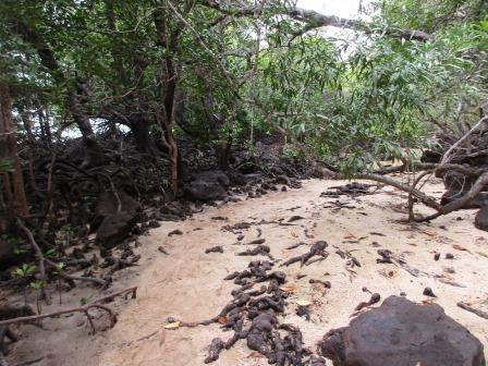
Walked
up to the end of the beach (to the right) and through the mangroves to find the
windmill and well. The windmill pumped the water from the well up to the homes
on the hill above us where the settlement was.


Steve
climbed up with the camera to take better photos.


Margaret
had climbed up too and found an interesting fungus.

Steve
took us up another path to another grave he found – maybe one of the pearl
divers.


Back
to the camp ground area.

Dead
crab on the beach and a big fish carcass too.

Must
have been a jetty here as there are old posts.

We
headed to the other end of the beach to check out some cave paintings when a
shower of rain came over so I rushed back to fold up chairs etc. By the time I
did that the rain stopped.
As
I came out I spotted some more graves closer to the beach than the Jardines
were. Cancan was a pearl diver. The other was a Japanese pearl diver, Kobori
Itchimatsu, who was buried here in 1909.
Kobori came from the village of Nishi Mukai in Wakayama prefecture, an area
that provided 80% of the 7000 Japanese who left their country to become pearl
divers.


Next
to them is a memorial to Edmund Kennedy.


I
caught up with the others who were climbing over rocks to get around the point
as the tide was still too high to walk in the water. Another big log stuck in
the mangroves.


Bob
charged on but Mal, Margaret and I decided it was too rocky and slippery. Steve
continued on with my camera to find Bob. They got around the point to a little
beach with exposed sandstone and a cave. They found some paintings right at the
back and some interesting holes through the sandstone.


Quite
afternoon relaxing and reading. Nice listening to the waves roll up onto the
beach. A couple more rain showers but nothing heavy. Grey sky made it hard to
know what time it was. Got the fire going and had drinks and dinner around it.
Kerry was doing a crossword so we all tried to answer the questions.
Enjoyed
a lovely warm shower. The sky has cleared and the stars are out.
No comments:
Post a Comment