7am
15 degrees, clear sky and no wind. Listened to the news on ABC Radio about
Cyclone Debbie heading towards Airlie Beach and Bowen.
8am
heading to Wave Rock so we can have a full day there.
Passed
more road signs to more rocks, Allan Rock, Graham Rock. Steve said maybe it was
the surname of a pioneer of the area!! No there are just lots of granite rocks
jutting out but not high enough that you can see them across the fields.
Into
Wave Rock carpark. There was a chap painting who works for the Shire. I thought
we could use our parks pass but it is managed by the Shire so the $10 entrance
goes to the upkeep of the paths etc. There is a caravan park right beside the
rock and across the road is the information/café with the Lace Place, Toy
Solider Collection, Wildlife park and wildflower display which we will check
out later.
Checked
out all the info. The Wave became famous when a keen photographer, Jay Hodges,
won world recognition for his photograph of Wave Rock at the 1964-65 New York
World Photography Fair. The photo was later printed in the National Geographic
and Walkabout Magazine bringing it to the attention of the world and making it
an iconic tourist destination.


In
the next shed there were more boards but obviously done at a previous time.


Followed
the track to the ‘rock’ and found the start of the wave. Steve went for a surf.


More
info.


On
top of the rock is a rock wall which stops the rainwater from flowing over the
rock. It then flows to a dam up on the rock and is used for Hyden’s water
supply. Quite amazing as it was done in 1928.

Walked
around a bit further for my turn at surfing – Steve said I have no idea how to
surf!!


So
he showed me how.

Then
he tried to climb up it!! Didn’t get far.


In
the middle – looking left then up and then to the right.


Walked
to the other end – looking back. Then I climbed up a bit for another shot.


As
we continued around the base we noticed the capping cracking off.

A
few huts provided more info on the quarry at this spot.


Further
around we came to the info about the dam then climbed the steps to check it
out. The lower wall was the first one built in 1928. The next wall came in 1951.


Looking
back to the quarry site.


Up
the rock face to another platform for a view of the dam.


Bit
of a wobbly wall but it must work.


Steve
spotted a lizard.

Followed
the info board pathway along a fault line in the rock.


The
rock pool beside the sign was dry.


Further
over were lots of boulders.

The
lizard we saw was actually a dragon.

Got
to the top of the rock for a top view over the dam then out over the salt lake
area to Lake Magic.


Found
a rock pool with water in it.

The
hollows are home to plants and animals.


Across
the other way looking at the catchment wall then across to Hyden and the grain
bins.


Another
hollow area.

I
spotted two dragons doing their bobbing action and tried to get a video of
them.

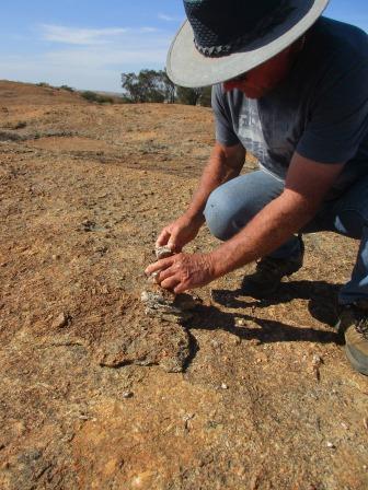
Steve found some rocks to make a cairn.

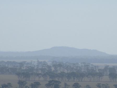
The
Humps on the horizon – bit smoky as the farmers are burning off the stubble
getting ready to plant.


Another
hollow with another small wave.


In
the centre of the hollow is a lone Sandalwood tree.


Continued
along to cairnville – lots of loose rocks here where they used to quarry the
rock and tourists have been leaving their mark (like we did) by building a
cairn.


Another
seam in the rock.


These
are the rocks we saw in the distance when we first climbed up. Lots of
interesting weathering here.


Steve
squeezed in and around this split rock.


I
found a cute little cubby.


Looking
further across to the rock where the Hippo’s Yawn is.

This
is the seam we saw when we first climbed up near the dam. It looks like someone
has glued the rocks back together.

Here
we climb over the wall to get back down to the ground on the entrance end of
the Wave.

Another
plaque about the birds and trees below us.


Last
plaque as we walk down.


The
other side of the wall and further along above the wave there has been a
breakaway.


Looking
back along the Wave from up on the rock.

Back
to the van for a cuppa then I dug out my fly net and we headed off along the
edge of the Rock to find Hippo’s Yawn. Lovely Salmon Gums along the way.

Back
to the Wave entrance then we turned left and walked along the bottom of the
rock. This spot is marked as the Waterfall on the map but there is no info
about it, only about the lichen etc.


Bright
red bottlebrush.


Continued
along the edge of the rock reading the info about Life on the Edge as we went.


Found
a hole.


We
reached the end of the catchment wall. There are a couple of holes along the
wall which need patching by the looks of it.


Climbed
up the rock and we could see another wall on the higher part of the rock.


Don’t
I look great in my fly net.

The
path narrows now as the bush comes up to the rock now the water can flow freely
off the rock into the bush.


Further
along the capping is cracking and plants are growing in the cracks up on the
rock.


Lots
of interesting weathering patterns to see.


Finally
at the Hippo’s Yawn. Hope he doesn’t close his mouth.


Steve
went up to check out his tonsils.

You
can see right out through his ears!!


Looking
out his mouth.

More
info.


Walked
further around, lots of loose boulders.

Walked
back along the Wave Rock Circuit to the carpark.


Drove
out and through the salt lakes towards the airport following the walk circuit.


Not
much happening at the airport.


This
must be the emu fence the lady at Varley mentioned – the entrance to the Wave
Rock Resort.

We
parked the van next to Lake Magic. So clear and inviting and with its high salt
content you would float very easily. It is formed from gysum.


Steve
tasted it and said it was much saltier than sea water.

Info
about weather forecasting and names of clouds. Not many to look at today.


Obviously
with the recent rain other low areas are full of water now.

The
other side of Lake Magic.


Zoomed
in on the Rocks of Hippo Yawn than Wave Rock, the hollow where the dam is then
The Breakers.


Chatted
with some other couples who did the whole circuit that we saw at Hippo Yawn. We
cheated and drove out. Walked into the Resort area – all very quiet though we
saw a car in one of the units. Nicely presented even with ‘green’ grass. The
cottages were built in 1998 and the development is owned by 3 local farmers who
have invested in their town.

Found
this old army tank come paddock clearer.

Walked
around the other side and found a big amphitheatre still under construction.
Found two plaques explaining the construction.


They
have used the emu templates to create another fence.

Interesting
construction.


Back
to the resort to the swimming pool with island in the middle. Even has a rinse
off shower and it sprays well – I tried it and nearly got soaked.


Drove
back to the shops and went in for a look. Gorgeous old Model T Ford.


The
ceiling is covered in dried wildflowers. One collection is in the shape of a
butterfly.


A
display of stuffed birds. Access to the Wildlife Park is from here. Lots of
different animals and birds etc in a 7 acre natural bush setting. As we have
seen them all in the wild we gave it a miss.

Interesting
story.

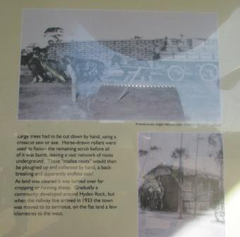
Top
photo of the wave and tractors.

The
Lace Place is a collection started by Mrs Margaret Blackburn OAM JP of Perth
(1920-1990). The Mouritz family of Hyden purchased the collection and added it
to Valerie Mouritz’s collection of antique gowns and wedding dresses. I took a
quick photo but we didn’t go in, nor to the Toy Soldier Collection created by
Alex Smith which has approximately 6000 figures and took over 50 years of
collecting, restoring and re-producing toys.


Across
the road is the caravan park with its cute fence.

Drove
back along the road to the Breakers Picnic area. Had lunch in the van, too many
flies wanting to share our lunch!! Listened to the news on the radio about Cat
4 Cyclone Debbie – 262km/hr winds recorded at Hamilton Island. Poor things.
Walked
up the track to check out the Breakers.


It
doesn’t look steep but Steve was only just staying there.


Walked
back to the easier spot to climb up onto the rock. Steve found a basin to wash
his hands in amongst all the boulders.


We
are on the other side of the dam so the catchment wall continues around this
rock as well.


Back
down we walked along the track some more and found more boulders.


Back
to the truck and we headed out and onto the road to The Humps, 16km north.
Parked and checked out the info board. There is a dam here too but the
catchment wall is along the bottom rather than up on the rock itself.


There
are two walks, we will do the Kalari Trail over the rock.

First
to check out Mulka’s Cave and all the handprints.

More
info before we head into the cave.


Steve
heads in first. It is a big cave and an opening on the other side too. We
climbed up onto the boulders inside to check out the handprints.


The
handprints are very faded though they came out better in the photos using the
flash.


Looking
back out the opening.

Then
we followed the trail around the rock base then started the climb up.


Lots
of boulders strewn everywhere.


More
info plaques. View up to the Amphitheatre part of the rock and then down the
rock valley.


Rock
pools.


Another
view down the valley.

Armchair
shaped hollow.


A
wannabe wave – very wobbly one!! Photos from different ends and angles as we
walked past it and up onto the top of the rock.


Another
wave above that last one.

Top
view over the paddocks being prepared for seeding.

Weathered
boulders resting at the top, on the slope and down the bottom.


On
top of the world – now marked with a survey marker.


View
down to more granite area and the catchment wall going around the base.


The
top continues on to where a cairn is.

The
wall continues around till it reaches the dam.


The
cairn had been knocked down so Steve rebuilt it.


We
have left our mark.

Followed
the markers back down the side of the rock through more loose boulders.


Steve
found a dragon ‘Kalari’ who was busy bobbing his head so we reckon the bobbing
isn’t just for mating!!

Steve
and his friends head down hill – I have my fly net on – I’m the smart one.
Steve just sounds like a steam train going whoosh whoosh with his mouth to blow
the flies away!!


Made it to the bottom of the rock and around to the valley bottom. A couple who we
chatted to at Lake Magic were heading up the hill.

Someone
made an earth dam here at the bottom.


Back
to the truck and van and back into Hyden for a cuppa at the Sculpture Park.


On
the other side was the railway line and shed.

Lovely
salmon gums line the road.

Across
the road was the Lions Park with little sculptures and a rock table setting.


Just
got a photo of a travelling shearing set up.

Headed
west out of town to Kalgarin (aboriginal name of a nearby hill and means ‘place
of fire’) – a tiny farming community of about 50 people. Small and Proud is the
town’s motto. It was first noted by Surveyor General JS Roe in 1848 and settled
in the 1920s. It became a soldier settlement site and was gazetted in 1931 and
a school built in 1932 but that closed in 2005. The railway was so come past
but that changed in the 30s as the railway was built from Lake Grace. It is
famous for wildflowers and its annual Gilgie Races (type of freshwater crayfish
found in the local dams). There is a Museum come Van Park nearby but we have
seen enough ploughs, tractors etc though it has a collection of gramophones and
records which would have been interesting. The Millaa house gramophone has gone
to my cousin Chris who is planning to restore it so hopefully one day we will hear
the old records play again. The old school had a ‘cool’ mural and a big cactus.


Found
some Mallee Fowl though I think they are bigger than the real ones.


Continued
along the highway a bit then turned south to find McCann’s Rock to stop at for
the night. Back onto the dirt roads.

Small
area but room enough for us at the base of the rock. There is a tower and a dam
up on the rock for agricultural/stock use.


Across
from us were some sheds which we check out and they were for campers. Nice BBQ
and a big fire pit area.


In
the bush we found an entrance gate and tin shed toilet so obviously it is used
by the RSL.


As
the sun was heading down we walked up onto the rock and found the dam.


They
have raised its capacity by adding another brick.

Climbed
up further for a view back over the dam and the catchment wall that feeds the
water into the dam – such a smart idea.


Up
to the tower which we think is for two way radios.

Nice
view back over the dam and the fields.


Someone
is burning off his field to get ready for planting.

Walked
down the other side then followed the wall back around to the dam. Steve
explained that the hole before the dam is for the silt to fall into – though it
seems a bit deep or they must get some good rain to get it up and over the wall
into the dam.


Our
camp site.

Did
some blog then headed back up the hill to get a photo of sunset. As I did a
camper pulled in parked right behind the van.

Nice
colour in the sky with the smoke in the air.


Then
another one came and parked beside them. It seems the way with the
international visitors – they need security and camp on top of each other and
us!! They obviously haven’t walked over to check out the camp BBQ area or they
would have parked right beside that!

Didn’t
worry us as the wind is picking up and it is cooling off so we were inside the
van. They will have to listen to the HWS heat up and if it gets cold I will be
putting the diesel heater on!!
No comments:
Post a Comment